MyTopo
Colorado National Monument Colorado US Topo Map
Couldn't load pickup availability
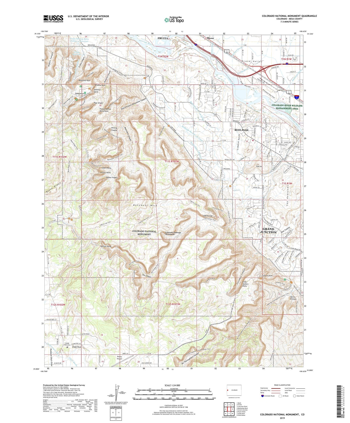
2023 topographic map quadrangle Colorado National Monument in the state of Colorado. Scale: 1:24000. Based on the newly updated USGS 7.5' US Topo map series, this map is in the following counties: Mesa. The map contains contour data, water features, and other items you are used to seeing on USGS maps, but also has updated roads and other features. This is the next generation of topographic maps. Printed on high-quality waterproof paper with UV fade-resistant inks.
Quads adjacent to this one:
West: Battleship Rock
Northwest: Mack
North: Fruita
Northeast: Corcoran Point
East: Grand Junction
Southeast: Island Mesa
South: Glade Park
Southwest: Payne Wash
This map covers the same area as the classic USGS quad with code o39108a6.
Contains the following named places: Artists Point, Balanced Rock, Black Ridge, Black Ridge Trail, Book Cliff View, Broadway Elementary School, Coke Ovens, Coke Ovens Overlook, Cold Shivers Point, Colorado National Monument, Colorado National Monument Headquarters, Colorado River Wildlife Management Area, Columbus Canyon, Cruse Wash, Culvert Arch, Devils Kitchen, Devils Kitchen Picnic Area, Distant View Overlook, East Entrance Colorado National Monument, East Entrance Monument Canyon, Fallen Rock Overlook, Fruita Aqueduct, Fruita Canyon, Fruita Canyon View, Fruita Reservoir, Fruita Settling Basin Number 2 Dam, Fruita Settling Basin Number 2 Reservoir, Glade Park Cemetery, Gold Star Canyon, Grand Junction Carrier Annex Post Office, Grand Junction Fire Department Station 5, Grand View, Highland View Overlook, Hinderlider Lift Canal, Historic Trail View, Huffer Pit, Hunter Wash, Independence Monument, John Ottos Trail, KEKB-FM (Fruita), KIOB-FM (Grand Junction), Kissing Couple, KJOL-FM (Grand Junction), KJYE-FM (Grand Junction), KPRN-FM (Grand Junction), Liberty Cap, Liberty Cap Trail, Limekin Gulch, Lizard Canyon, Monument Canyon, Monument Canyon Trail, Monument Mesa, Persigo Wash, Pinyon Airport, Pipe Organ, Pritchard Wash, Red Canyon Overlook, Redlands, Redlands Census Designated Place, Redlands First Lift Canal, Redlands Middle School, Redlands Second Lift Canal, Riggs Hill, Saddlehorn, Sentinel Spire, Serpents Trail, Squaw Fingers, Suction Point, Thompson Ditch Draw, Ute Canal Trail, Ute Canyon, Wedding Canyon, West Entrance Colorado National Monument, Window Rock, ZIP Code: 81507


