
MyTopo
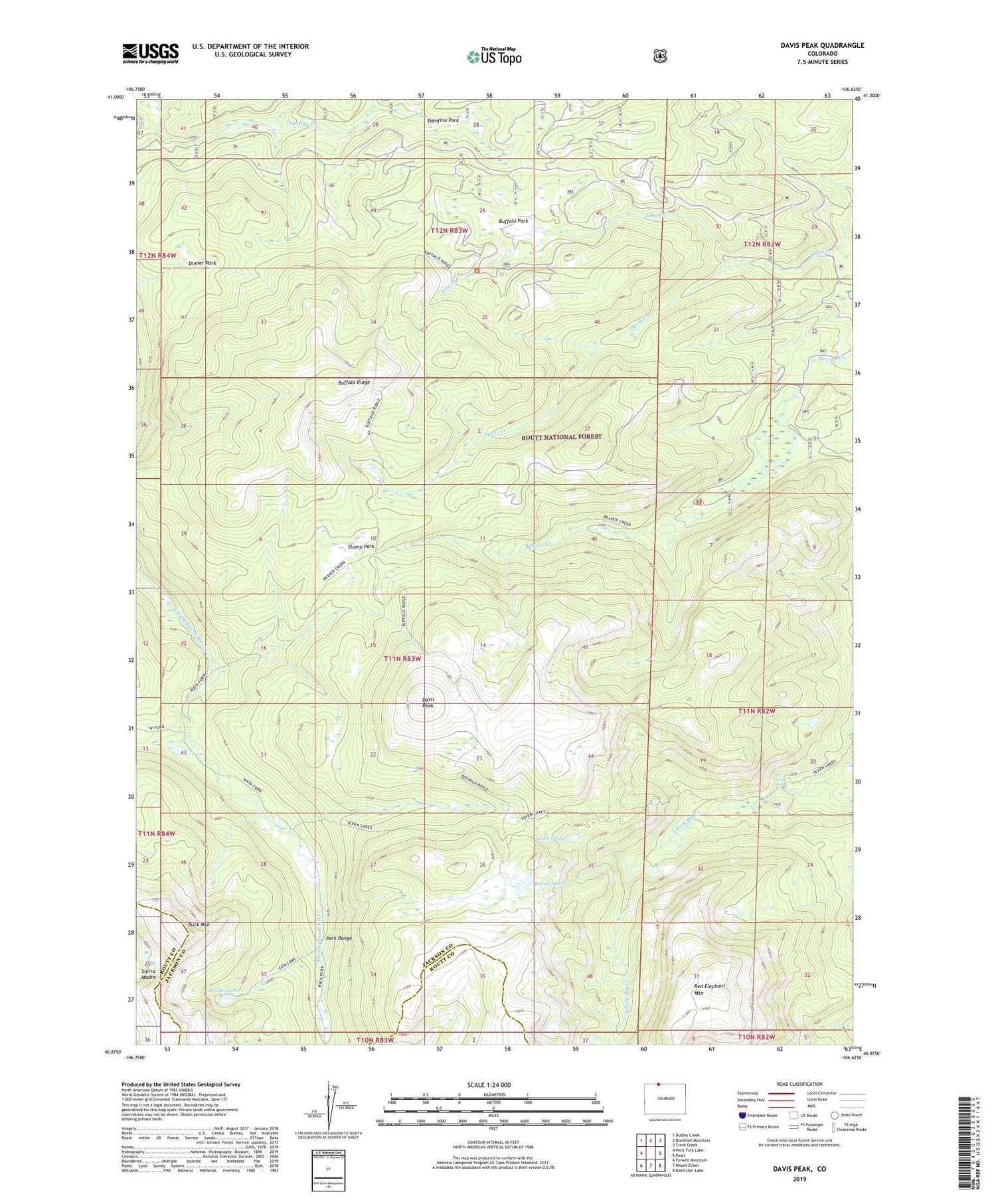
Davis Peak Colorado US Topo Map
Couldn't load pickup availability
Also explore the Davis Peak Forest Service Topo of this same quad for updated USFS data
2022 topographic map quadrangle Davis Peak in the states of Colorado, Wyoming. Scale: 1:24000. Based on the newly updated USGS 7.5' US Topo map series, this map is in the following counties: Jackson, Routt. The map contains contour data, water features, and other items you are used to seeing on USGS maps, but also has updated roads and other features. This is the next generation of topographic maps. Printed on high-quality waterproof paper with UV fade-resistant inks.
Quads adjacent to this one:
West: West Fork Lake
Northwest: Dudley Creek
North: Blackhall Mountain
Northeast: Trent Creek
East: Pearl
Southeast: Boettcher Lake
South: Mount Zirkel
Southwest: Farwell Mountain
This map covers the same area as the classic USGS quad with code o40106h6.
Contains the following named places: Beaver Creek Campground, Beaver Creek Stump Park Trail, Big Creek Falls, Big Creek Trail, Buffalo Park, Buffalo Ridge, Buffalo Ridge Trail, Damfino Creek, Damfino Park, Davis Creek, Davis Peak, Dinner Park, Gem Lake, Gem Lake Trail, Lake Eileen, Main Fork Trail, Red Elephant Mountain, Seven Lakes, State Line Trail, Stump Park, Stump Park Trail


