MyTopo
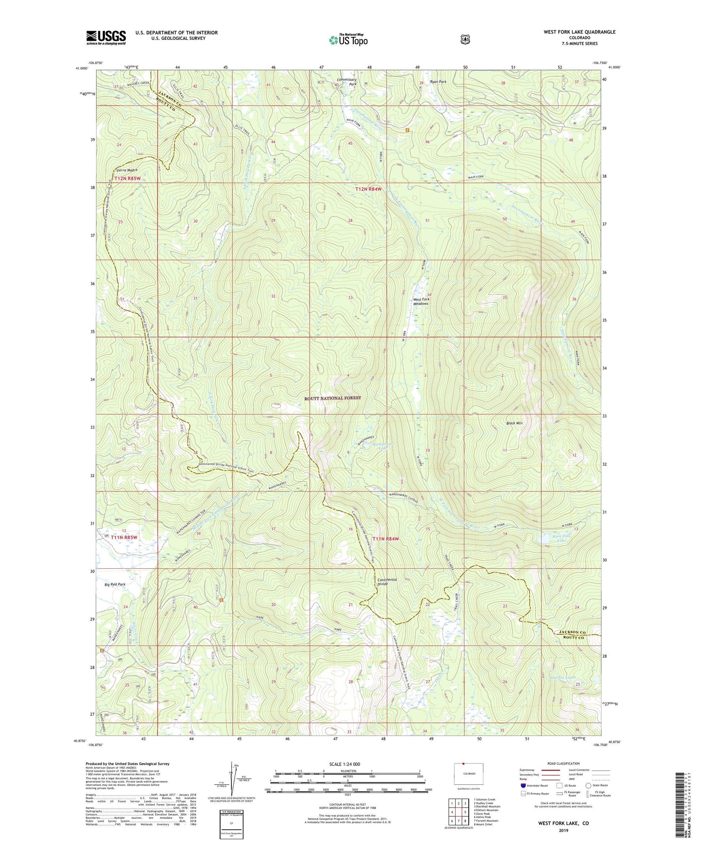
West Fork Lake Colorado US Topo Map
Couldn't load pickup availability
Also explore the West Fork Lake Forest Service Topo of this same quad for updated USFS data
2022 topographic map quadrangle West Fork Lake in the state of Colorado. Scale: 1:24000. Based on the newly updated USGS 7.5' US Topo map series, this map is in the following counties: Jackson, Routt. The map contains contour data, water features, and other items you are used to seeing on USGS maps, but also has updated roads and other features. This is the next generation of topographic maps. Printed on high-quality waterproof paper with UV fade-resistant inks.
Quads adjacent to this one:
West: Elkhorn Mountain
Northwest: Solomon Creek
North: Dudley Creek
Northeast: Blackhall Mountain
East: Davis Peak
Southeast: Mount Zirkel
South: Farwell Mountain
Southwest: Hahns Peak
This map covers the same area as the classic USGS quad with code o40106h7.
Contains the following named places: Black Mountain, Ellis Trail, Fireline Trail, Hog Park Guard Station, Lower Big Creek Dam, Lower Big Creek Reservoir, Manzanares Lake, Peak 9731 Mine, Ryan Park, Sanchez Lakes, West Fork Encampment River, West Fork Lake, West Fork Meadows, West Fork Trail