MyTopo
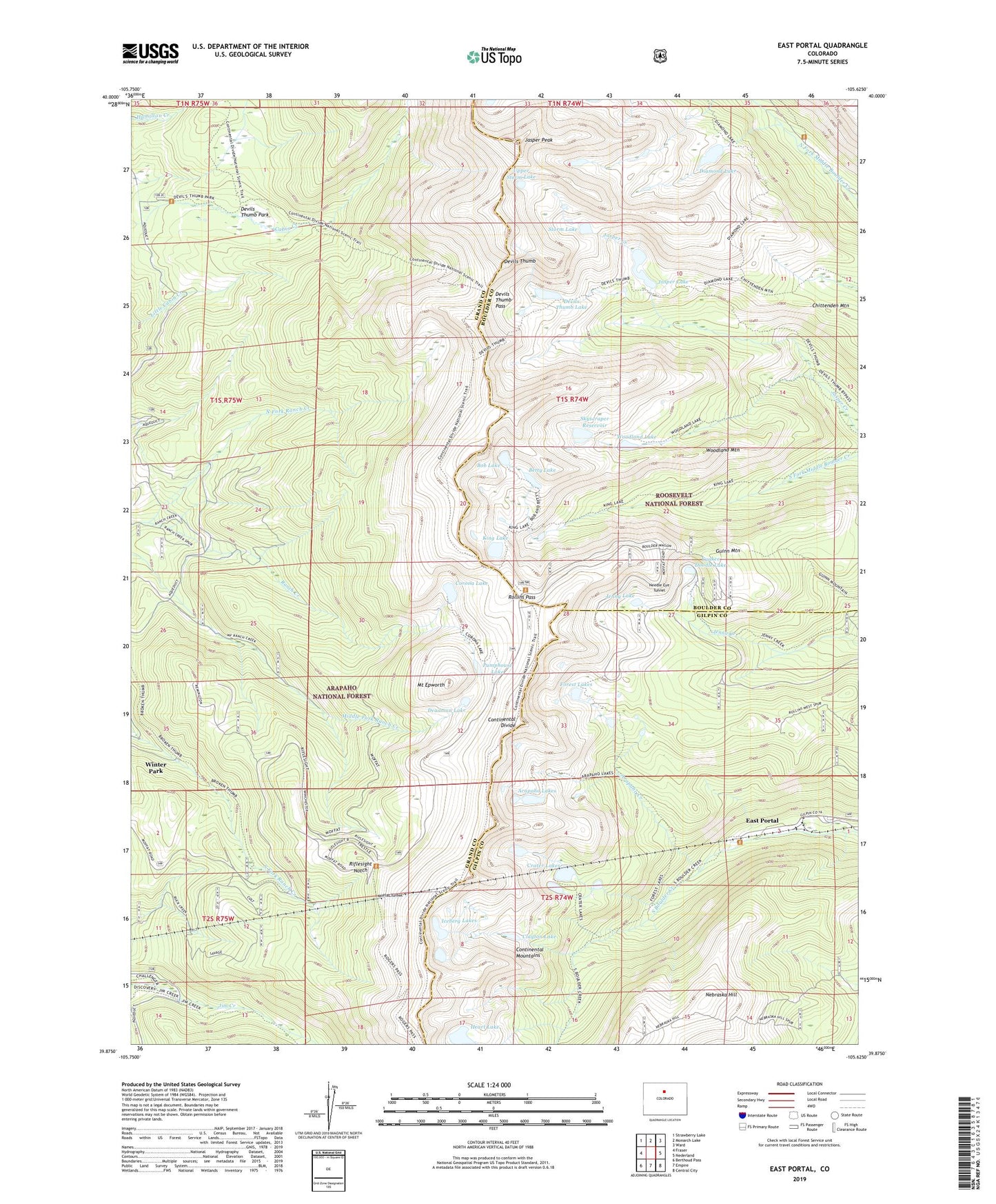
East Portal Colorado US Topo Map
Couldn't load pickup availability
Also explore the East Portal Forest Service Topo of this same quad for updated USFS data
2022 topographic map quadrangle East Portal in the state of Colorado. Scale: 1:24000. Based on the newly updated USGS 7.5' US Topo map series, this map is in the following counties: Grand, Boulder, Gilpin. The map contains contour data, water features, and other items you are used to seeing on USGS maps, but also has updated roads and other features. This is the next generation of topographic maps. Printed on high-quality waterproof paper with UV fade-resistant inks.
Quads adjacent to this one:
West: Fraser
Northwest: Strawberry Lake
North: Monarch Lake
Northeast: Ward
East: Nederland
Southeast: Central City
South: Empire
Southwest: Berthoud Pass
This map covers the same area as the classic USGS quad with code o39105h6.
Contains the following named places: Arapaho Creek, Arapaho Lakes, Betty Lake, Blue Stones Mine, Bob Lake, Buckingham Campground, Chittenden Mountain Trail, Clayton Lake, Corona, Corona Lake, Corona Range Study Plot, Corona Trailhead, Crater Lakes, Deadman Lake, Devils Thumb, Devils Thumb Lake, Devils Thumb Park, Devils Thumb Pass, Devils Thumb Trail, Diamond Lake, Diamond Lake Trail, East Portal, Forest Lakes, Fourth of July Campground, Fourth of July Trailhead, Gold Spring Group Mine, Guinn Mountain, Guinn Mountain Ski Trail, Heart Lake, Iceberg Lakes, Jasper Dam, Jasper Lake, Jenny Lake, King Lake, King Lake Trail, Moffat Tunnel, Mount Epworth, Mount Jasper, Mountain Goat Mine, Nebraska Hill, Needle Eye Tunnel, North Fork Ranch Creek, Pumphouse Lake, Riflesight Notch, Rollins Pass, Skyscraper Dam, Skyscraper Reservoir, South Boulder Creek Trail, Storm Lake, Upper Diamond Lake, Upper Storm Lake, Woodland Lake, Woodland Mountain, Yankee Doodle Lake