MyTopo
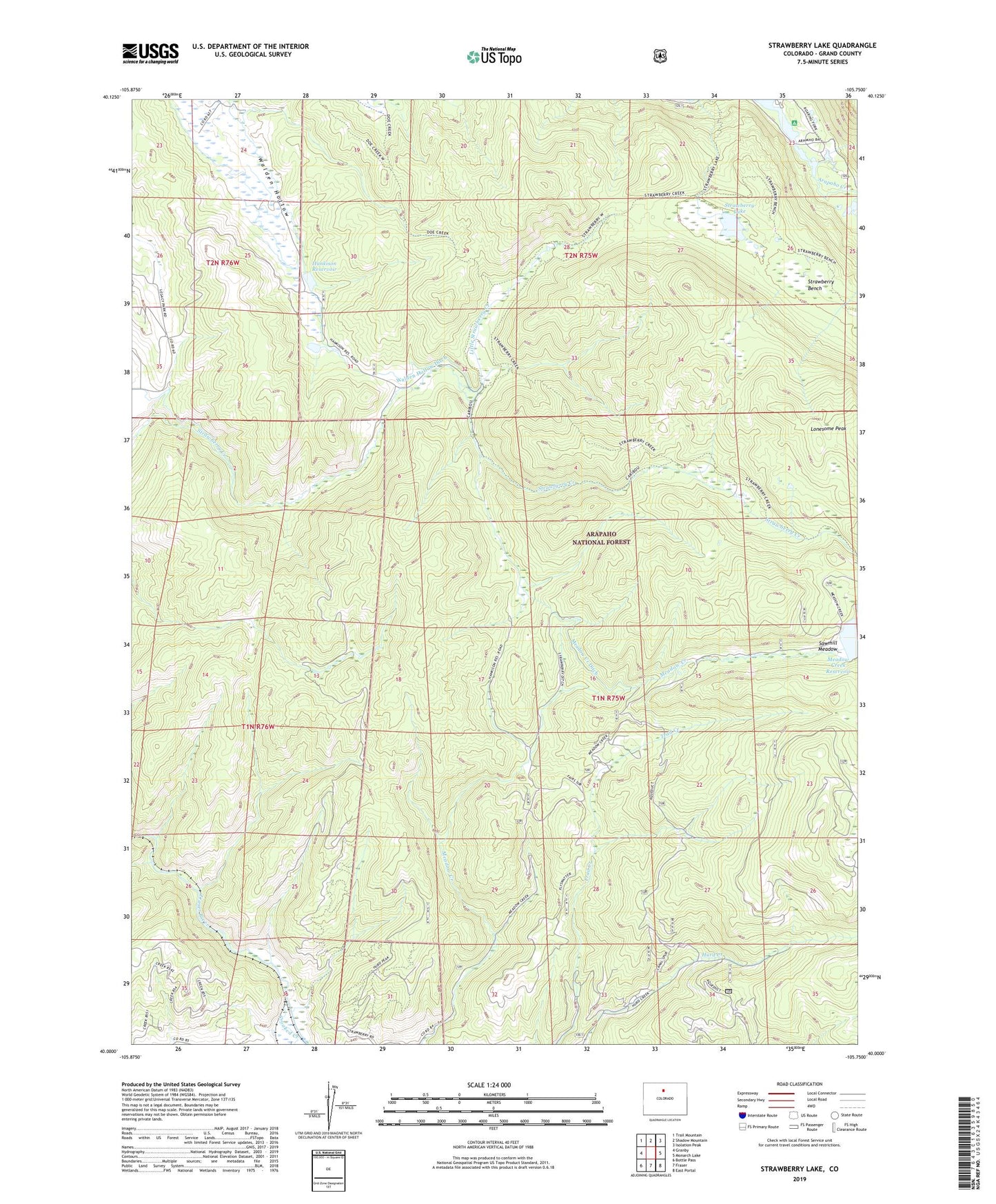
Strawberry Lake Colorado US Topo Map
Couldn't load pickup availability
Also explore the Strawberry Lake Forest Service Topo of this same quad for updated USFS data
2022 topographic map quadrangle Strawberry Lake in the state of Colorado. Scale: 1:24000. Based on the newly updated USGS 7.5' US Topo map series, this map is in the following counties: Grand. The map contains contour data, water features, and other items you are used to seeing on USGS maps, but also has updated roads and other features. This is the next generation of topographic maps. Printed on high-quality waterproof paper with UV fade-resistant inks.
Quads adjacent to this one:
West: Granby
Northwest: Trail Mountain
North: Shadow Mountain
Northeast: Isolation Peak
East: Monarch Lake
Southeast: East Portal
South: Fraser
Southwest: Bottle Pass
This map covers the same area as the classic USGS quad with code o40105a7.
Contains the following named places: Arapaho Bay Campground, Arapaho Creek, Arapaho Valley Ranch, Beaver Mica Mine, Big Rock Campground, Caribou Trail, Crooked Creek, Doe Creek, Granby Division, Granby Mesa, Hankison Dam, Hankison Reservoir, Irving Hale Creek, Little HO Ranch, Little Strawberry Creek, Meadow Creek, Meadow Creek Dam, Meadow Creek Ditch, Meadow Creek Fisherman Parking, Moraine Campground, Strawberry Bench, Strawberry Lake, Strawberry Trail, Walden Hollow Ditch, Western Box Campground, ZIP Code: 80478