MyTopo
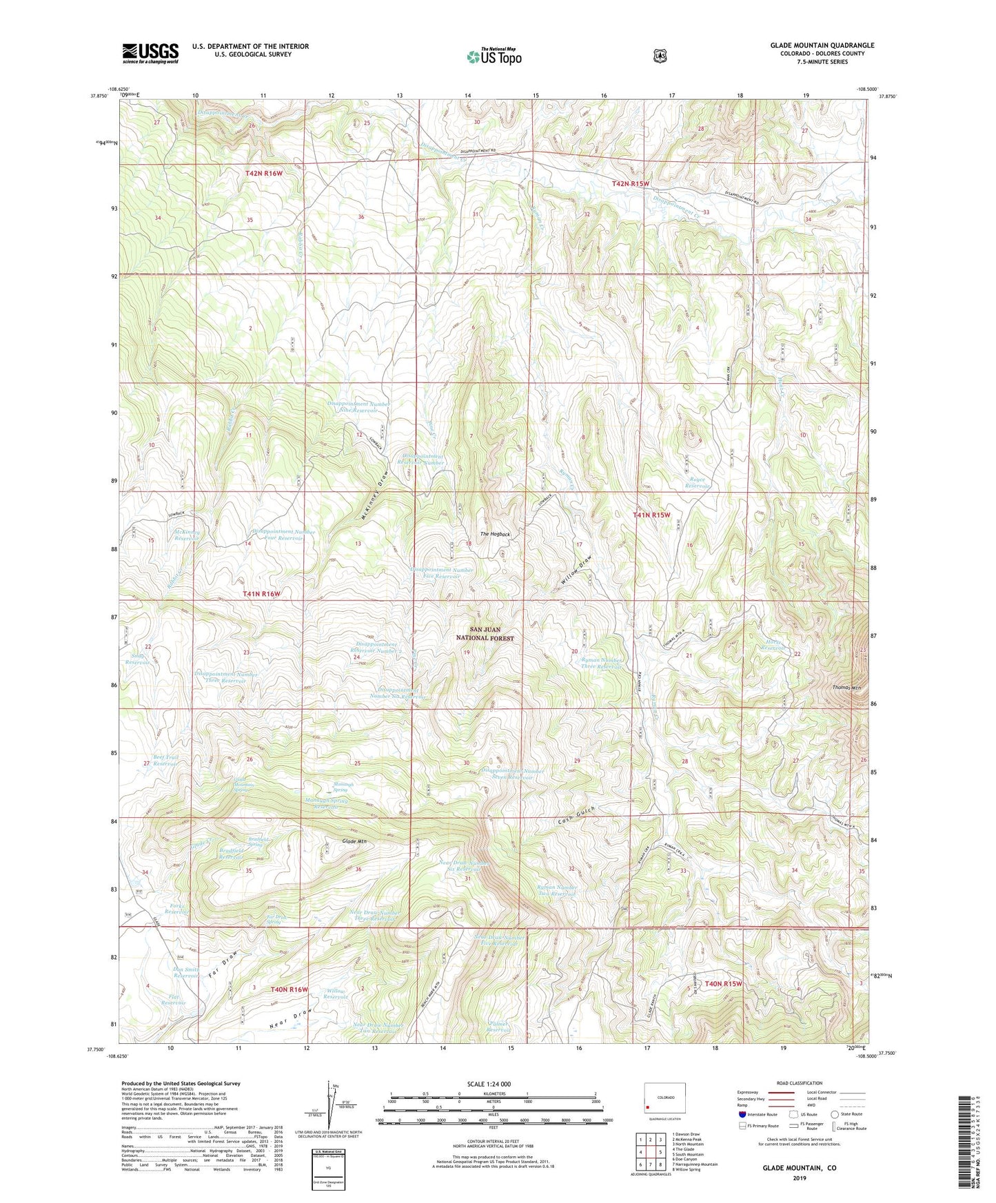
Glade Mountain Colorado US Topo Map
Couldn't load pickup availability
Also explore the Glade Mountain Forest Service Topo of this same quad for updated USFS data
2022 topographic map quadrangle Glade Mountain in the state of Colorado. Scale: 1:24000. Based on the newly updated USGS 7.5' US Topo map series, this map is in the following counties: Dolores. The map contains contour data, water features, and other items you are used to seeing on USGS maps, but also has updated roads and other features. This is the next generation of topographic maps. Printed on high-quality waterproof paper with UV fade-resistant inks.
Quads adjacent to this one:
West: The Glade
Northwest: Dawson Draw
North: McKenna Peak
Northeast: North Mountain
East: South Mountain
Southeast: Willow Spring
South: Narraguinnep Mountain
Southwest: Doe Canyon
This map covers the same area as the classic USGS quad with code o37108g5.
Contains the following named places: Beef Trail Reservoir, Benchmark Lookout, Bradfield Reservoir, Bradfield Spring, Broken Thumb Mine, Cash Gulch, Cat Reservoir, Diana Reservoir, Disappointment Number Five Reservoir, Disappointment Number Four Reservoir, Disappointment Number Nine Reservoir, Disappointment Number Seven Reservoir, Disappointment Number Six Reservoir, Disappointment Number Three Reservoir, Disappointment Reservoir Number 1, Disappointment Reservoir Number 2, Dolores County, Don Smith Reservoir, Far Draw Spring, Flat Reservoir, Forks Reservoir, Glade Mountain, Glade Mountain Spring, Horse Reservoir, Hunt Creek, Manaugh Spring, Manaugh Spring Reservoir, McKinney Draw, McKinney Draw Reservoir, McKinney Reservoir, Near Draw Number Five Reservoir, Near Draw Number Four Reservoir, Near Draw Number Six Reservoir, Near Draw Number Three Reservoir, Near Draw Number Two Reservoir, Palmer Reservoir, Pine Creek, Rabbit Creek, Royce Reservoir, Ryman Creek, Ryman Number Four Reservoir, Ryman Number Three Reservoir, Ryman Number Two Reservoir, Salt Arroyo, Snag Reservoir, The Hogback, Thomas Mountain, Willow Draw, Willow Reservoir