MyTopo
North Mountain Colorado US Topo Map
Couldn't load pickup availability
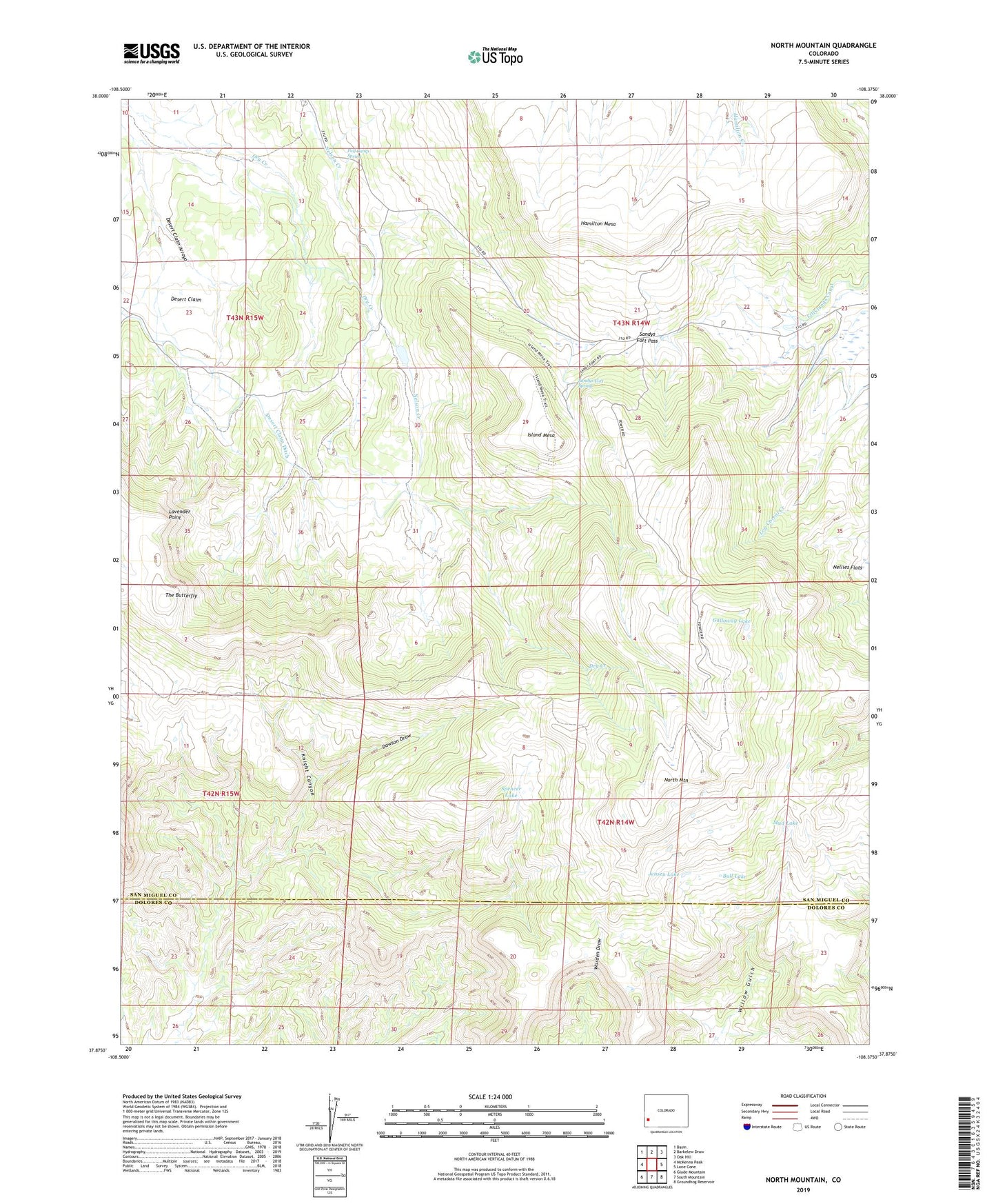
2022 topographic map quadrangle North Mountain in the state of Colorado. Scale: 1:24000. Based on the newly updated USGS 7.5' US Topo map series, this map is in the following counties: San Miguel, Dolores. The map contains contour data, water features, and other items you are used to seeing on USGS maps, but also has updated roads and other features. This is the next generation of topographic maps. Printed on high-quality waterproof paper with UV fade-resistant inks.
Quads adjacent to this one:
West: McKenna Peak
Northwest: Basin
North: Barkelew Draw
Northeast: Oak Hill
East: Lone Cone
Southeast: Groundhog Reservoir
South: South Mountain
Southwest: Glade Mountain
This map covers the same area as the classic USGS quad with code o37108h4.
Contains the following named places: Bull Lake, Davis Sheep Camp, Dawson Draw, Desert Claim, Desert Claim Ditch, Fall Camp Spring, Galloway Lake, Hamilton Mesa, Island Mesa, Jensen Lake, Jensens Cow Camp, Knight Canyon, Lavender Point, Mud Lake, North Mountain, Sandys Fort Pass, Sandys Fort Spring, Spencer Lake, The Butterfly