
MyTopo
Hackamore Ranch Colorado US Topo Map
Couldn't load pickup availability
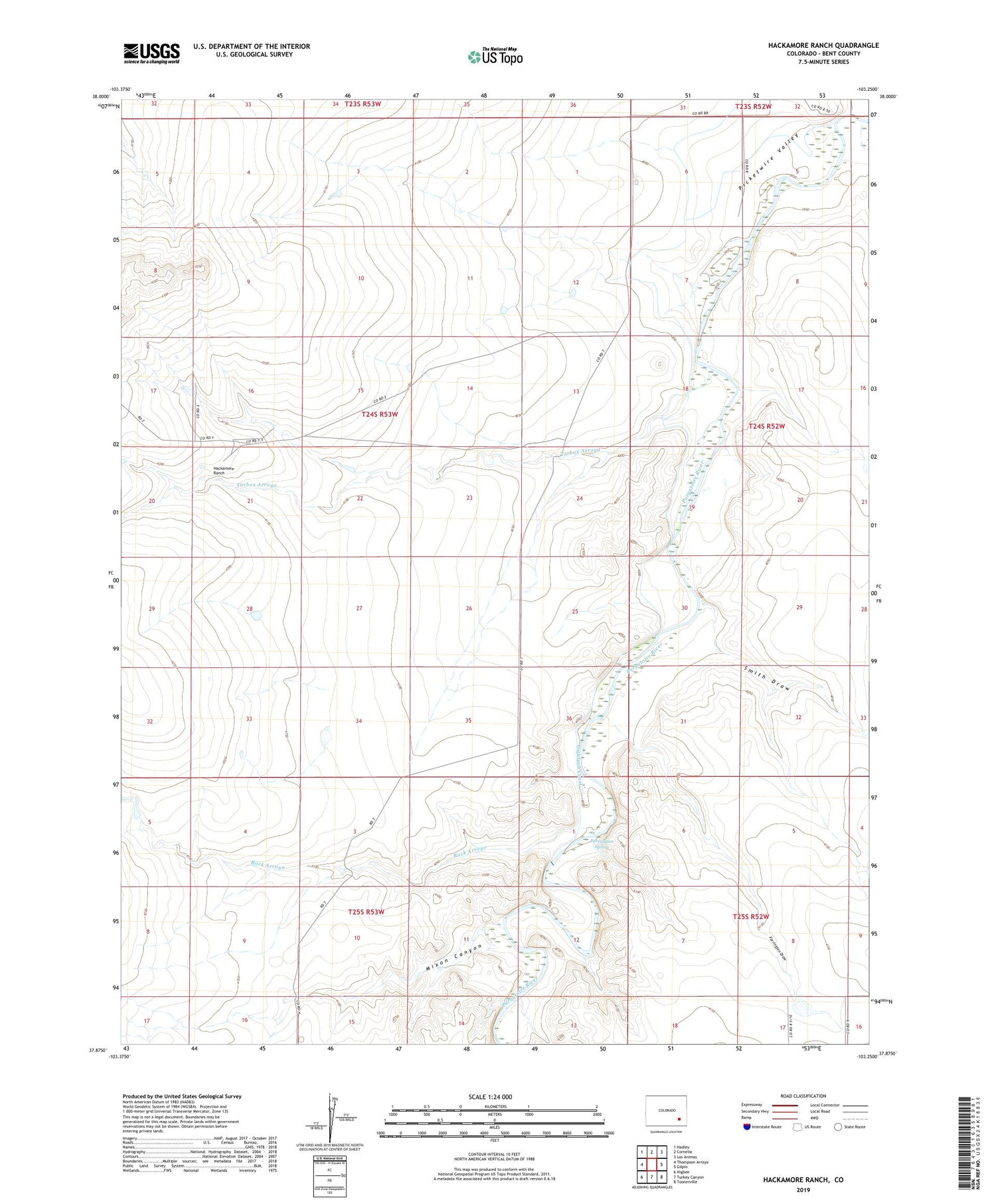
2022 topographic map quadrangle Hackamore Ranch in the state of Colorado. Scale: 1:24000. Based on the newly updated USGS 7.5' US Topo map series, this map is in the following counties: Bent. The map contains contour data, water features, and other items you are used to seeing on USGS maps, but also has updated roads and other features. This is the next generation of topographic maps. Printed on high-quality waterproof paper with UV fade-resistant inks.
Quads adjacent to this one:
West: Thompson Arroyo
Northwest: Hadley
North: Cornelia
Northeast: Las Animas
East: Gilpin
Southeast: Toonerville
South: Turkey Canyon
Southwest: Higbee
This map covers the same area as the classic USGS quad with code o37103h3.
Contains the following named places: Farrington Draw, Farrington Spring, Hackamore Ranch, Highland Canal, J J Windmill, Mixon Canyon, Rock Arroyo, Smith Draw, Tarbox Arroyo


