
MyTopo
Homelake Colorado US Topo Map
Couldn't load pickup availability
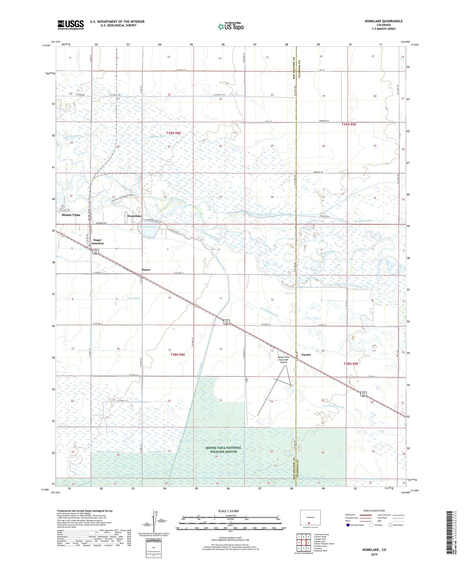
2022 topographic map quadrangle Homelake in the state of Colorado. Scale: 1:24000. Based on the newly updated USGS 7.5' US Topo map series, this map is in the following counties: Rio Grande, Alamosa. The map contains contour data, water features, and other items you are used to seeing on USGS maps, but also has updated roads and other features. This is the next generation of topographic maps. Printed on high-quality waterproof paper with UV fade-resistant inks.
Quads adjacent to this one:
West: Monte Vista
Northwest: Sevenmile Plaza
North: Center South
Northeast: Hooper West
East: Mount Pleasant School
Southeast: Alamosa West
South: Waverly
Southwest: Fulcher Gulch
This map covers the same area as the classic USGS quad with code o37106e1.
Contains the following named places: Billings Ditch, Bowen Ditch, Colorado State Veterans Center at Homelake, Getz Ditch, Homelake, Leyden Lateral, Lower Centennial Ditch, McLean Drain, Monte Vista Municipal Airport, Parma, Parma Drain, San Luis Valley Canal, Sanderson Ditch, Sherman Lake, Spring Creek, Sugar Junction, The Feed Store Church, Zinzer


