MyTopo
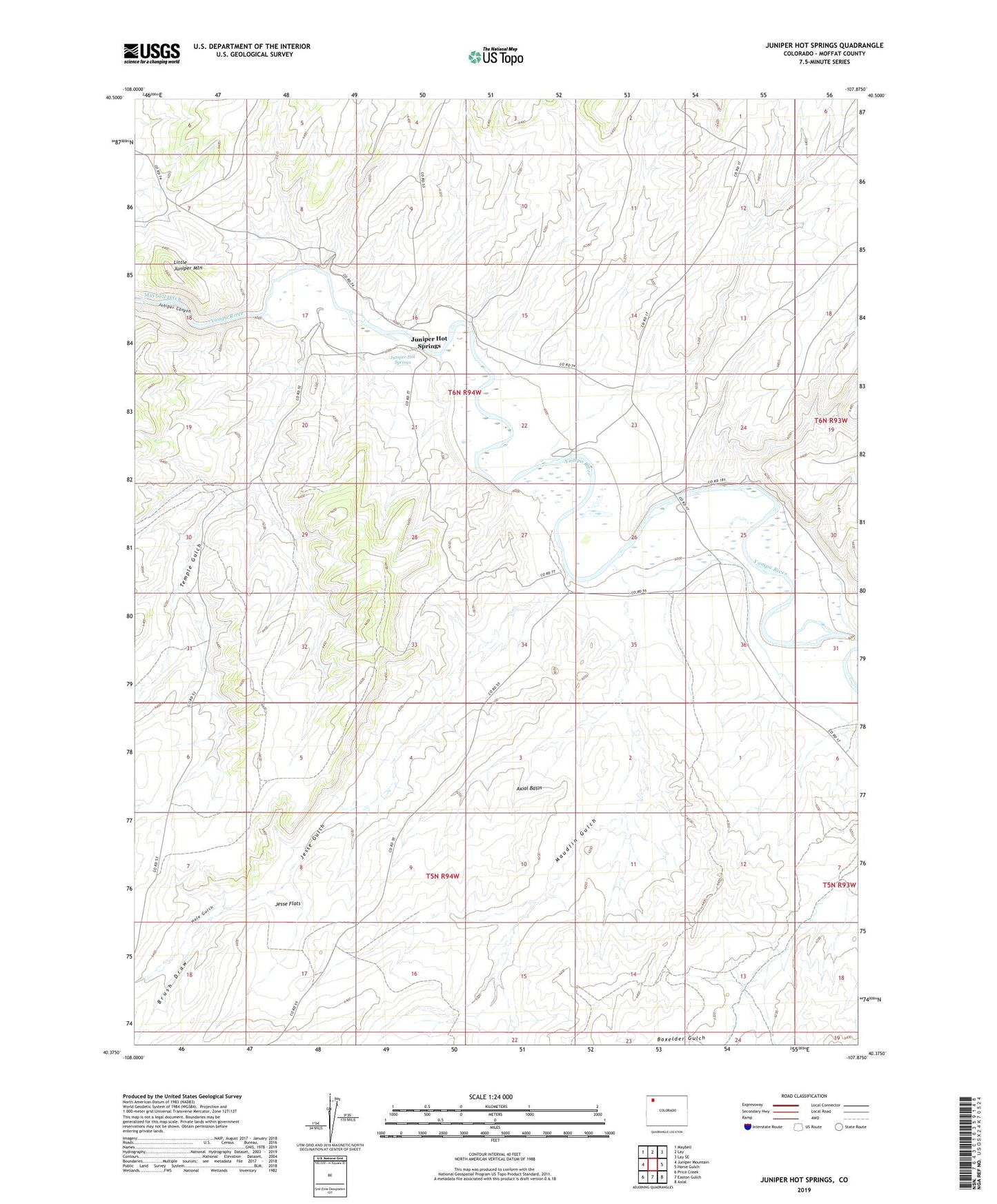
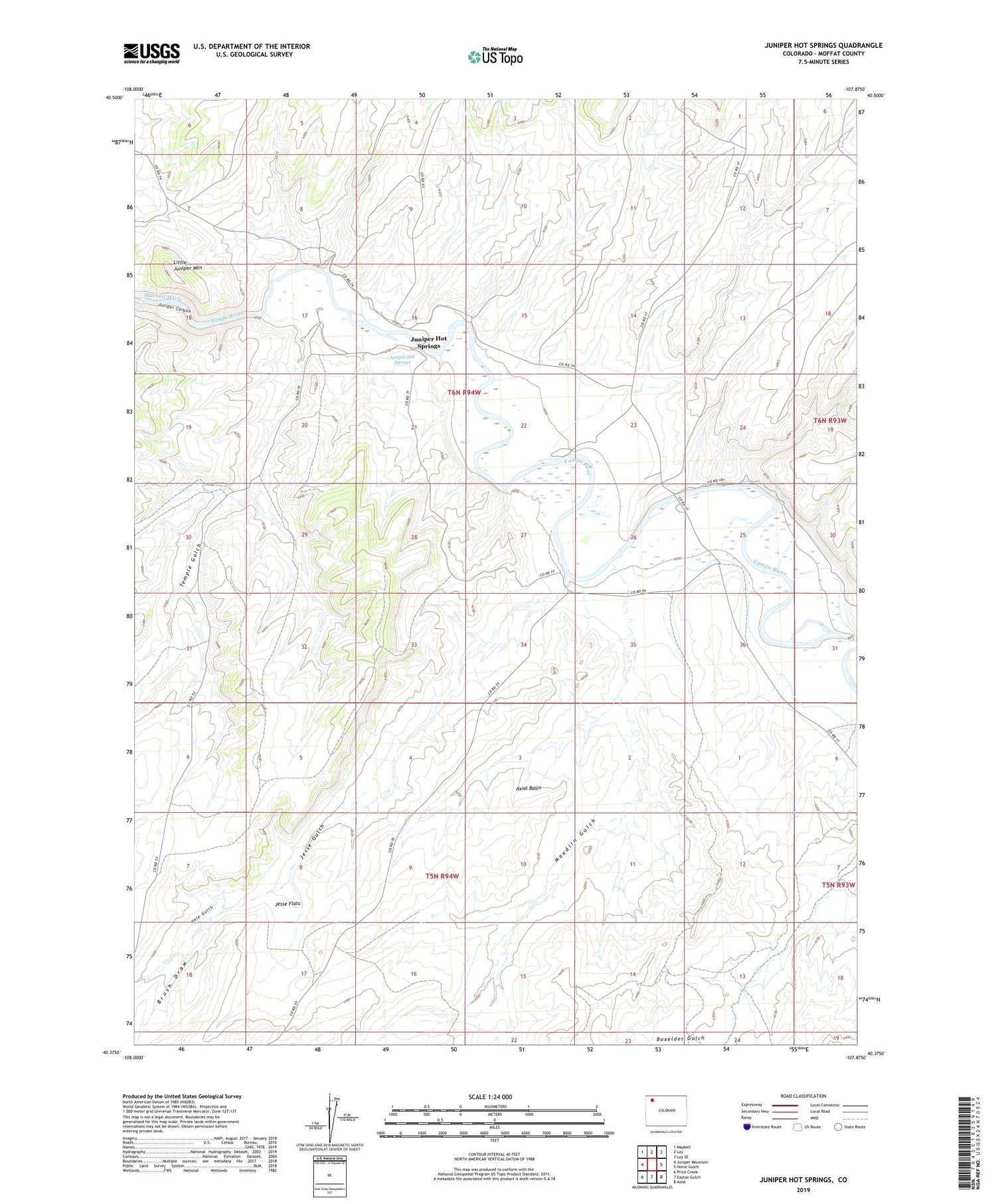
Juniper Hot Springs Colorado US Topo Map
Couldn't load pickup availability
2022 topographic map quadrangle Juniper Hot Springs in the state of Colorado. Scale: 1:24000. Based on the newly updated USGS 7.5' US Topo map series, this map is in the following counties: Moffat. The map contains contour data, water features, and other items you are used to seeing on USGS maps, but also has updated roads and other features. This is the next generation of topographic maps. Printed on high-quality waterproof paper with UV fade-resistant inks.
Quads adjacent to this one:
West: Juniper Mountain
Northwest: Maybell
North: Lay
Northeast: Lay SE
East: Horse Gulch
Southeast: Axial
South: Easton Gulch
Southwest: Price Creek
This map covers the same area as the classic USGS quad with code o40107d8.
Contains the following named places: Airborne Anomaly B17-89 Mine, Airborne Anomaly B17-90 Mine, Airborne Anomaly B17-93 Mine, Airborne Anomaly B17-94 Mine, Airborne Anomaly B17-95 Mine, Airborne Anomaly B17-96 Mine, Brush Draw, Cedars Mining Company Claim Number One, Hale Gulch, Jesse Flats, Jesse Gulch, Juniper Hot Springs, Little Juniper Mountain, Maudlin Gulch, Temple Gulch