MyTopo
Kremmling Colorado US Topo Map
Couldn't load pickup availability
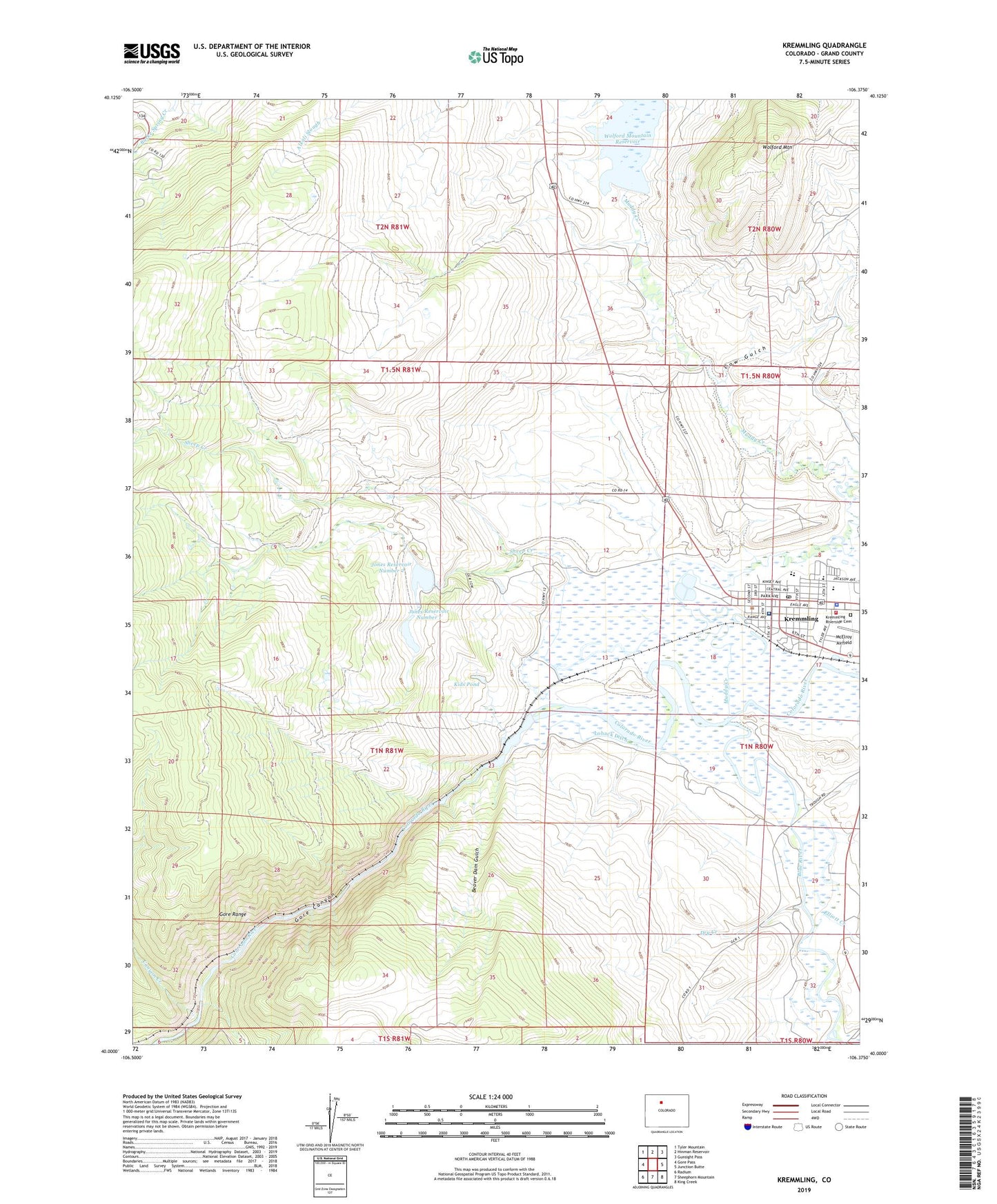
2022 topographic map quadrangle Kremmling in the state of Colorado. Scale: 1:24000. Based on the newly updated USGS 7.5' US Topo map series, this map is in the following counties: Grand. The map contains contour data, water features, and other items you are used to seeing on USGS maps, but also has updated roads and other features. This is the next generation of topographic maps. Printed on high-quality waterproof paper with UV fade-resistant inks.
Quads adjacent to this one:
West: Gore Pass
Northwest: Tyler Mountain
North: Hinman Reservoir
Northeast: Gunsight Pass
East: Junction Butte
Southeast: King Creek
South: Sheephorn Mountain
Southwest: Radium
This map covers the same area as the classic USGS quad with code o40106a4.
Contains the following named places: Beaver Creek, Beaver Dam Gulch, Blue River, Canyon Creek, City Reservoir, Colorado State Patrol Kremmling Post, Cow Gulch, De Berard Ranch, Dry Creek, Elliott Creek, Engle Ranch, Gore, Gore Canyon, Grand County Emergency Medical Services Station 4, Inspiration Point, Jones Number 1 Dam, Jones Number 2 Dam, Jones Number 3 Dam, Jones Reservoir Number 1, Jones Reservoir Number 3, Kids Pond, Kremmling, Kremmling Community Church, Kremmling Fire Protection District, Kremmling Police Department, Kremmling Post Office, Kremmling Riverside Cemetery, Kremmling Town Hall, KRKM-FM (Kremmling), Loback Ditch, Martin Ranch, Middle Park Medical Center Kremmling Campus, Muddy Creek, Saint Peters Catholic Community Church, San Toy Mountain, Sheep Creek, Town of Kremmling, West Grand Elementary and Middle School, West Grand High School, Wolford Mountain, Wolford Mountain Reservoir, Yust Ranch