MyTopo
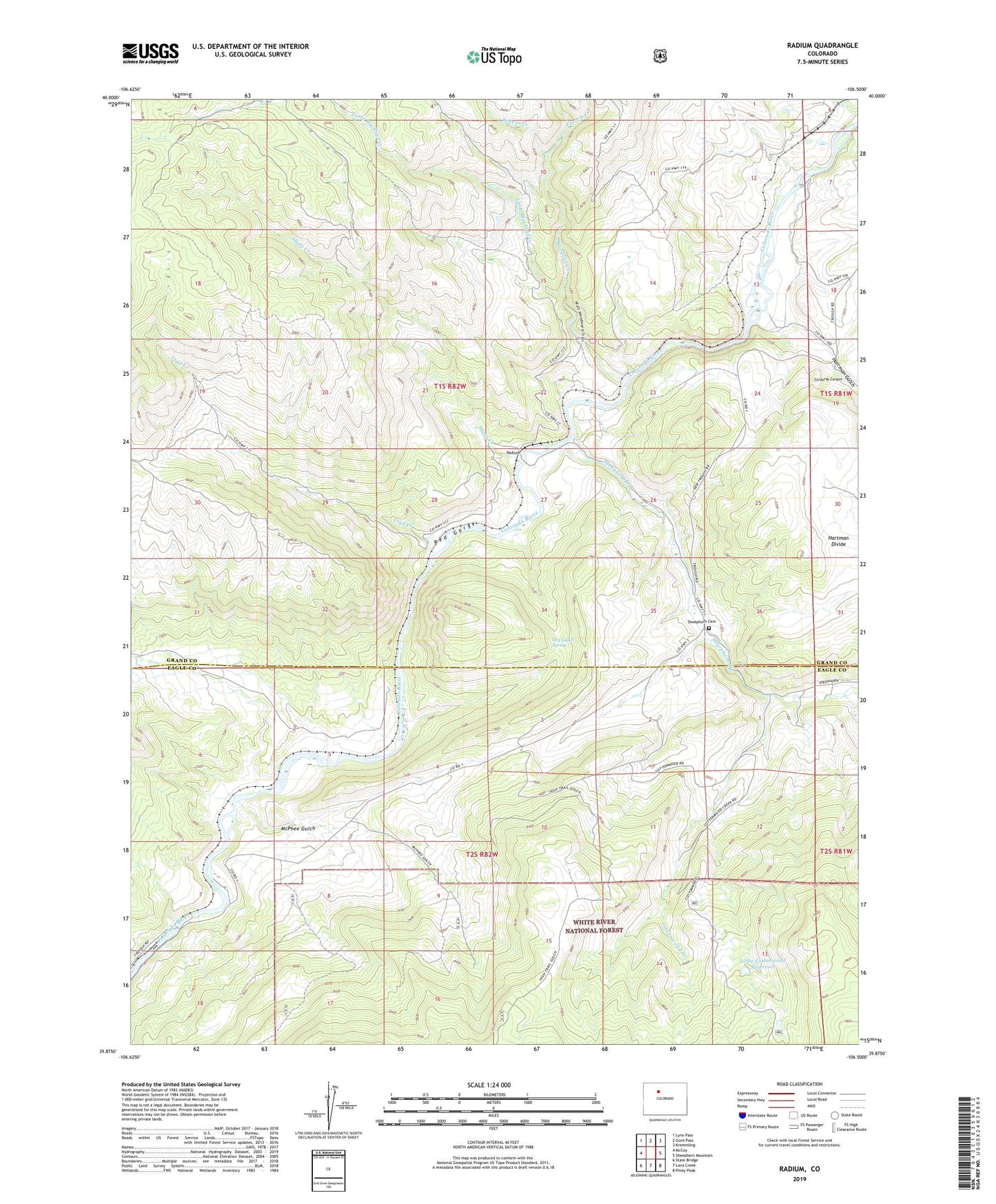
Radium Colorado US Topo Map
Couldn't load pickup availability
Also explore the Radium Forest Service Topo of this same quad for updated USFS data
2022 topographic map quadrangle Radium in the state of Colorado. Scale: 1:24000. Based on the newly updated USGS 7.5' US Topo map series, this map is in the following counties: Grand, Eagle. The map contains contour data, water features, and other items you are used to seeing on USGS maps, but also has updated roads and other features. This is the next generation of topographic maps. Printed on high-quality waterproof paper with UV fade-resistant inks.
Quads adjacent to this one:
West: McCoy
Northwest: Lynx Pass
North: Gore Pass
Northeast: Kremmling
East: Sheephorn Mountain
Southeast: Piney Peak
South: Lava Creek
Southwest: State Bridge
This map covers the same area as the classic USGS quad with code o39106h5.
Contains the following named places: Azure, Beaver Creek, Champion Mine, Corduroy Canyon, Cottonwood Creek, Dry Gulch Spring, East Saint Louis Mine, French Creek, Garden Gulch, Harrman Gulch, Little Blacktail Creek, Little Cottonwood Reservoir, McPhee Gulch, Mitchell Mine, No Name Mine, Radium, Rancho Del Rio, Red Gorge, Red Gorge Mine, Rock Gap Dam, Rock Hat Claim, Sheep Creek, Sheephorn Cemetery, Sheephorn Creek, Trail Creek, Yarmony, ZIP Code: 80423