MyTopo
Lascar Colorado US Topo Map
Couldn't load pickup availability
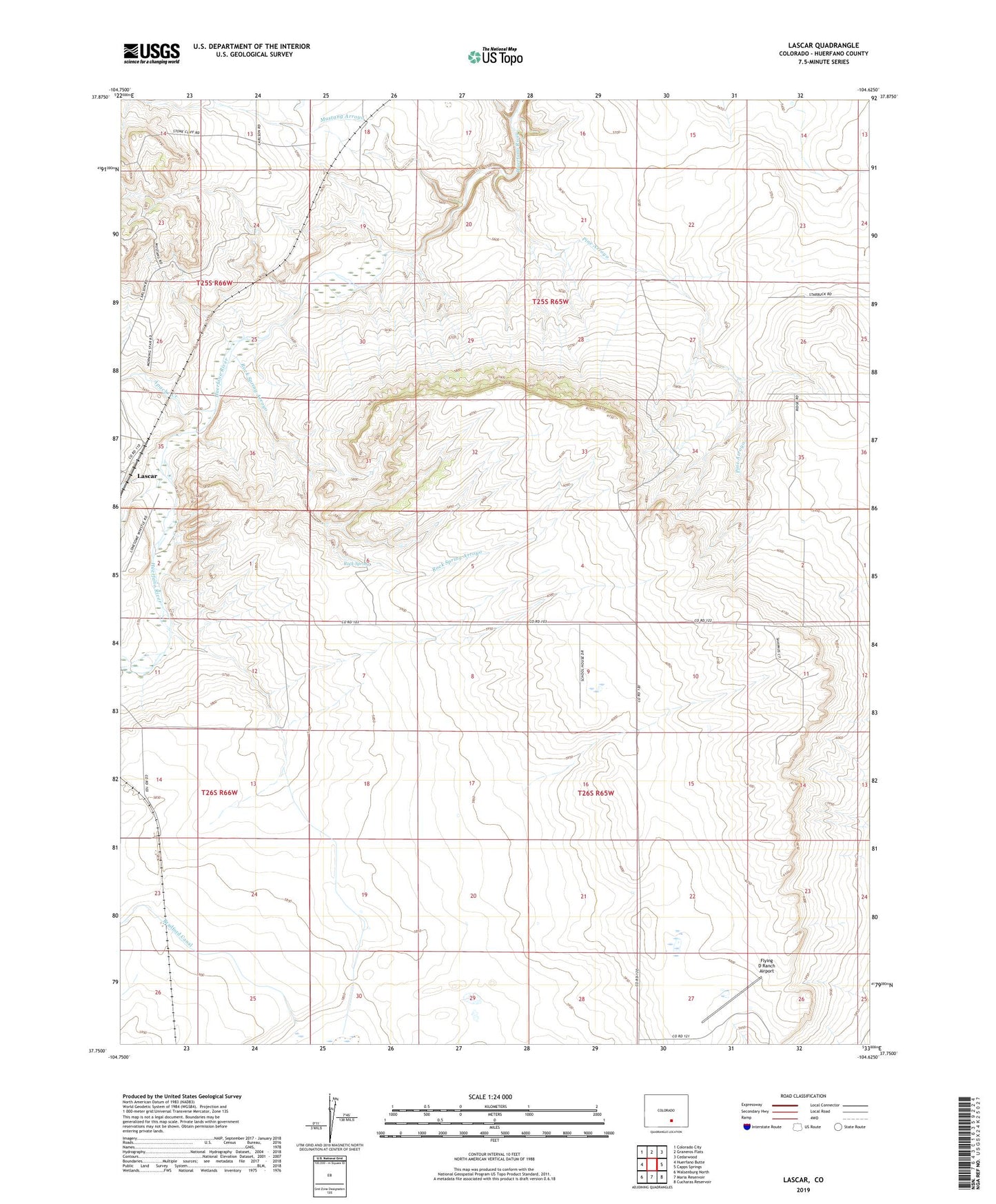
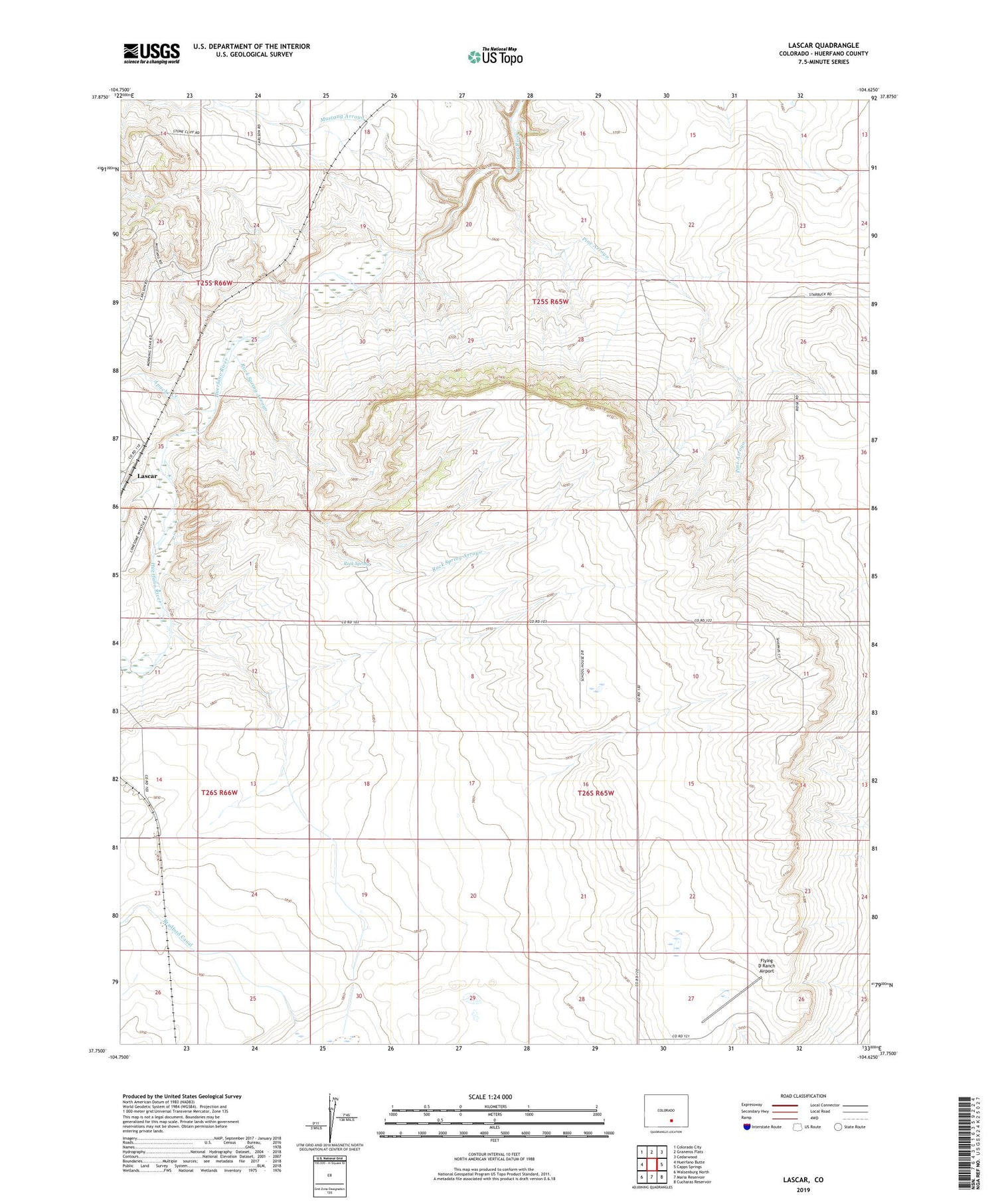
2022 topographic map quadrangle Lascar in the state of Colorado. Scale: 1:24000. Based on the newly updated USGS 7.5' US Topo map series, this map is in the following counties: Huerfano. The map contains contour data, water features, and other items you are used to seeing on USGS maps, but also has updated roads and other features. This is the next generation of topographic maps. Printed on high-quality waterproof paper with UV fade-resistant inks.
Quads adjacent to this one:
West: Huerfano Butte
Northwest: Colorado City
North: Graneros Flats
Northeast: Cedarwood
East: Capps Springs
Southeast: Cucharas Reservoir
South: Maria Reservoir
Southwest: Walsenburg North
This map covers the same area as the classic USGS quad with code o37104g6.
Contains the following named places: Apache Creek, Ballard Well, Flying D Ranch Airport, Greasewood Arroyo, Lascar, Mustang Arroyo, Pine Arroyo, Rock Spring, Rock Spring Arroyo, Shepard Well, Turkey Ridge School