MyTopo
Cedarwood Colorado US Topo Map
Couldn't load pickup availability
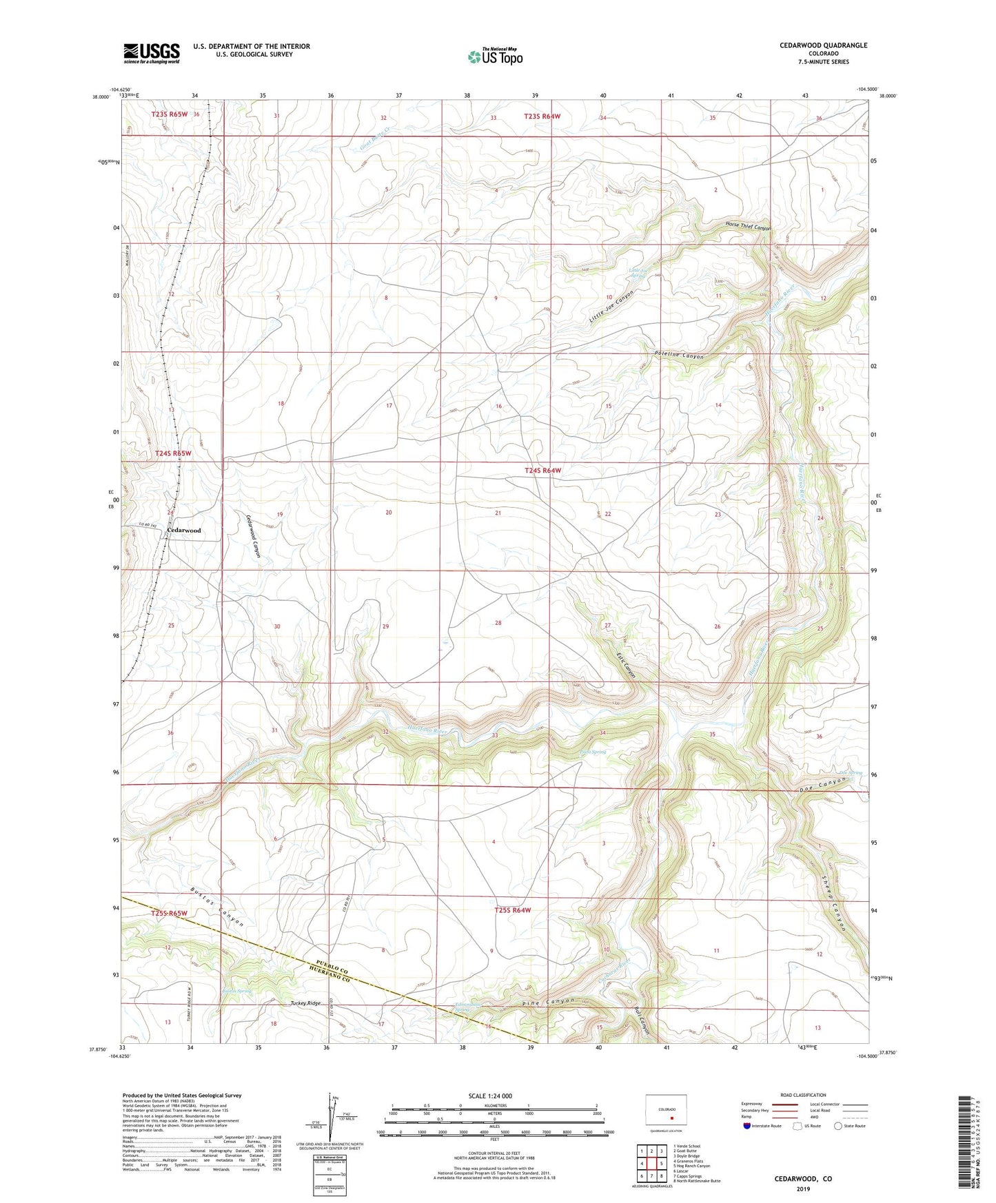
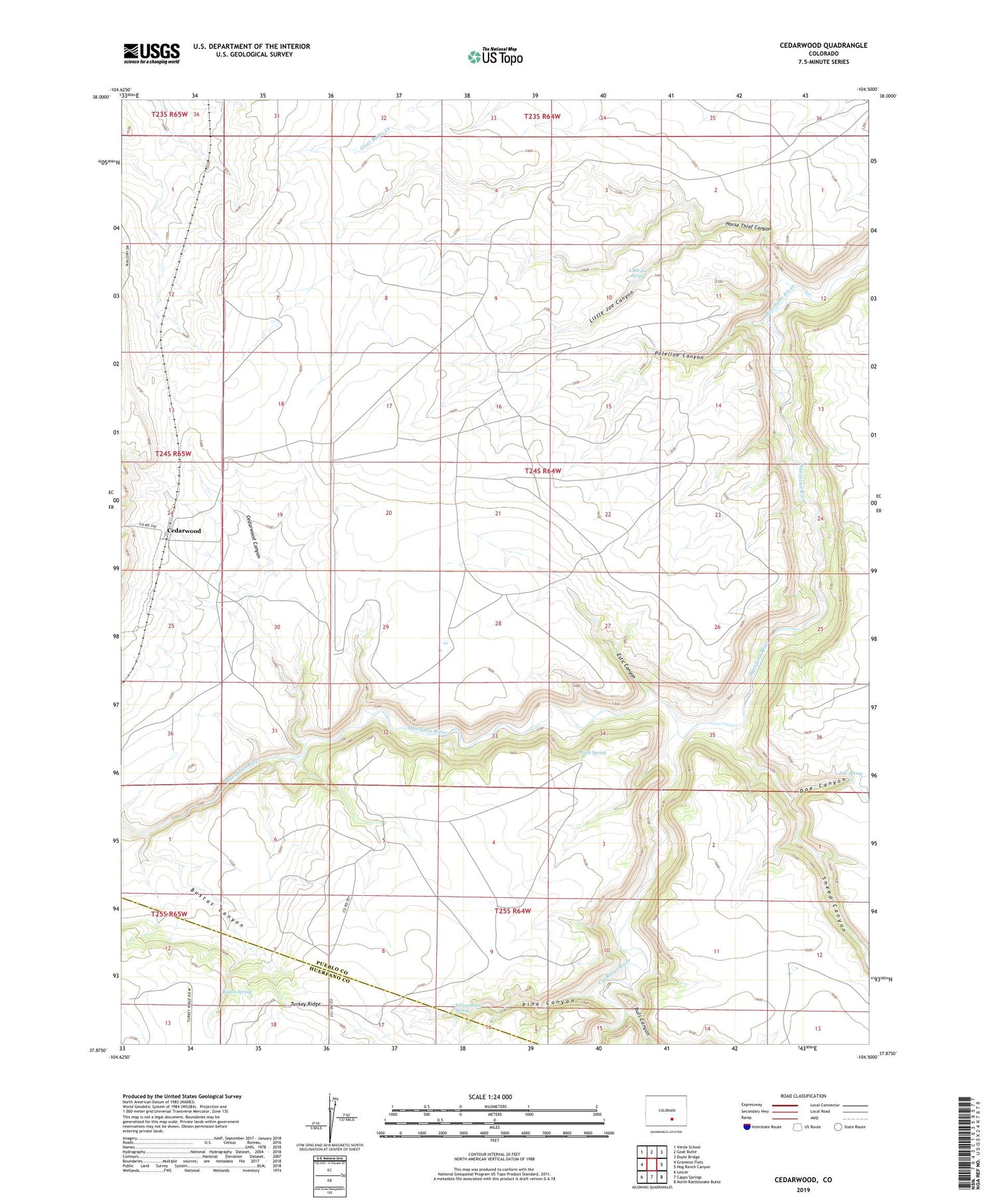
2022 topographic map quadrangle Cedarwood in the state of Colorado. Scale: 1:24000. Based on the newly updated USGS 7.5' US Topo map series, this map is in the following counties: Pueblo, Huerfano. The map contains contour data, water features, and other items you are used to seeing on USGS maps, but also has updated roads and other features. This is the next generation of topographic maps. Printed on high-quality waterproof paper with UV fade-resistant inks.
Quads adjacent to this one:
West: Graneros Flats
Northwest: Verde School
North: Goat Butte
Northeast: Doyle Bridge
East: Hog Ranch Canyon
Southeast: North Rattlesnake Butte
South: Capps Springs
Southwest: Lascar
This map covers the same area as the classic USGS quad with code o37104h5.
Contains the following named places: Bull Canyon, Bustos Canyon, Bustos Spring, Cedarwood, Cedarwood Canyon, Cedarwood Well, Cucharas River, Doe Canyon, Doe Spring, Edmondson Spring, Estic Canyon, Horse Thief Canyon, Little Joe Canyon, Little Joe Spring, Pine Canyon, Point Spring, Poleline Camp, Poleline Canyon, Sheep Canyon