MyTopo
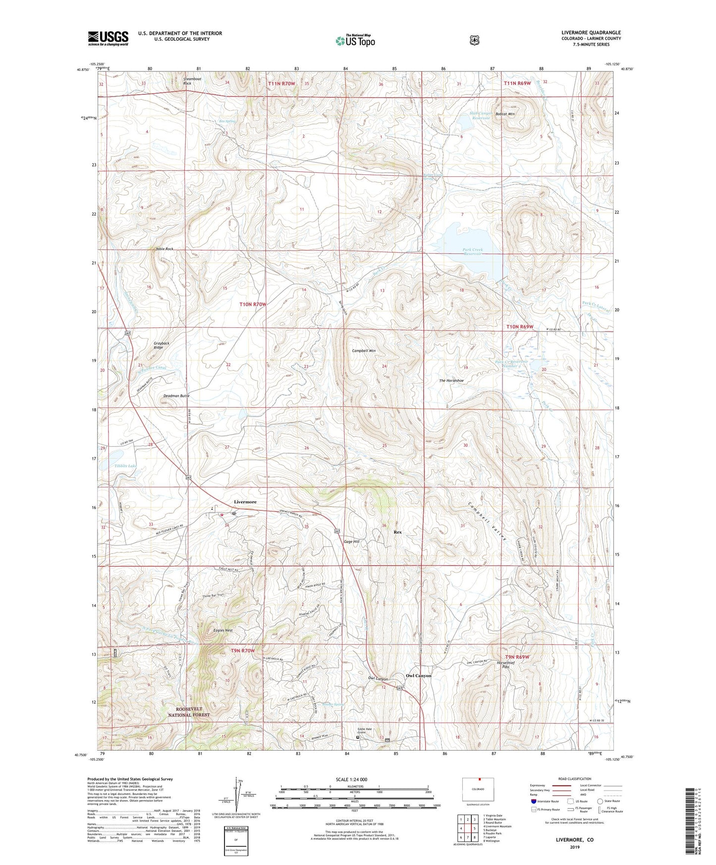
Livermore Colorado US Topo Map
Couldn't load pickup availability
Also explore the Livermore Forest Service Topo of this same quad for updated USFS data
2022 topographic map quadrangle Livermore in the state of Colorado. Scale: 1:24000. Based on the newly updated USGS 7.5' US Topo map series, this map is in the following counties: Larimer. The map contains contour data, water features, and other items you are used to seeing on USGS maps, but also has updated roads and other features. This is the next generation of topographic maps. Printed on high-quality waterproof paper with UV fade-resistant inks.
Quads adjacent to this one:
West: Livermore Mountain
Northwest: Virginia Dale
North: Table Mountain
Northeast: Round Butte
East: Buckeye
Southeast: Wellington
South: Laporte
Southwest: Poudre Park
This map covers the same area as the classic USGS quad with code o40105g2.
Contains the following named places: Bobcat Mountain, Bonner Spring, Box Spring, Campbell Mountain, Campbell Valley, Davis Nickel Prospect, Deadman Butte, Deadman Butte Mine, Eagles Nest, Eddie Hale Grave, Folsom Point Diggings, Gage Hill, Grayback Ridge, Horsethief Pass, Lateral Number 1, Livermore, Livermore Fire Protection District Livermore Station 1, Livermore Post Office, North Poudre Canal, Owl Canyon, Owl Canyon Mine, Owl Creek, Park Creek Dam, Park Creek Number 2 Dam, Park Creek Reservoir, Park Creek Reservoir Number 2, Pinon Grove, Rex, Rex Quarry, Roberts Quarry, Roller Stone Well, Rufner Camp Spring, Slab Canyon Dam, Slab Canyon Reservoir, Slab Canyon Wash, Spring Gulch, Spring Hill Ranch, Table Rock, The Horseshoe, Tibbits Lake