MyTopo
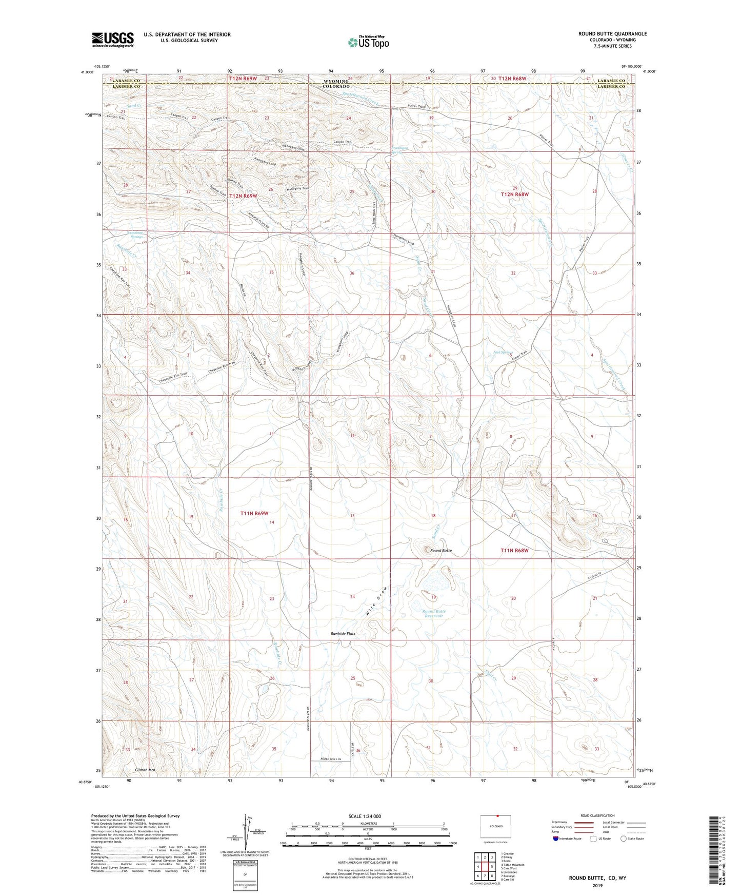
Round Butte Colorado US Topo Map
Couldn't load pickup availability
2022 topographic map quadrangle Round Butte in the state of Colorado. Scale: 1:24000. Based on the newly updated USGS 7.5' US Topo map series, this map is in the following counties: Larimer, Laramie. The map contains contour data, water features, and other items you are used to seeing on USGS maps, but also has updated roads and other features. This is the next generation of topographic maps. Printed on high-quality waterproof paper with UV fade-resistant inks.
Quads adjacent to this one:
West: Table Mountain
Northwest: Granite
North: Emkay
Northeast: Borie
East: Carr West
Southeast: Carr SW
South: Buckeye
Southwest: Livermore
Contains the following named places: Brannigan Camp, Brannigan Spring, Castle Rock Camp, Graves Camp, Jack Springs, Jack Springs Camp, Lower Jack Springs Camp, Mountain Supply Number 1 Dam, Mountain Supply Reservoir Number 1, Rawhide Flats, Rawhide Strip, Round Butte, Round Butte Reservoir, Sand Creek, Soapstone Camp, Soapstone Springs, Upper Barton Camp, Upper Jack Springs Camp