
MyTopo
Lone Mountain Colorado US Topo Map
Couldn't load pickup availability
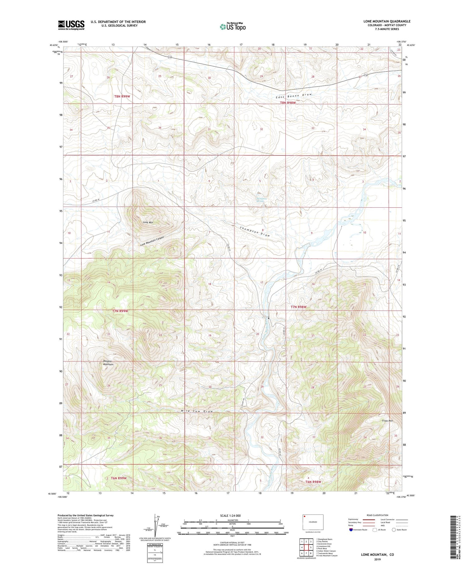
2022 topographic map quadrangle Lone Mountain in the state of Colorado. Scale: 1:24000. Based on the newly updated USGS 7.5' US Topo map series, this map is in the following counties: Moffat. The map contains contour data, water features, and other items you are used to seeing on USGS maps, but also has updated roads and other features. This is the next generation of topographic maps. Printed on high-quality waterproof paper with UV fade-resistant inks.
Quads adjacent to this one:
West: Limestone Hill
Northwest: Sheephead Basin
North: Clay Buttes
Northeast: Sevenmile Draw
East: Peck Mesa
Southeast: Cross Mountain Canyon
South: Twelvemile Mesa
Southwest: Indian Water Canyon
This map covers the same area as the classic USGS quad with code o40108e4.
Contains the following named places: Cross Mountain, Lone Mountain, Lone Mountain Canyon, Sheridan Ranch, Thompson Draw, Thompson Springs, Tisdell Ranch, Wild Cow Draw


