
MyTopo
Indian Water Canyon Colorado US Topo Map
Couldn't load pickup availability
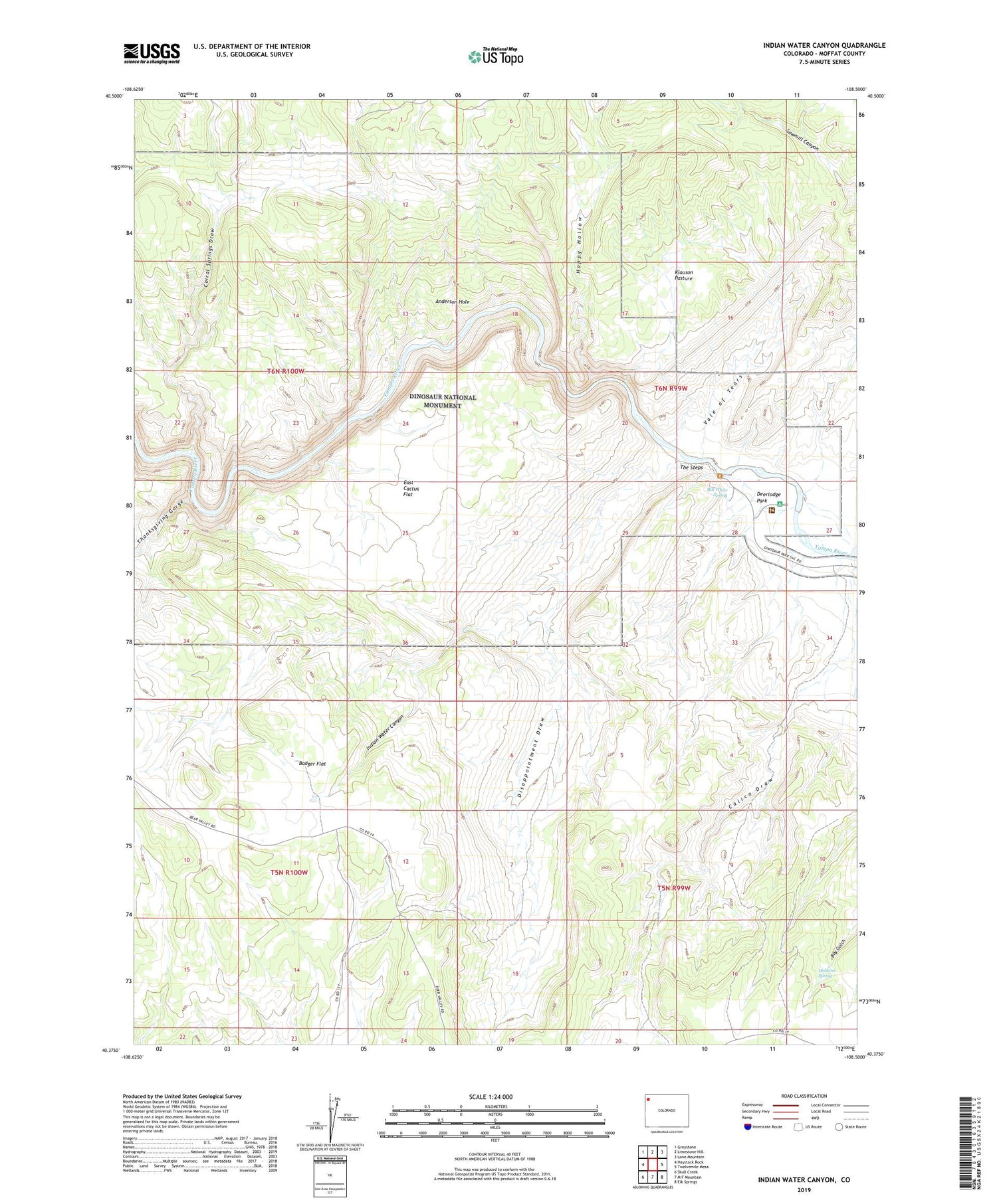
2022 topographic map quadrangle Indian Water Canyon in the state of Colorado. Scale: 1:24000. Based on the newly updated USGS 7.5' US Topo map series, this map is in the following counties: Moffat. The map contains contour data, water features, and other items you are used to seeing on USGS maps, but also has updated roads and other features. This is the next generation of topographic maps. Printed on high-quality waterproof paper with UV fade-resistant inks.
Quads adjacent to this one:
West: Haystack Rock
Northwest: Greystone
North: Limestone Hill
Northeast: Lone Mountain
East: Twelvemile Mesa
Southeast: Elk Springs
South: M F Mountain
Southwest: Skull Creek
This map covers the same area as the classic USGS quad with code o40108d5.
Contains the following named places: Anderson Hole, Badger Flat, Bill White Spring, Corral Springs Draw, Deerlodge Park, Deerlodge Park Campground, Disappointment Draw, Dobbins Spring, East Cactus Flat, Happy Hollow, Indian Water Canyon, Klauson Pasture, Spurgion Cabin, Stubs Cabin, Thanksgiving Gorge, The Steps, Vale of Tears


