MyTopo
McClave Colorado US Topo Map
Couldn't load pickup availability
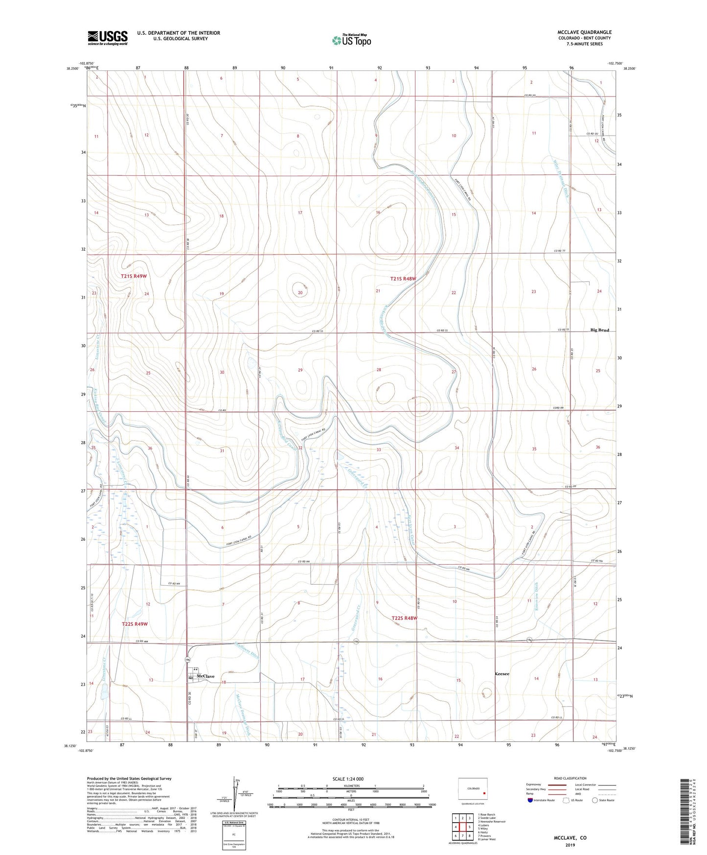
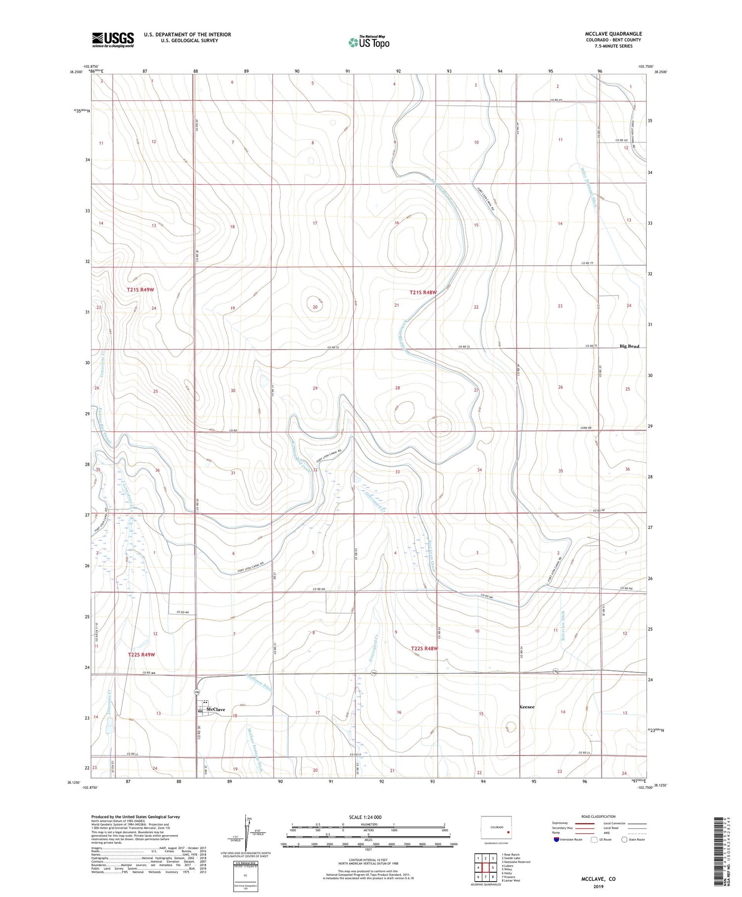
2022 topographic map quadrangle McClave in the state of Colorado. Scale: 1:24000. Based on the newly updated USGS 7.5' US Topo map series, this map is in the following counties: Bent. The map contains contour data, water features, and other items you are used to seeing on USGS maps, but also has updated roads and other features. This is the next generation of topographic maps. Printed on high-quality waterproof paper with UV fade-resistant inks.
Quads adjacent to this one:
West: Lubers
Northwest: Rose Ranch
North: Swede Lake
Northeast: Neenoshe Reservoir
East: Wiley
Southeast: Lamar West
South: Prowers
Southwest: Hasty
This map covers the same area as the classic USGS quad with code o38102b7.
Contains the following named places: Big Bend, George Simpson Ditch Number 2, Hasty - McClave Fire Department, Keesee, McClave, McClave Census Designated Place, McClave Post Office, Methodist Church of McClave, Sunflower Ditch, ZIP Code: 81092