MyTopo
Prowers Colorado US Topo Map
Couldn't load pickup availability
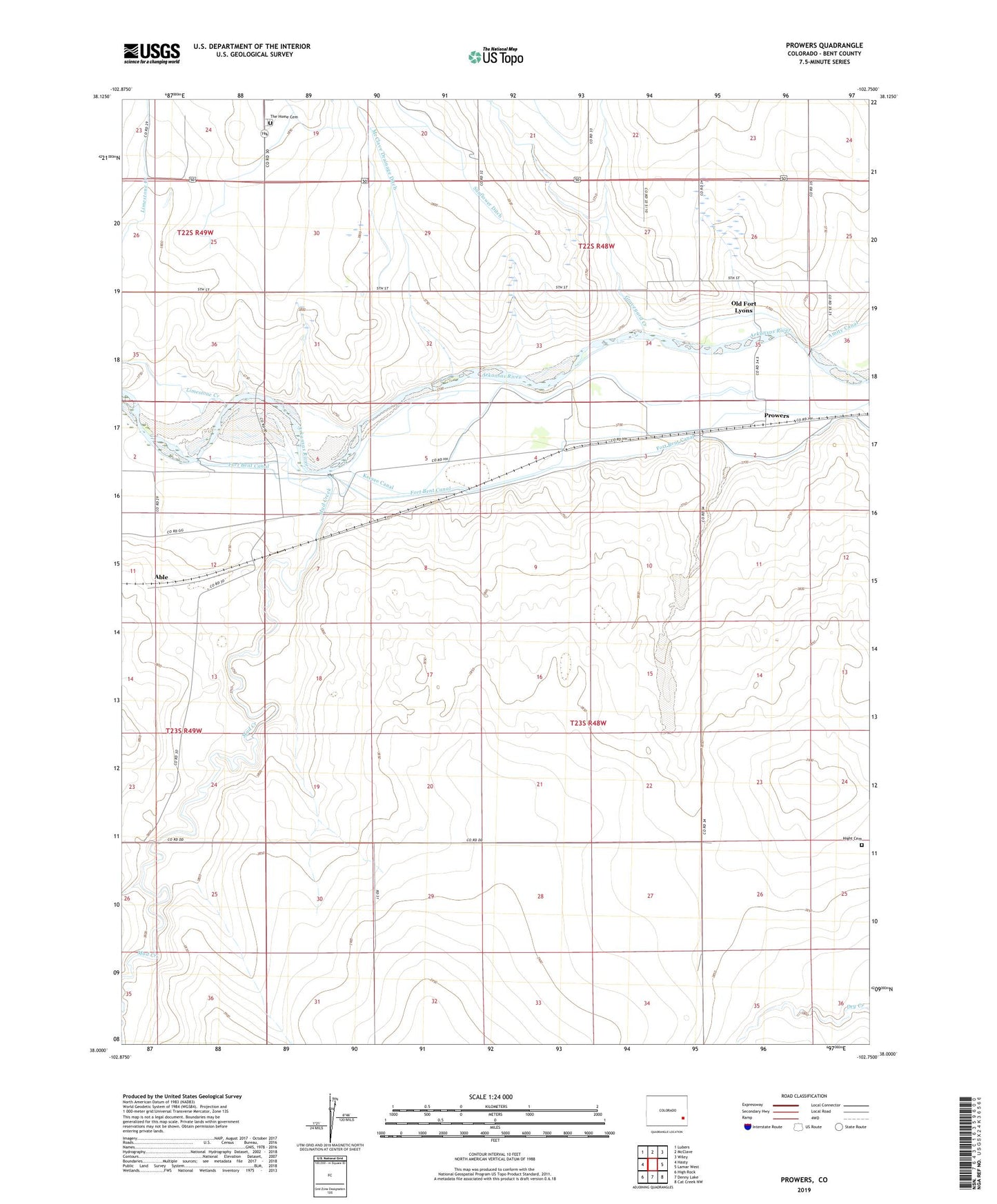
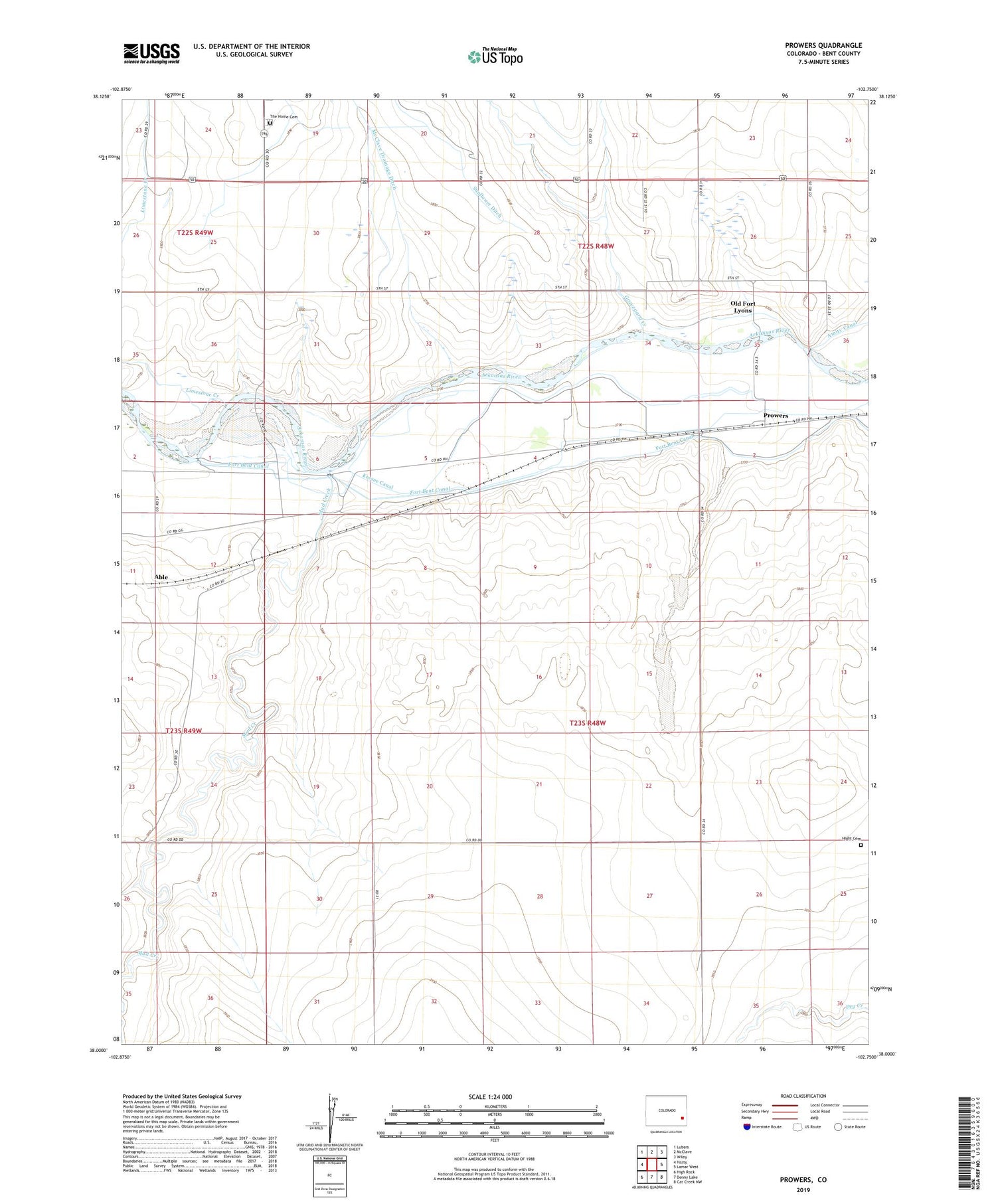
2022 topographic map quadrangle Prowers in the state of Colorado. Scale: 1:24000. Based on the newly updated USGS 7.5' US Topo map series, this map is in the following counties: Bent. The map contains contour data, water features, and other items you are used to seeing on USGS maps, but also has updated roads and other features. This is the next generation of topographic maps. Printed on high-quality waterproof paper with UV fade-resistant inks.
Quads adjacent to this one:
West: Hasty
Northwest: Lubers
North: McClave
Northeast: Wiley
East: Lamar West
Southeast: Cat Creek NW
South: Denny Lake
Southwest: High Rock
This map covers the same area as the classic USGS quad with code o38102a7.
Contains the following named places: Able, Bents New Fort Marker, Four Corners Crossing, Graveyard Creek, Graveyard Ditch, Hight Cemetery, Keesee Canal, Lakeview School, Limestone Creek, McClave Drainage Ditch, Mud Creek, Old Fort Lyons, Prowers, The Home Cemetery