MyTopo
Miller Ranch Colorado US Topo Map
Couldn't load pickup availability
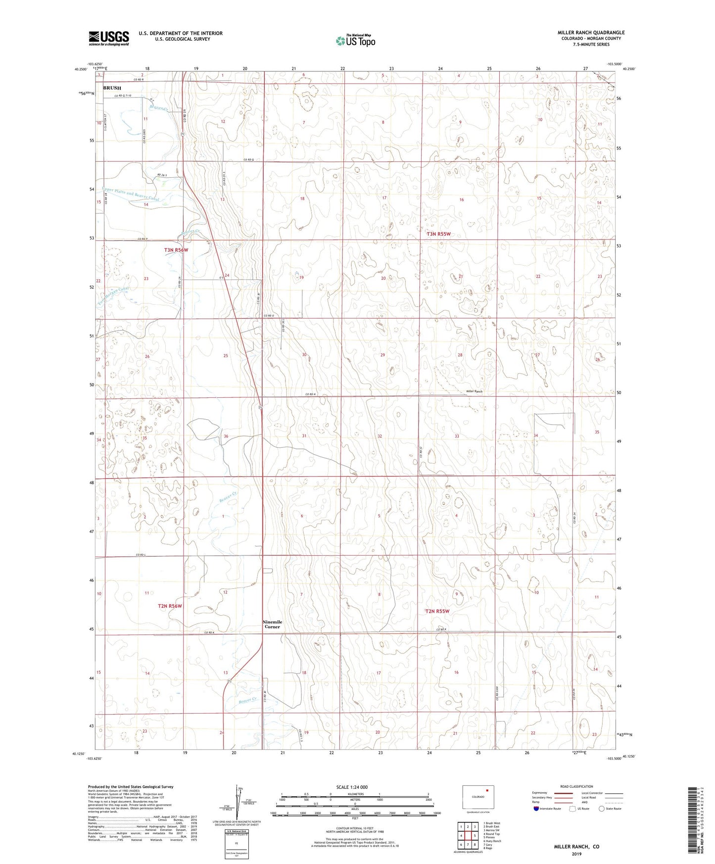
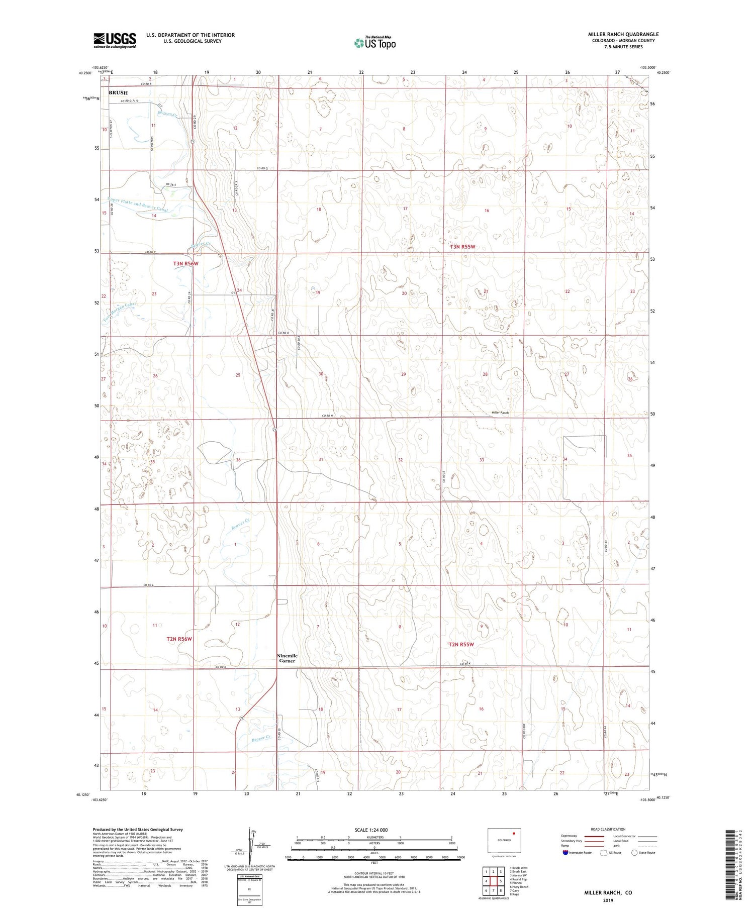
2022 topographic map quadrangle Miller Ranch in the state of Colorado. Scale: 1:24000. Based on the newly updated USGS 7.5' US Topo map series, this map is in the following counties: Morgan. The map contains contour data, water features, and other items you are used to seeing on USGS maps, but also has updated roads and other features. This is the next generation of topographic maps. Printed on high-quality waterproof paper with UV fade-resistant inks.
Quads adjacent to this one:
West: Round Top
Northwest: Brush West
North: Brush East
Northeast: Merino SW
East: Pinneo
Southeast: Rago
South: Gary
Southwest: Huey Ranch
This map covers the same area as the classic USGS quad with code o40103b5.
Contains the following named places: Atkinson Windmill, Bass Windmill, Brush Division, Brush Golf Course, East Windmill, Marwitz Windmill, Miller Ranch, Mitchell Windmills, Moreland Windmill, Ninemile Corner, North Windmill, School Section Windmill, Segelke Windmills, South Windmill, Weiss Windmill, Zorichak Oil Field, ZIP Code: 80723