MyTopo
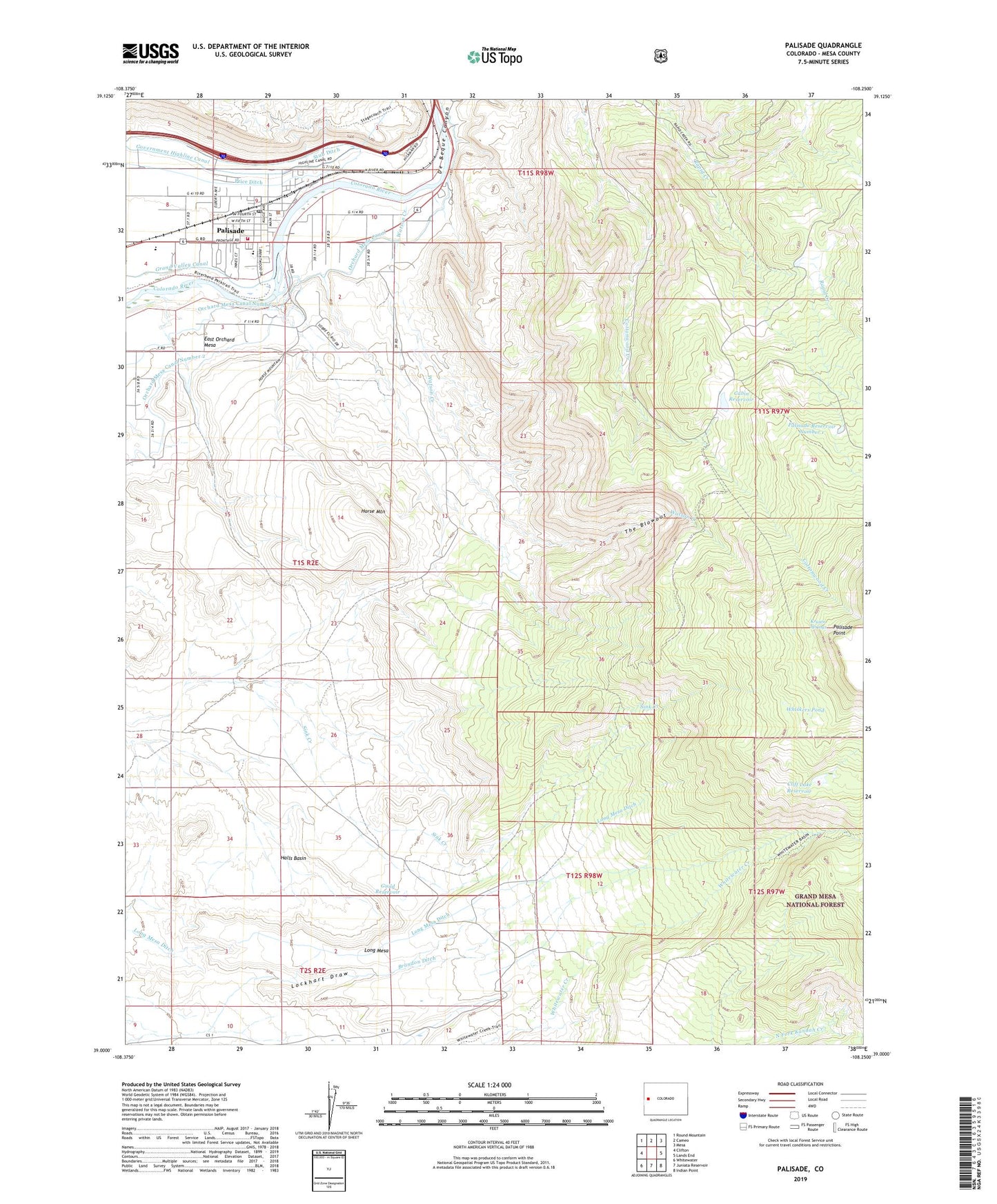
Palisade Colorado US Topo Map
Couldn't load pickup availability
Also explore the Palisade Forest Service Topo of this same quad for updated USFS data
2022 topographic map quadrangle Palisade in the state of Colorado. Scale: 1:24000. Based on the newly updated USGS 7.5' US Topo map series, this map is in the following counties: Mesa. The map contains contour data, water features, and other items you are used to seeing on USGS maps, but also has updated roads and other features. This is the next generation of topographic maps. Printed on high-quality waterproof paper with UV fade-resistant inks.
Quads adjacent to this one:
West: Clifton
Northwest: Round Mountain
North: Cameo
Northeast: Mesa
East: Lands End
Southeast: Indian Point
South: Juniata Reservoir
Southwest: Whitewater
This map covers the same area as the classic USGS quad with code o39108a3.
Contains the following named places: Blackbird Mine, Brandon Ditch, Cabin Reservoir, Cliff Lake Dam, Cliff Lake Reservoir, De Beque Canyon, Farmers Mine, Guild Enlargement Dam, Guild Enlargement Reservoir, Guild Reservoir, Halls Basin, Horse Mountain, Kannah Creek Mine, KJCT-TV (Grand Junction), Kruzen Springs, Lockhart Draw, Long Mesa, Long Mesa Ditch, Midwest Mine, Midwest Red Arrow Mine, Mount Lincoln Mine, Palisade, Palisade Cabin Dam, Palisade Fire Department, Palisade Mines, Palisade Point, Palisade Post Office, Palisade Reservoir Number 1, Palisade Town Police Department, Phylcon Number 1 Dam, Phylcon Number 1 Reservoir, Taylor School, The Blowout, Thomas Allen Lease Mine, Town of Palisade, Watson Creek, Whiskers Pond, Whitewater Basin Trail, ZIP Code: 81526