MyTopo
Mesa Colorado US Topo Map
Couldn't load pickup availability
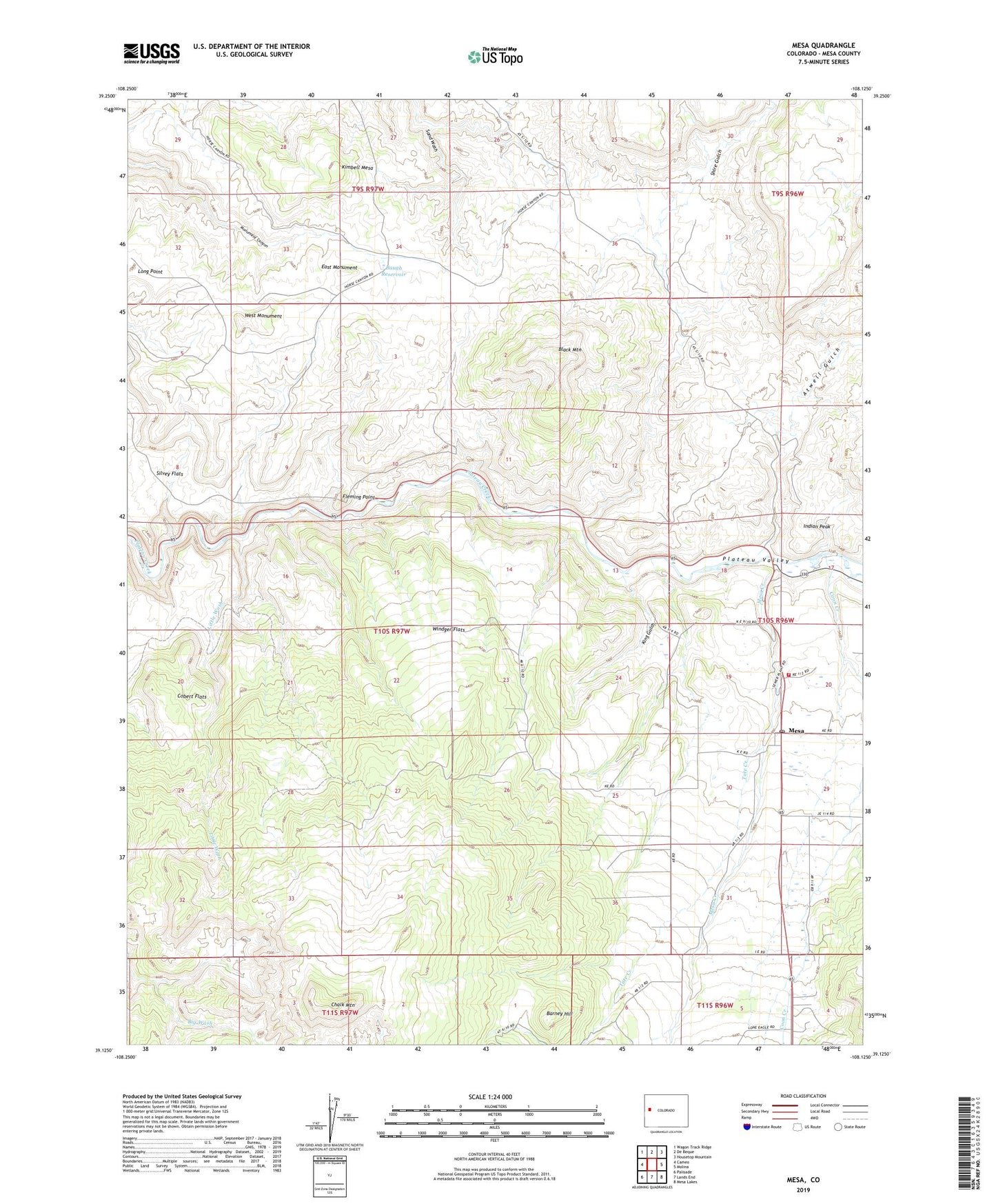
2022 topographic map quadrangle Mesa in the state of Colorado. Scale: 1:24000. Based on the newly updated USGS 7.5' US Topo map series, this map is in the following counties: Mesa. The map contains contour data, water features, and other items you are used to seeing on USGS maps, but also has updated roads and other features. This is the next generation of topographic maps. Printed on high-quality waterproof paper with UV fade-resistant inks.
Quads adjacent to this one:
West: Cameo
Northwest: Wagon Track Ridge
North: De Beque
Northeast: Housetop Mountain
East: Molina
Southeast: Mesa Lakes
South: Lands End
Southwest: Palisade
This map covers the same area as the classic USGS quad with code o39108b2.
Contains the following named places: Atwell Gulch, Atwell Homestead, Barney Hill, Baugh Reservoir, Black Mountain, Carver Homestead, Chalk Mountain, Cobert Flats, Coon Creek, East Monument, Eddington Homestead, Fleming Point, Frank Ball Homestead, Harris Homestead, Indian Peak, John Held Corner, Kimbell Mesa, King Gulch, Little Wash, Long Point, Meeker Tree, Mesa, Mesa Creek, Mesa Post Office, Morris Ranch, Plateau Valley, Plateau Valley Fire Protection District Ambulance, Plateau Valley Fire Protection District Station 92, Ray Ball Homestead, Shire Gulch, Silvey Flats, Tate Creek, West Monument, Windger Flats