
MyTopo
Pine Canyon Colorado US Topo Map
Couldn't load pickup availability
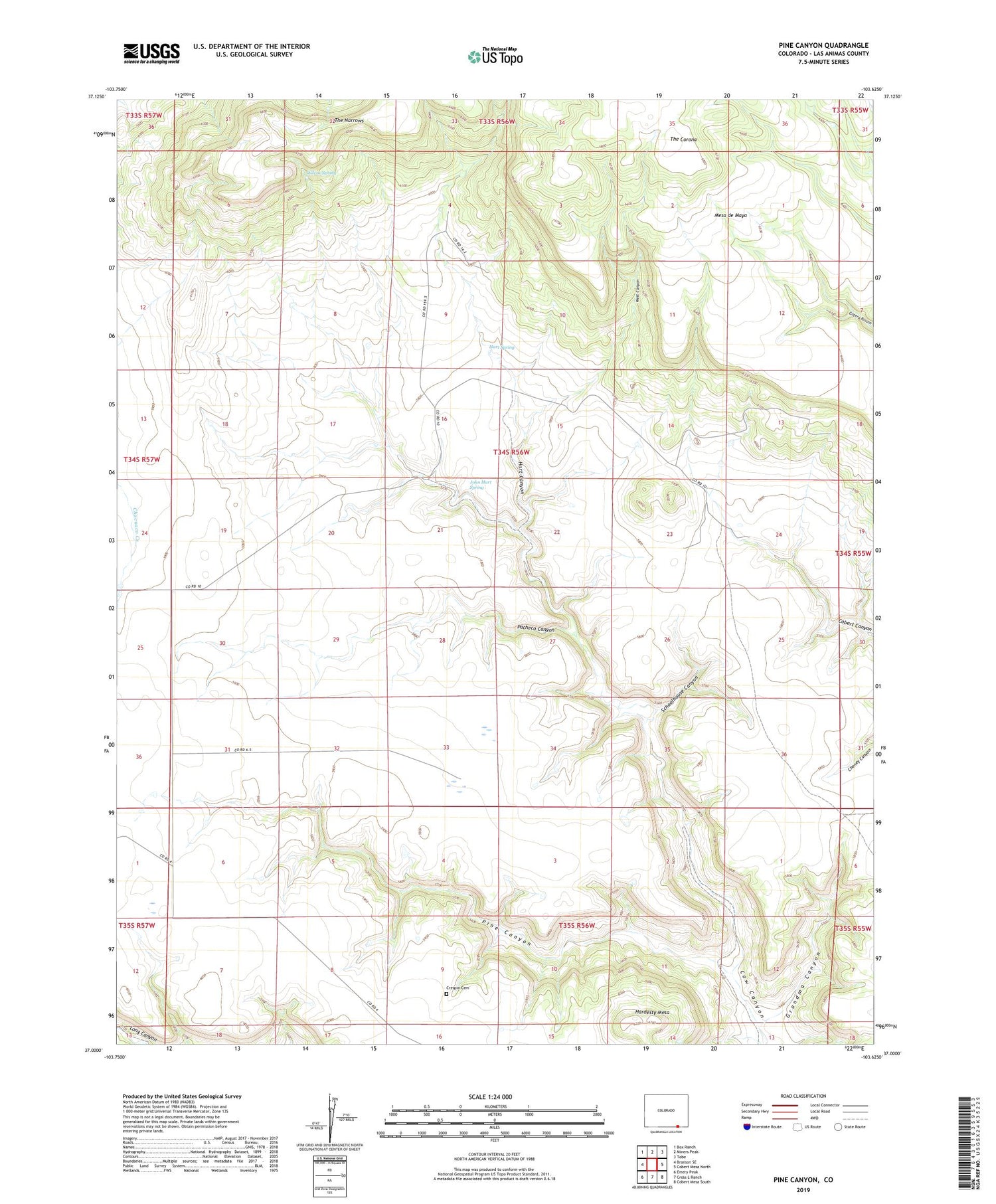
2022 topographic map quadrangle Pine Canyon in the state of Colorado. Scale: 1:24000. Based on the newly updated USGS 7.5' US Topo map series, this map is in the following counties: Las Animas. The map contains contour data, water features, and other items you are used to seeing on USGS maps, but also has updated roads and other features. This is the next generation of topographic maps. Printed on high-quality waterproof paper with UV fade-resistant inks.
Quads adjacent to this one:
West: Branson SE
Northwest: Box Ranch
North: Miners Peak
Northeast: Tobe
East: Cobert Mesa North
Southeast: Cobert Mesa South
South: Cross L Ranch
Southwest: Emery Peak
This map covers the same area as the classic USGS quad with code o37103a6.
Contains the following named places: Crespin Cemetery, Grandma Canyon, Hardesty Mesa, Hart Canyon, Hart Spring, John Hart Spring, Lone Oak, Pacheco Canyon, Pine Canyon, Schoolhouse Canyon, The Corona, The Narrows, West Canyon, Wilcox Spring


