MyTopo
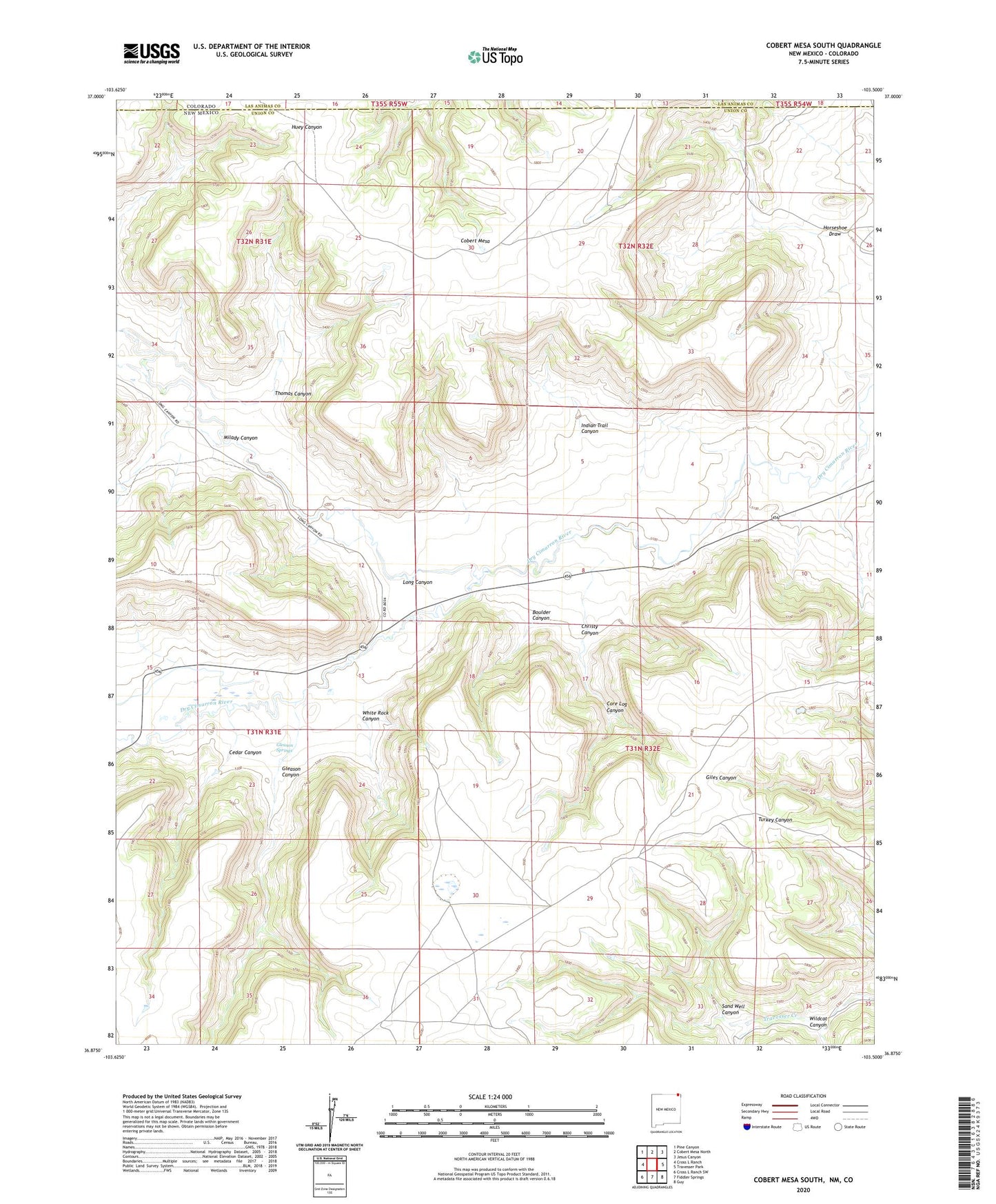
Cobert Mesa South New Mexico US Topo Map
Couldn't load pickup availability
2023 topographic map quadrangle Cobert Mesa South in the state of New Mexico. Scale: 1:24000. Based on the newly updated USGS 7.5' US Topo map series, this map is in the following counties: Union, Las Animas. The map contains contour data, water features, and other items you are used to seeing on USGS maps, but also has updated roads and other features. This is the next generation of topographic maps. Printed on high-quality waterproof paper with UV fade-resistant inks.
Quads adjacent to this one:
West: Cross L Ranch
Northwest: Pine Canyon
North: Cobert Mesa North
Northeast: Jesus Canyon
East: Travesser Park
Southeast: Guy
South: Fiddler Springs
Southwest: Cross L Ranch SW
This map covers the same area as the classic USGS quad with code o36103h5.
Contains the following named places: Boulder Canyon, Cedar Canyon, Christy Canyon, Core Log Canyon, Folsom Area, Gleason Canyon, Gleason Springs, Horseshoe Draw, Indian Trail Canyon, Long Canyon, Milady Canyon, Sand Well Canyon, Thomas Canyon, White Rock Canyon, Wildcat Canyon, ZIP Code: 88419