MyTopo
Pryor Colorado US Topo Map
Couldn't load pickup availability
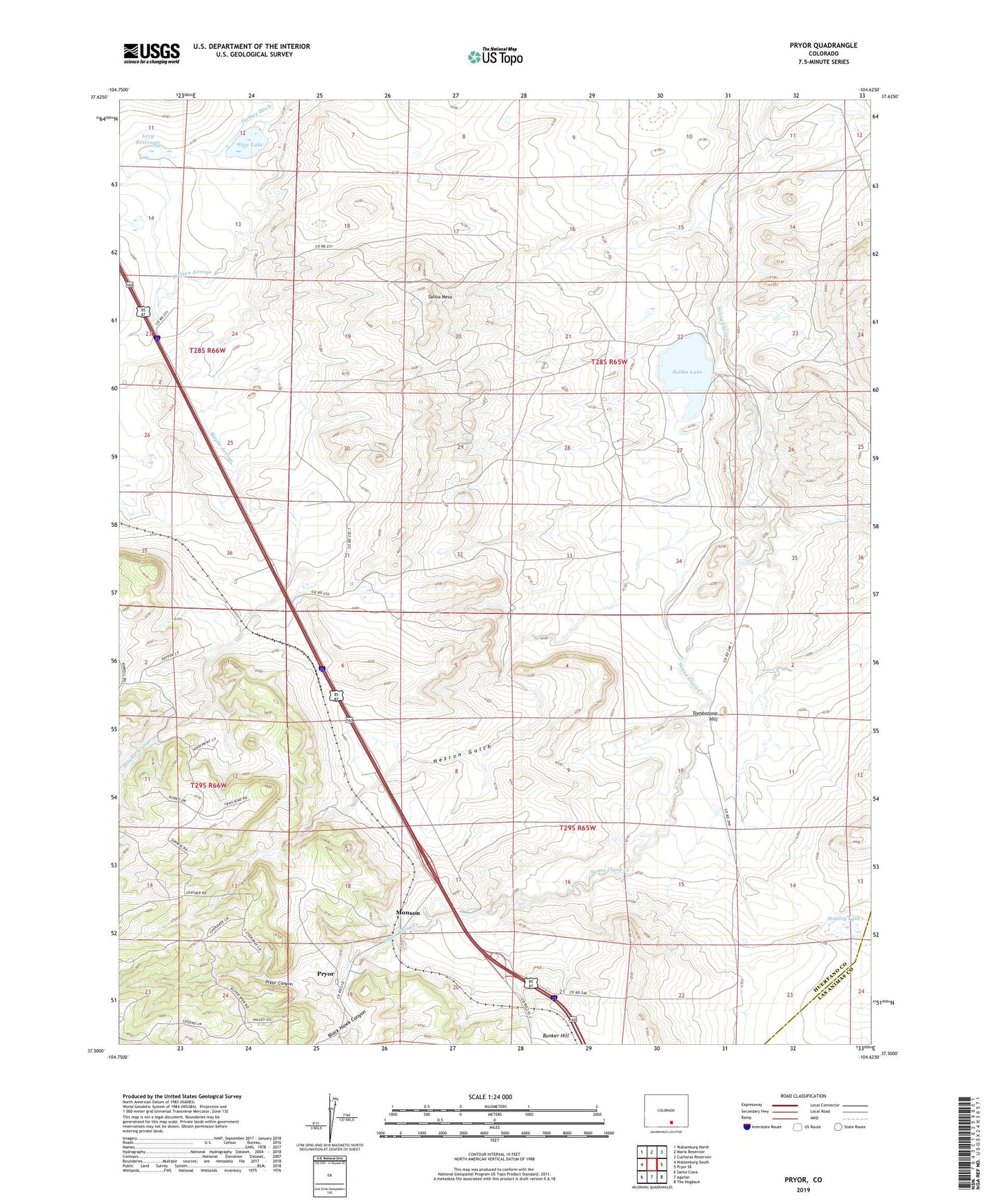
2022 topographic map quadrangle Pryor in the state of Colorado. Scale: 1:24000. Based on the newly updated USGS 7.5' US Topo map series, this map is in the following counties: Huerfano, Las Animas. The map contains contour data, water features, and other items you are used to seeing on USGS maps, but also has updated roads and other features. This is the next generation of topographic maps. Printed on high-quality waterproof paper with UV fade-resistant inks.
Quads adjacent to this one:
West: Walsenburg South
Northwest: Walsenburg North
North: Maria Reservoir
Northeast: Cucharas Reservoir
East: Pryor SE
Southeast: The Hogback
South: Aguilar
Southwest: Santa Clara
This map covers the same area as the classic USGS quad with code o37104e6.
Contains the following named places: Antonio Valdez Dam, Black Hawk Canyon, Blue Blaze Mine, Bunker Hill, Capps Ranch, Caprock Mine, Chapman Reservoir Dam, Farr Lake, Hezron Camp, Hezron Gulch, Hezron Mines, Lester, Lester Mine, Levy Dam, Levy Reservoir, Mayne, Mayne Arroyo, Midway Mine, Monson, New Pryor Mine, Old Rouse Mine, Primrose Mine, Pryor, Pryor Canyon, Pryor Mine, Rugby Mine, Saliba Lake, Saliba Mesa, Stanley Lake, Tombstone Hill, Viking Mine