MyTopo
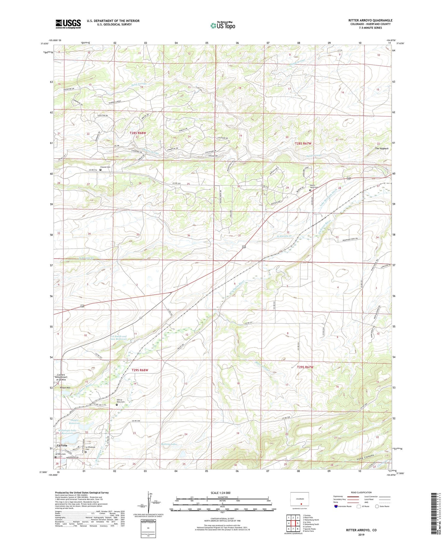
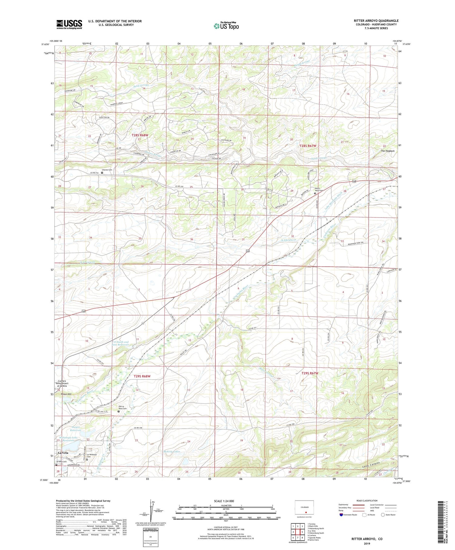
Ritter Arroyo Colorado US Topo Map
Couldn't load pickup availability
2022 topographic map quadrangle Ritter Arroyo in the state of Colorado. Scale: 1:24000. Based on the newly updated USGS 7.5' US Topo map series, this map is in the following counties: Huerfano. The map contains contour data, water features, and other items you are used to seeing on USGS maps, but also has updated roads and other features. This is the next generation of topographic maps. Printed on high-quality waterproof paper with UV fade-resistant inks.
Quads adjacent to this one:
West: La Veta
Northwest: Farisita
North: Black Hills
Northeast: Walsenburg North
East: Walsenburg South
Southeast: Santa Clara
South: Spanish Peaks
Southwest: Cuchara
This map covers the same area as the classic USGS quad with code o37104e8.
Contains the following named places: Chavez Arroyo, Chavez Cemetery, Daigre Dam, Daigre Reservoir, J O Smith and Sons Number 1 Dam, J O Smith and Sons Reservoir, L D R D Ditch, La Veta Cemetery, La Whatoya Cemetery, McEvoy Lakes, North Abeyta Creek, North Veta Cemetery, Old La Veta Cemetery, Pinon Hill, Ritter Arroyo, Ritter School, Shearer Dam, Shearer Reservoir, Wahatoya Creek, Wahatoya Lake Dam, Wahatoya Lake Reservoir, Wright-Brink Dam, Wright-Brink Reservoir