MyTopo
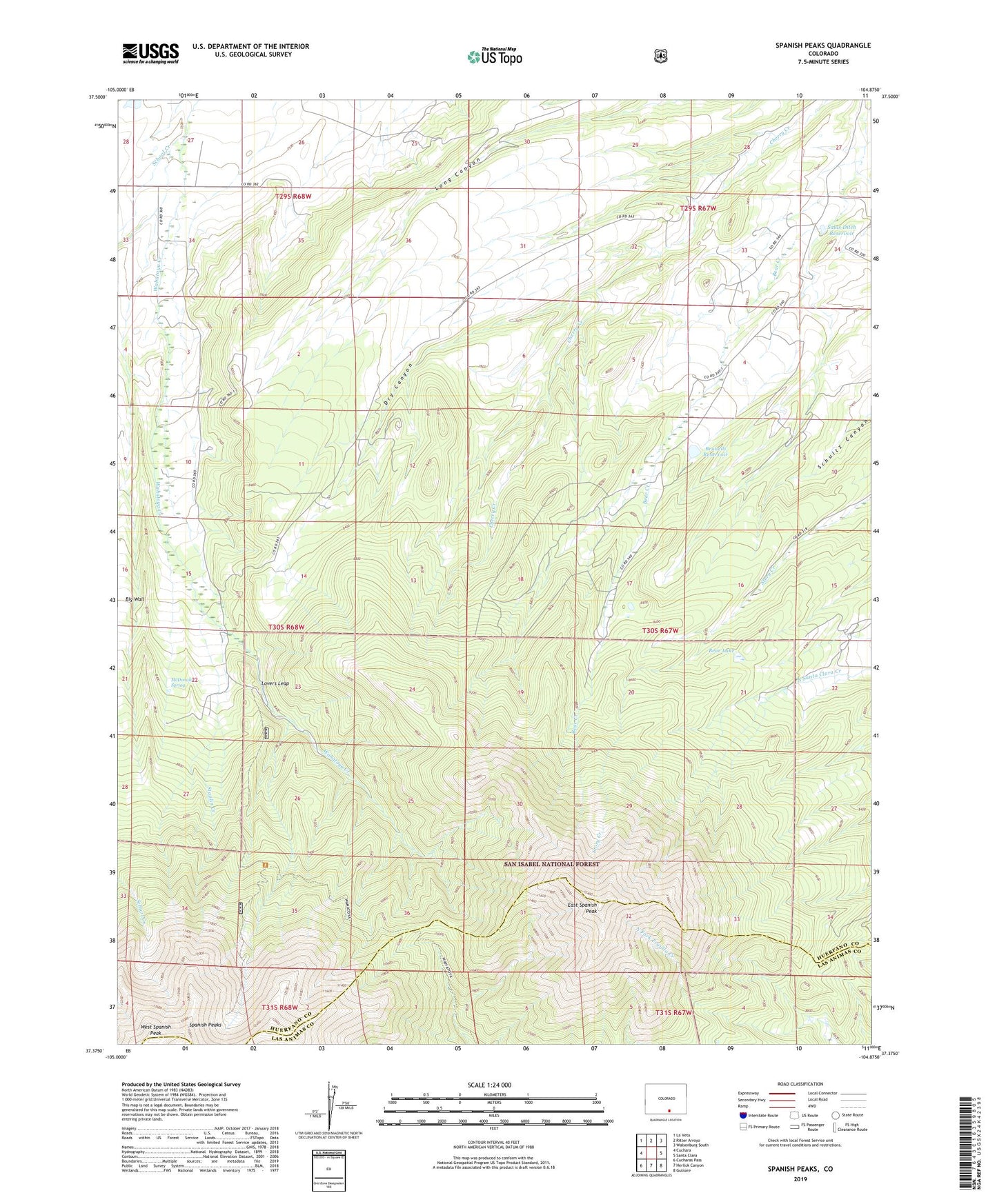
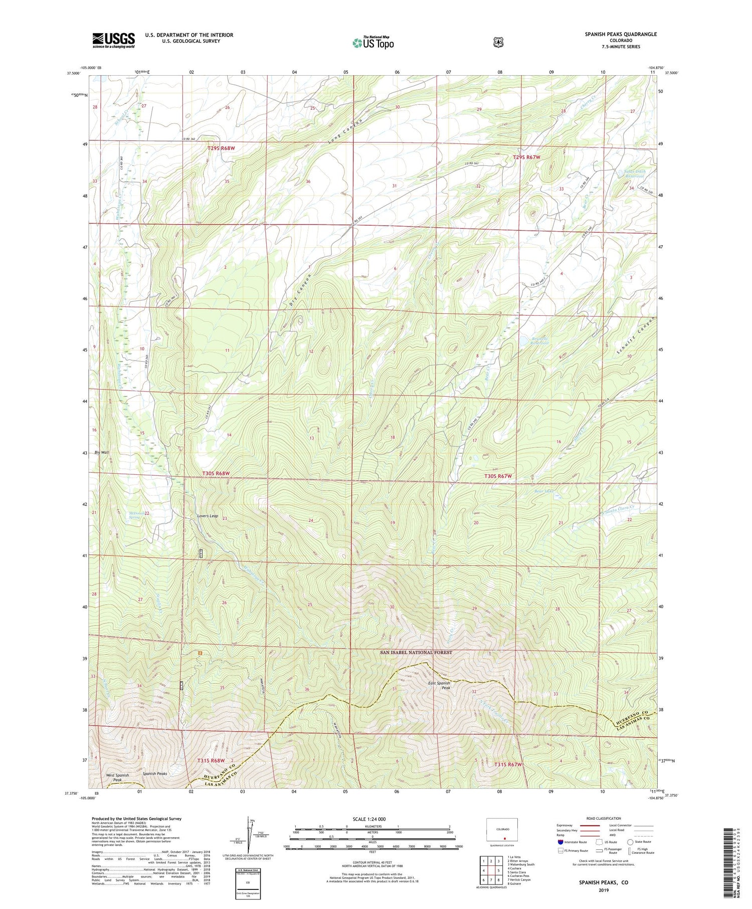
Spanish Peaks Colorado US Topo Map
Couldn't load pickup availability
Also explore the Spanish Peaks Forest Service Topo of this same quad for updated USFS data
2022 topographic map quadrangle Spanish Peaks in the state of Colorado. Scale: 1:24000. Based on the newly updated USGS 7.5' US Topo map series, this map is in the following counties: Huerfano, Las Animas. The map contains contour data, water features, and other items you are used to seeing on USGS maps, but also has updated roads and other features. This is the next generation of topographic maps. Printed on high-quality waterproof paper with UV fade-resistant inks.
Quads adjacent to this one:
West: Cuchara
Northwest: La Veta
North: Ritter Arroyo
Northeast: Walsenburg South
East: Santa Clara
Southeast: Gulnare
South: Herlick Canyon
Southwest: Cucharas Pass
This map covers the same area as the classic USGS quad with code o37104d8.
Contains the following named places: Bear Lake, Big Wall, Brunelli Dam, Brunelli Reservoir, Bulls Eye Mine, Dry Canyon, East Spanish Peak, Galvan Ditch, Lovers Leap, McDonald Spring, Salas Ditch Dam, Salas Ditch Reservoir, Santa Fe Trail Council Camp, School Creek, Spanish Peaks, Spanish Peaks Wilderness, Staplin Creek, Upper Bear Creek School, Wahatoya Camp, Wahatoya School, Wahatoya Trail, West Spanish Peak