MyTopo
Roper School Colorado US Topo Map
Couldn't load pickup availability
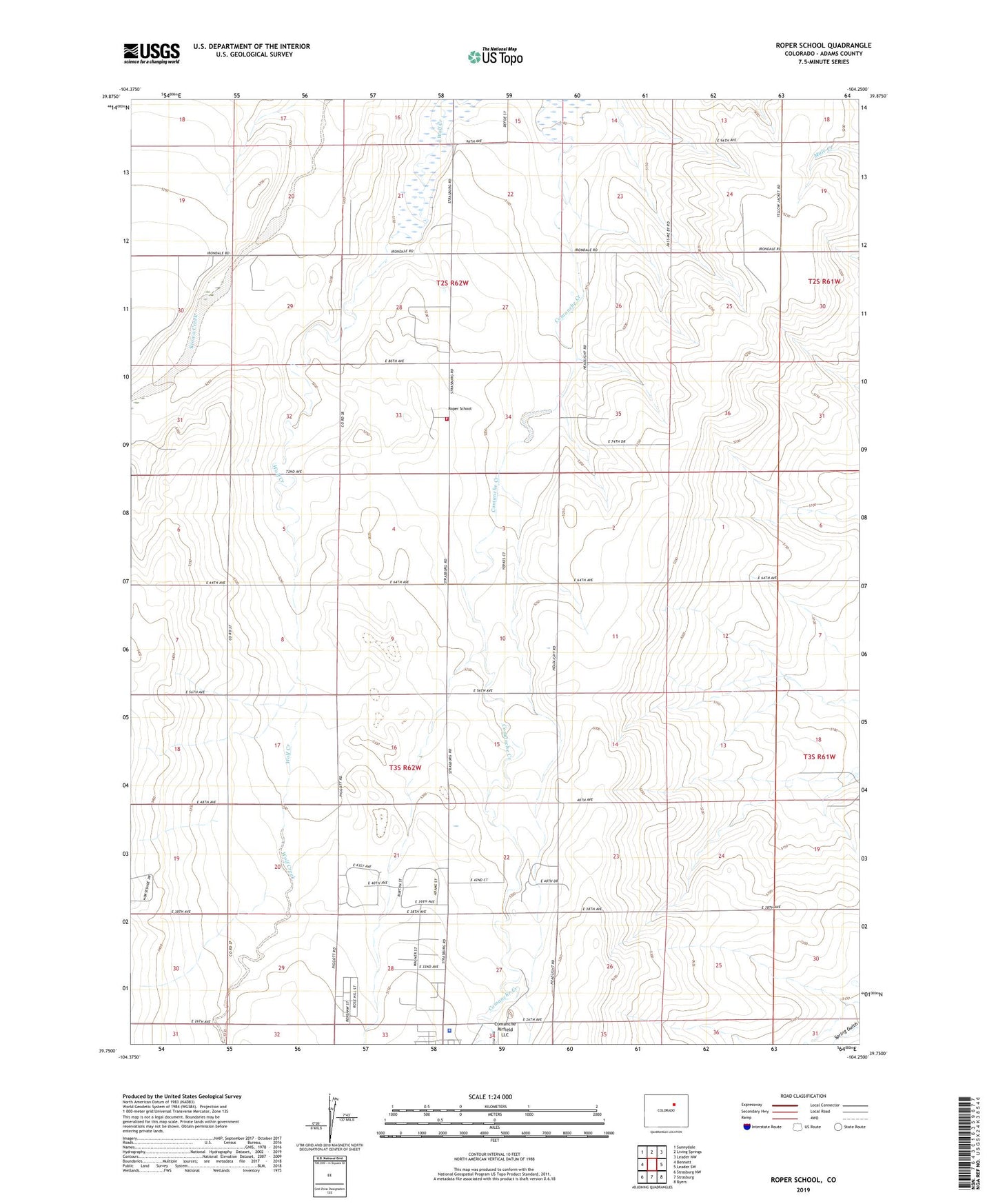
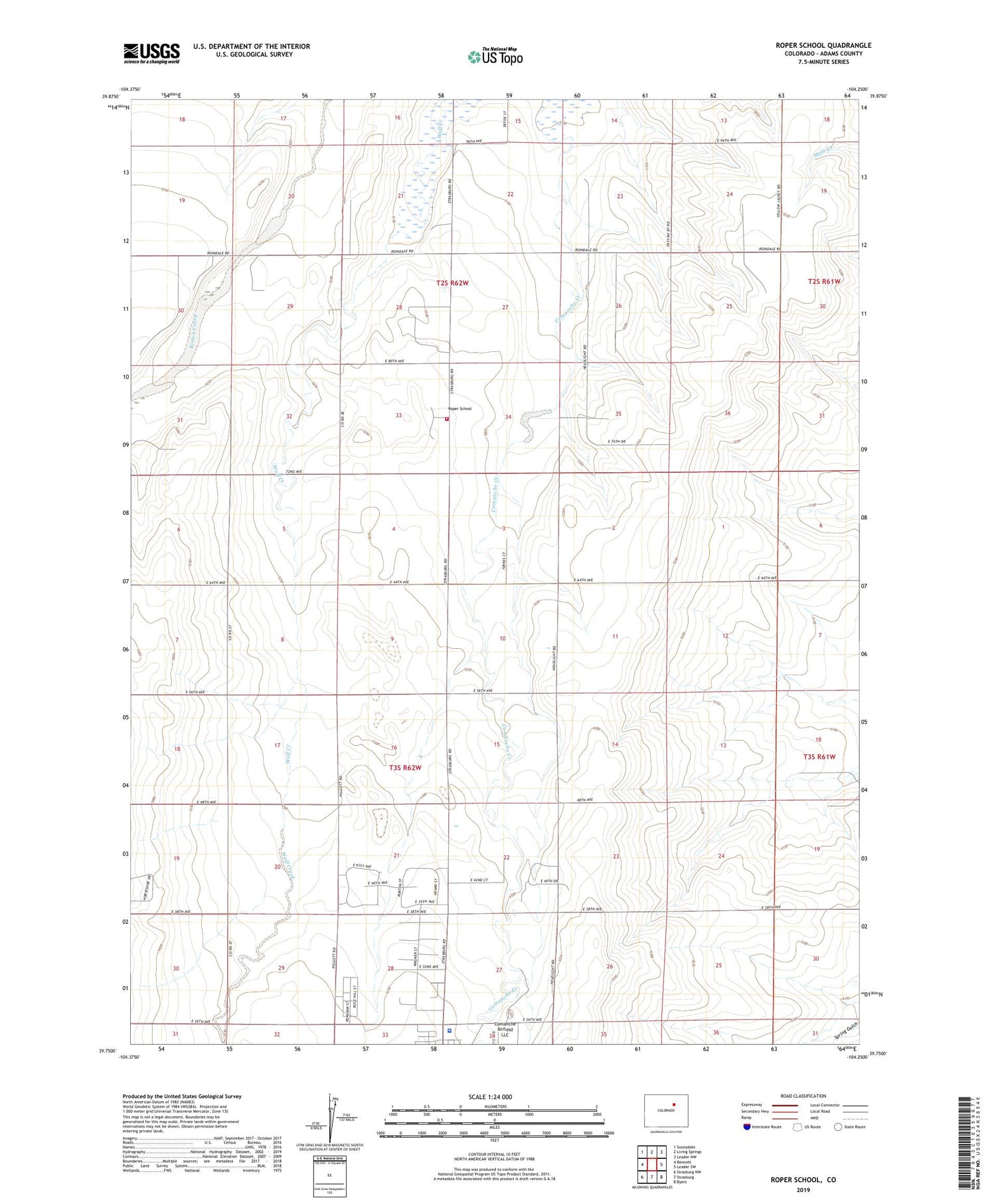
2022 topographic map quadrangle Roper School in the state of Colorado. Scale: 1:24000. Based on the newly updated USGS 7.5' US Topo map series, this map is in the following counties: Adams. The map contains contour data, water features, and other items you are used to seeing on USGS maps, but also has updated roads and other features. This is the next generation of topographic maps. Printed on high-quality waterproof paper with UV fade-resistant inks.
Quads adjacent to this one:
West: Bennett
Northwest: Sunnydale
North: Living Springs
Northeast: Leader NW
East: Leader SW
Southeast: Byers
South: Strasburg
Southwest: Strasburg NW
This map covers the same area as the classic USGS quad with code o39104g3.
Contains the following named places: Adams County, Adams County Sheriff's Office Strasburg Substation, Bowen Farms Number 2 Airport, Comanche Livestock Airport, Roper School, Strasburg Fire Protection District 8 Station 2, ZIP Code: 80136