MyTopo
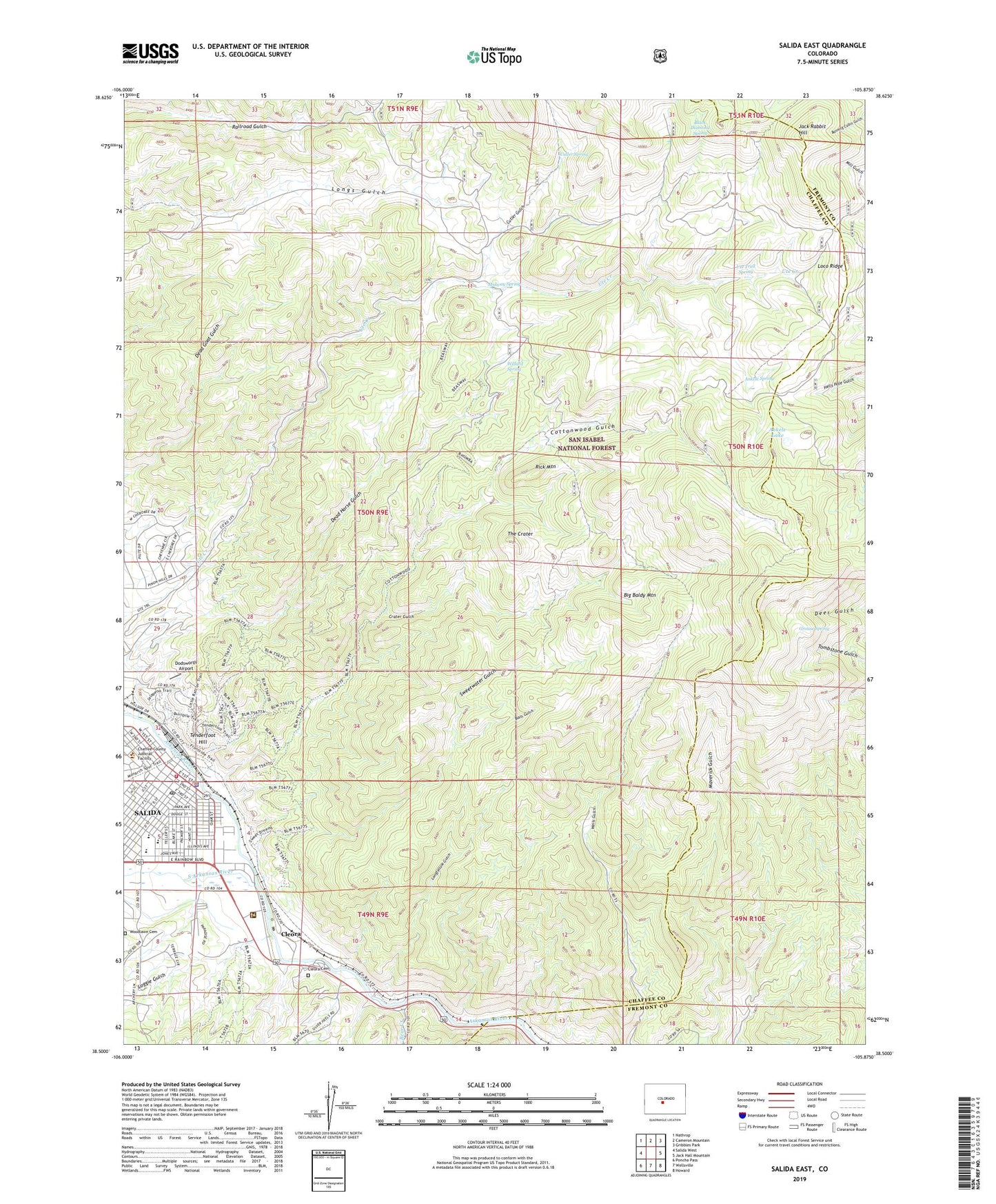
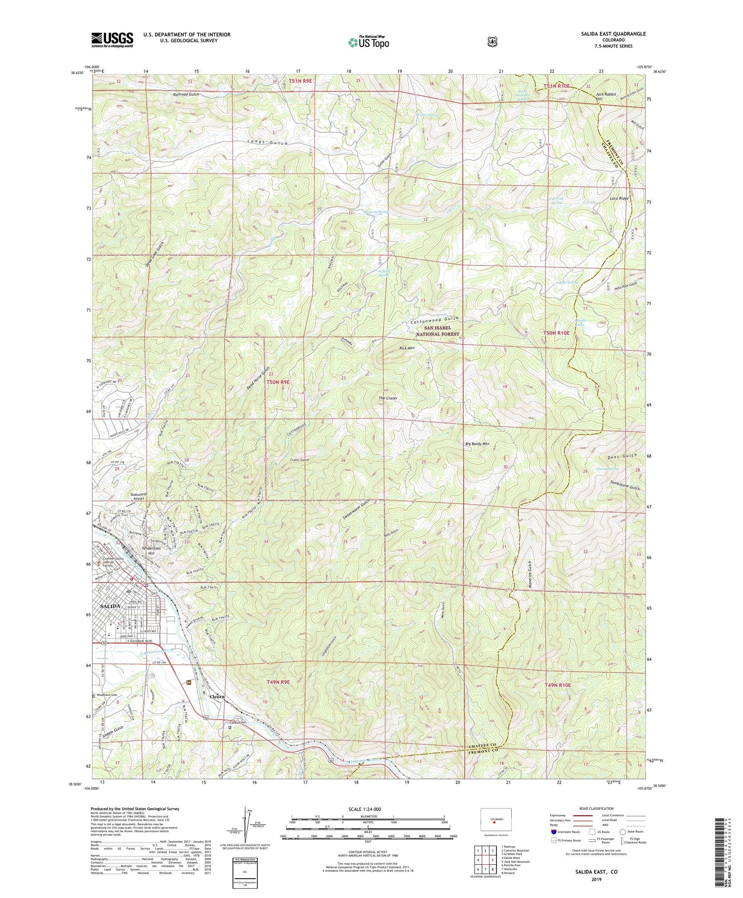
Salida East Colorado US Topo Map
Couldn't load pickup availability
Also explore the Salida East Forest Service Topo of this same quad for updated USFS data
2022 topographic map quadrangle Salida East in the state of Colorado. Scale: 1:24000. Based on the newly updated USGS 7.5' US Topo map series, this map is in the following counties: Chaffee, Fremont. The map contains contour data, water features, and other items you are used to seeing on USGS maps, but also has updated roads and other features. This is the next generation of topographic maps. Printed on high-quality waterproof paper with UV fade-resistant inks.
Quads adjacent to this one:
West: Salida West
Northwest: Nathrop
North: Cameron Mountain
Northeast: Gribbles Park
East: Jack Hall Mountain
Southeast: Howard
South: Wellsville
Southwest: Poncha Pass
This map covers the same area as the classic USGS quad with code o38105e8.
Contains the following named places: Ankele Lake, Ankele Spring, Arkansas Headwaters Recreation Area, Bails Gulch, Bear Creek, Big Baldy Mountain, Black Diamond Spring, Chaffee County Jail, Chaffee County Sheriff's Office, City of Salida, Cleora, Cleora Cemetery, Colorado State Parks Arkansas Headwaters Recreation Area, Cottonwood Gulch, Crater Gulch, Cutler Gulch, Cutler Spring, Dead Horse Gulch, Dodsworth Airport, Federal Quarry, Grouse Spring, Gypsy Queen Mine, Homestake Mine, Jack Rabbit Hill, Loco Ridge, Loggie Gulch, Longfellow Gulch, Midway Spring, Rick Mountain, Rock King Lode Mine, Saint Joseph School, Salida, Salida Fire Department, Salida Hospital Heliport, Salida Police Department, Salida Post Office, Savilla Queen Number Two Mine, South Arkansas River, Stockton Mine, Sweetwater Gulch, Tenderfoot Hill, The Crater, Tumble Mountain Quarry, Ute Trail Spring, Willard Spring, Woodlawn Cemetery