
MyTopo
Howard Colorado US Topo Map
Couldn't load pickup availability
Also explore the Howard Forest Service Topo of this same quad for updated USFS data
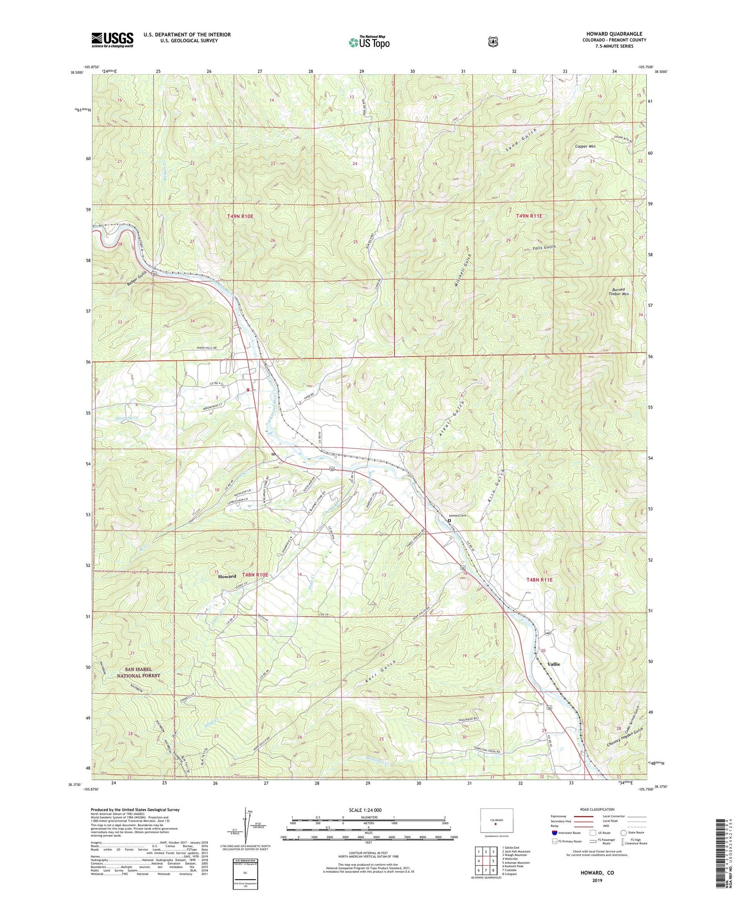
2022 topographic map quadrangle Howard in the state of Colorado. Scale: 1:24000. Based on the newly updated USGS 7.5' US Topo map series, this map is in the following counties: Fremont. The map contains contour data, water features, and other items you are used to seeing on USGS maps, but also has updated roads and other features. This is the next generation of topographic maps. Printed on high-quality waterproof paper with UV fade-resistant inks.
Quads adjacent to this one:
West: Wellsville
Northwest: Salida East
North: Jack Hall Mountain
Northeast: Waugh Mountain
East: Arkansas Mountain
Southeast: Cotopaxi
South: Coaldale
Southwest: Bushnell Peak
This map covers the same area as the classic USGS quad with code o38105d7.
Contains the following named places: Alkali Gulch, Amy Ditch, Badger Creek, Badger Gulch, Burned Timber Mountain, Caeradock Ditch, Cedar Springs Gulch, Chauncy Hayden Gulch, Cherry Creek, Copper Mountain, Falls Gulch, Hamilton Creek, Howard, Howard Cemetery, Howard Census Designated Place, Howard Creek, Howard Creek School, Howard Post Office, Howard Sand Gulch Mine, Howard Volunteer Fire Department, Kerr Gulch, Kiln Gulch, Kiln Gulch Mine, Mitchell Gulch, Pine Canyon Lode Mine, Sand Gulch, Short Creek, Stout Creek, Stout Creek School, Triangle V Mine, Union Church, Vallie, West Creek, ZIP Code: 81233


