
MyTopo
Sterling South Colorado US Topo Map
Couldn't load pickup availability
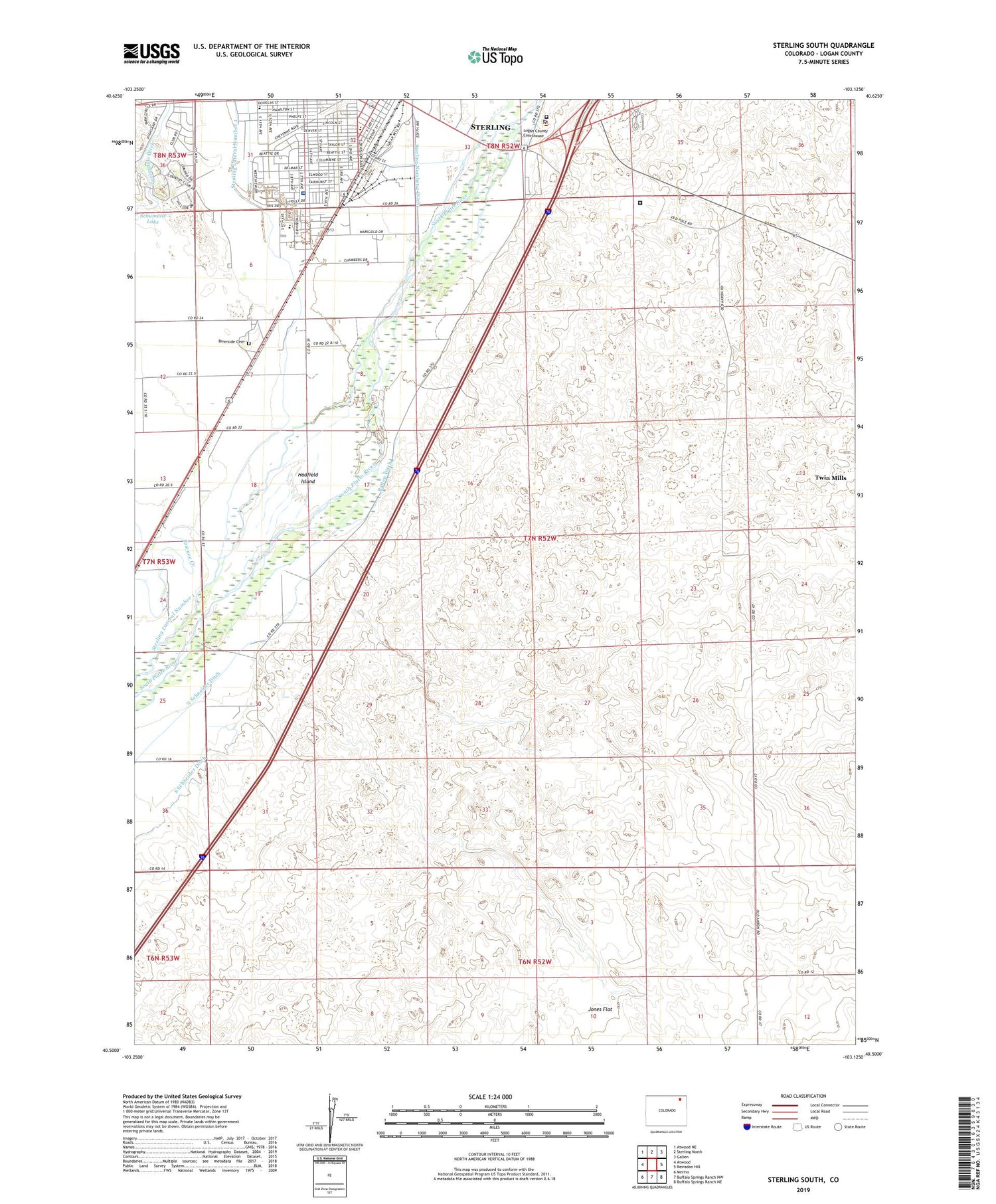
2022 topographic map quadrangle Sterling South in the state of Colorado. Scale: 1:24000. Based on the newly updated USGS 7.5' US Topo map series, this map is in the following counties: Logan. The map contains contour data, water features, and other items you are used to seeing on USGS maps, but also has updated roads and other features. This is the next generation of topographic maps. Printed on high-quality waterproof paper with UV fade-resistant inks.
Quads adjacent to this one:
West: Atwood
Northwest: Atwood NE
North: Sterling North
Northeast: Galien
East: Reiradon Hill
Southeast: Buffalo Springs Ranch NE
South: Buffalo Springs Ranch NW
Southwest: Merino
This map covers the same area as the classic USGS quad with code o40103e2.
Contains the following named places: Batten Ditch, Cheairs Park, City of Sterling, Colorado State Patrol Troop 3B Sterling, Columbine Park, Franklin School, Hadfield Island, Hall, Heart Center of the Rockies, Jones Flat, KSTC-AM (Sterling), Life Care Medical Ambulance, Logan County Detention Center, Logan County Sheriff's Office, North Schneider Ditch, Northeastern Pit, Overland Trail Museum, Overland Trail Park and Museum, Pawnee Creek, Pre-Ten Pit, Riverside Cemetery, Salud Family Health Center, Schumans Lake, Sterling Correctional Facility, Sterling Ready Mix Pit, Sterling Regional Medical Center, Sterling Regional Medical Center Heliport, Sterling Wells, Twin Mills, Van Gundy Pit


