MyTopo
Toonerville NE Colorado US Topo Map
Couldn't load pickup availability
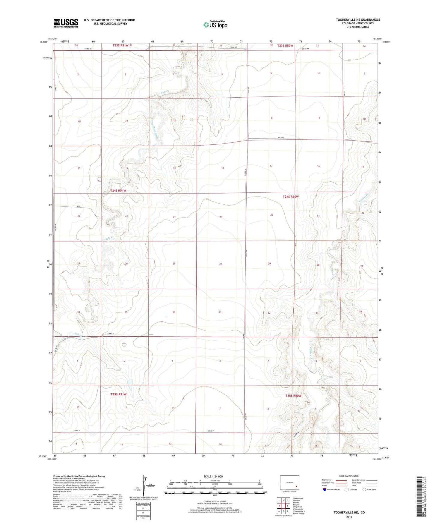
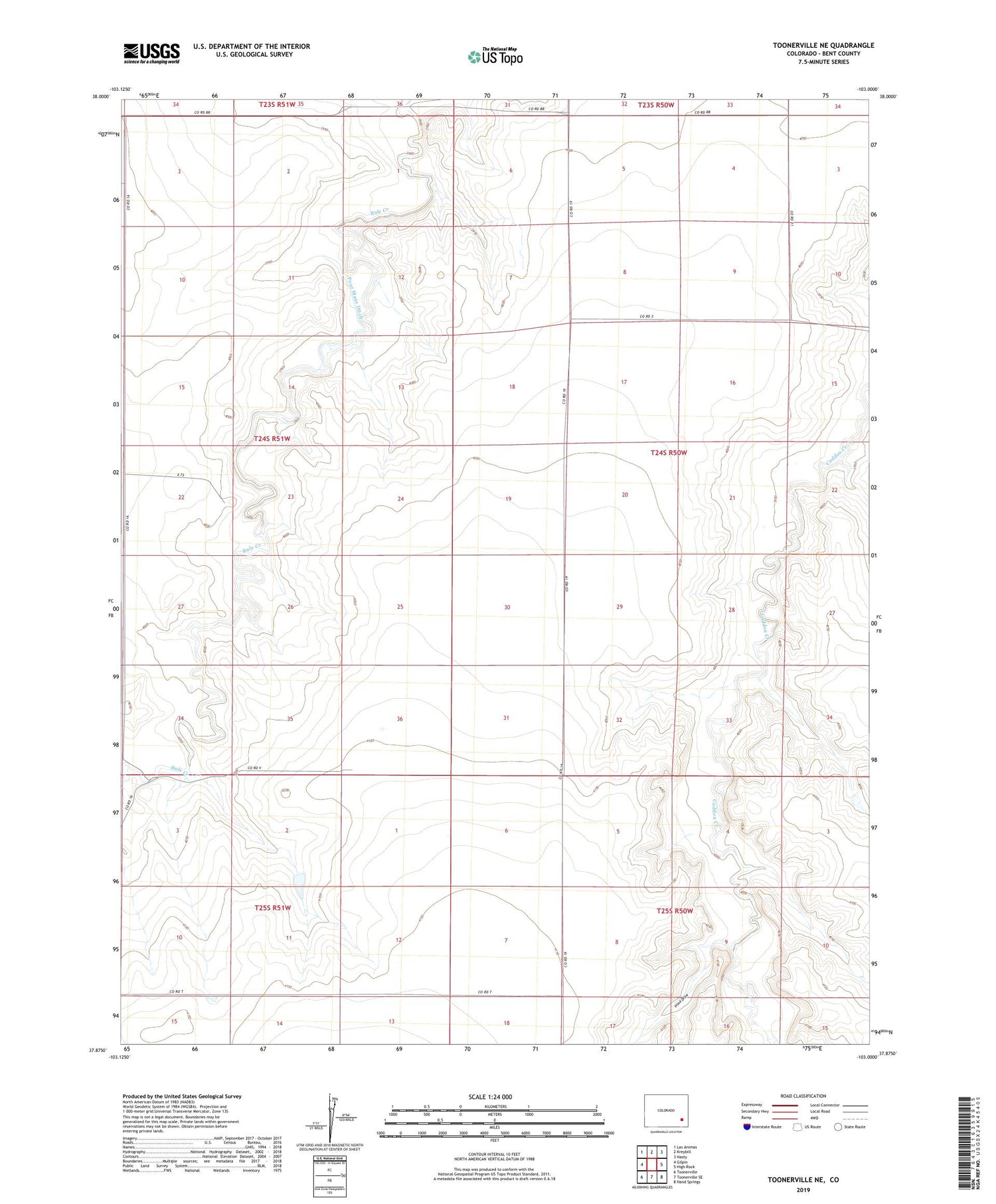
2022 topographic map quadrangle Toonerville NE in the state of Colorado. Scale: 1:24000. Based on the newly updated USGS 7.5' US Topo map series, this map is in the following counties: Bent. The map contains contour data, water features, and other items you are used to seeing on USGS maps, but also has updated roads and other features. This is the next generation of topographic maps. Printed on high-quality waterproof paper with UV fade-resistant inks.
Quads adjacent to this one:
West: Gilpin
Northwest: Las Animas
North: Kreybill
Northeast: Hasty
East: High Rock
Southeast: Hand Springs
South: Toonerville SE
Southwest: Toonerville
This map covers the same area as the classic USGS quad with code o37103h1.
Contains the following named places: Bent County, Crooked Arroyo CA-3 Detention Reservoir, Crooked Arroyo CA-4 Detention Reservoir, Crooked Arroyo Detention CA-3 Dam, Crooked Arroyo Detention CA-4 Dam, Hood Draw, Poor Mans Ditch