MyTopo
Yampa Colorado US Topo Map
Couldn't load pickup availability
Also explore the Yampa Forest Service Topo of this same quad for updated USFS data
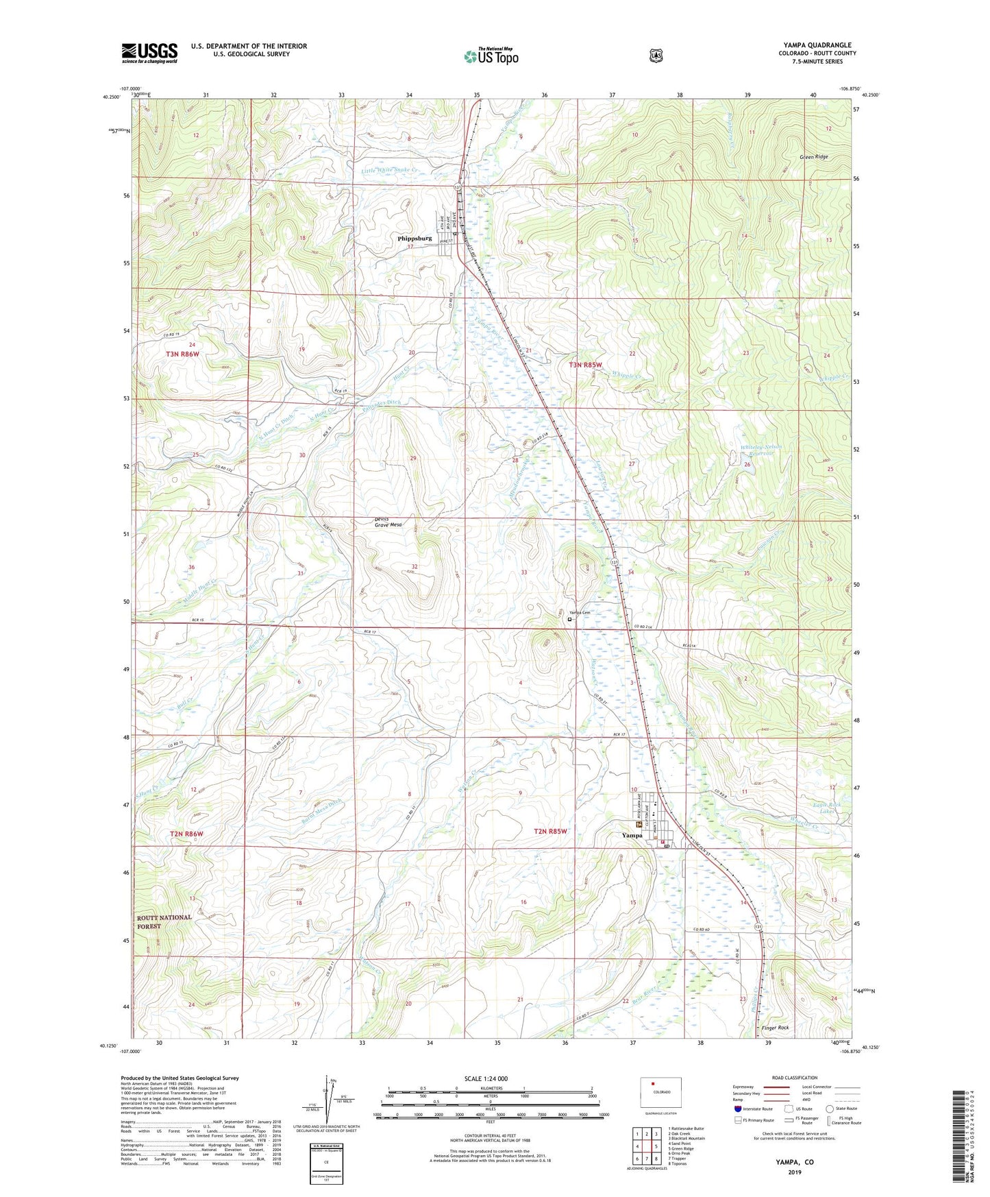
2022 topographic map quadrangle Yampa in the state of Colorado. Scale: 1:24000. Based on the newly updated USGS 7.5' US Topo map series, this map is in the following counties: Routt. The map contains contour data, water features, and other items you are used to seeing on USGS maps, but also has updated roads and other features. This is the next generation of topographic maps. Printed on high-quality waterproof paper with UV fade-resistant inks.
Quads adjacent to this one:
West: Sand Point
Northwest: Rattlesnake Butte
North: Oak Creek
Northeast: Blacktail Mountain
East: Green Ridge
Southeast: Toponas
South: Trapper
Southwest: Orno Peak
This map covers the same area as the classic USGS quad with code o40106b8.
Contains the following named places: Bull Creek, Burnt Mesa Ditch, Devils Grave Mesa, Eagle Rock Lakes, Finger Rock, Hunt Creek, KFMU-FM (Oak Creek), Lawson Creek, Little White Snake Creek, Meadowbrook Creek, Middle Hunt Creek, North Hunt Creek, North Hunt Creek Ditch, Palisades Ditch, Phillips Creek, Phippsburg, Phippsburg Census Designated Place, Phippsburg Heliport, Phippsburg Post Office, Seven Points Pit, South Hunt Creek, Town of Yampa, Watson Creek, Wheeler Creek, Whipple Creek, Whiteley-Nelson Dam, Whiteley-Nelson Reservoir, Yampa, Yampa Cemetery, Yampa Fire Protection District, Yampa Post Office, ZIP Code: 80469