MyTopo
Oak Creek Colorado US Topo Map
Couldn't load pickup availability
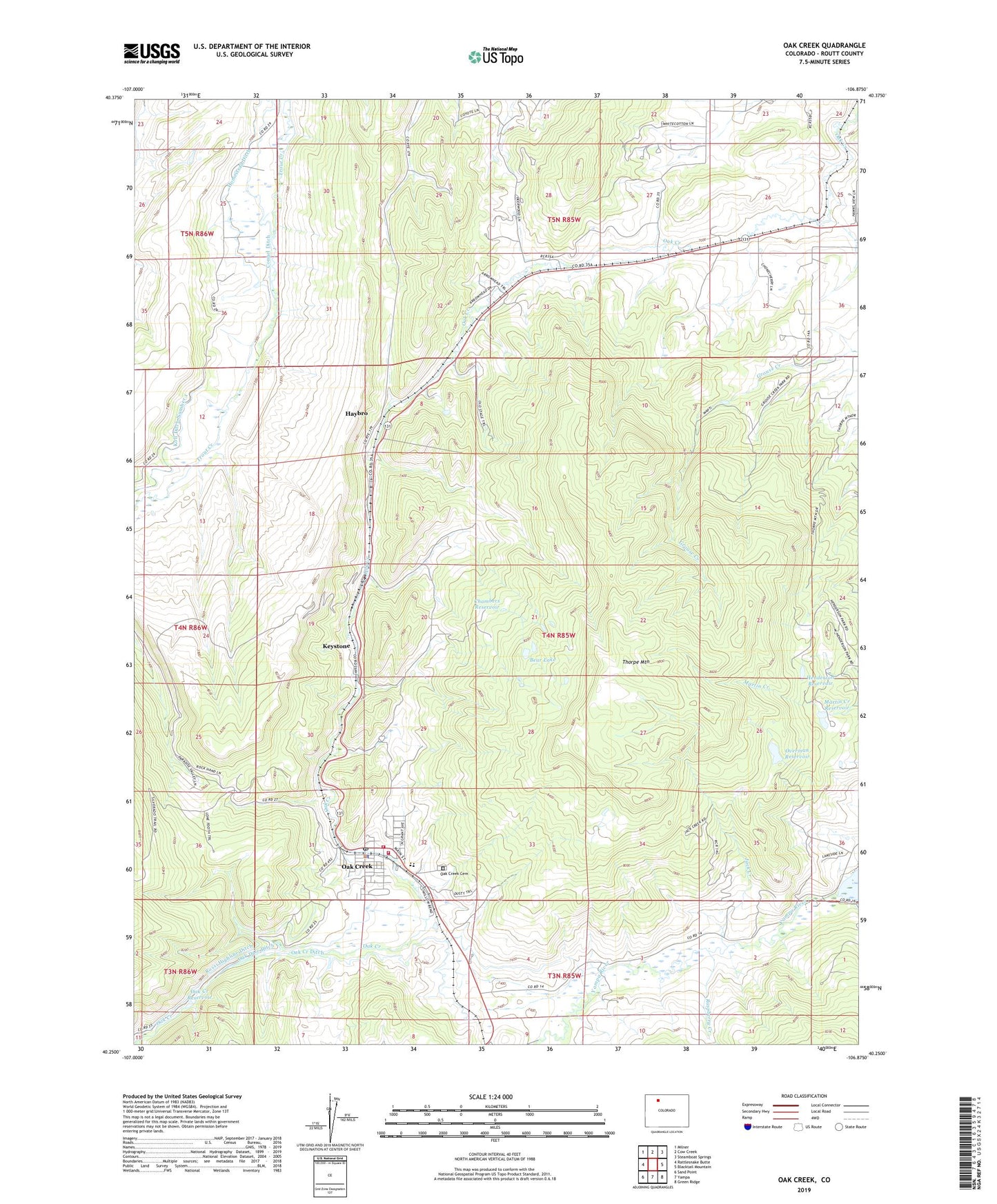
2022 topographic map quadrangle Oak Creek in the state of Colorado. Scale: 1:24000. Based on the newly updated USGS 7.5' US Topo map series, this map is in the following counties: Routt. The map contains contour data, water features, and other items you are used to seeing on USGS maps, but also has updated roads and other features. This is the next generation of topographic maps. Printed on high-quality waterproof paper with UV fade-resistant inks.
Quads adjacent to this one:
West: Rattlesnake Butte
Northwest: Milner
North: Cow Creek
Northeast: Steamboat Springs
East: Blacktail Mountain
Southeast: Green Ridge
South: Yampa
Southwest: Sand Point
This map covers the same area as the classic USGS quad with code o40106c8.
Contains the following named places: Arrowhead Mine, Bear Lake, Chambers Reservoir, Chirco Mine, Edna Mine, Edna Strip Mine, Haybro, Haybro Mine, Hayden Number One Mine, Henderson Reservoir, Jack Creek, Juniper Mine, Keystone, Keystone Mine, Koll Ditch Number 1, Martin Creek Reservoir, Martin Dam, Moffat Mine, Moffat Number Three Mine, Oak Creek, Oak Creek Cemetery, Oak Creek Ditch, Oak Creek Fire Protection District Oak Creek Station 1, Oak Creek Fire Protection District Oak Creek Station 2, Oak Creek Police Department, Oak Creek Post Office, Oak Creek Reservoir, Oak Dale Ditch, Overman Dam, Overman Reservoir, Park, Pinnacle Mine, Raspberry Creek, Rossi Highline Ditch, Ruby Mine, Thorpe Mountain, Town of Oak Creek, Valley Mine