MyTopo
Moodus Connecticut US Topo Map
Couldn't load pickup availability
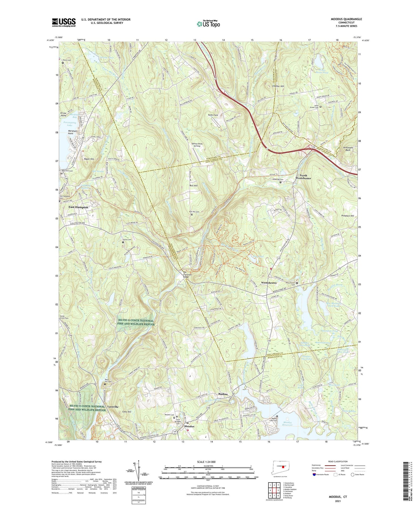
2024 topographic map quadrangle Moodus in the state of Connecticut. Scale: 1:24000. Based on the newly updated USGS 7.5' US Topo map series, this map is in the following counties: Middlesex, New London, Hartford, Tolland. The map contains contour data, water features, and other items you are used to seeing on USGS maps, but also has updated roads and other features. This is the next generation of topographic maps. Printed on high-quality waterproof paper with UV fade-resistant inks.
Quads adjacent to this one:
West: Middle Haddam
Northwest: Glastonbury
North: Marlborough
Northeast: Columbia
East: Colchester
Southeast: Hamburg
South: Deep River
Southwest: Haddam
This map covers the same area as the classic USGS quad with code o41072e4.
Contains the following named places: Amasa Day House, Arrow Point, Babcock Pond, Babcock Pond Dam, Babcock Swamp, Baker Hill, Banner Golf Course, Bashan, Bashan Lake Cemetery, Basin Hill Cemetery, Bear Swamp, Bevins Pond Dam, Blackledge River, Bull Hill, Bull Hill Cemetery, Camp Halburn, Cattle Lot Brook, Cave Hill, Chalker Hill, Colchester Hayward Volunteer Fire Department 2, Cone Pond, Cranberry Meadow, Day Meadow Brook, Day Pond, Day Pond Brook, Day Pond State Park, Dickinson Creek, East Haddam Fire Company 2 Moodus Station, East Haddam Free Public Library, East Haddam School, East Hampton Ambulance Association, East Hampton Cemetery, East Hampton Census Designated Place, Elbow Brook, Fawn Brook, Fawn Hill Brook, Flat Brook, Hartford County 4-H Camp, Jeremiahs Back, Jeremy River, Jones Street Cemetery, Jones Street Pond, Jones Street Pond Dam, Lakeview Cemetery, Leesville, Leesville Dam, Leesville Pond, Lyman Brook, Markham Bay, Markham Point, Marlborough Congregational Church, Meadow Brook, Memorial School, Molley Brook, Moodus, Moodus Cemetery, Moodus Census Designated Place, Moodus Post Office, Moodus Reservoir, Moodus Reservoir Dam, Nathan Hale Place, Nathan Hale Plaza Shopping Center, North Cemetery, North Westchester, North Westchester Pond, Number One Pond, Number Two Pond, Old Comstock Bridge, Pickerel Lake, Pickerel Lake Brook, Pickerel Lake Dam, Pine Brook, Pine Meadows Park Pond, Pine Meadows Park Pond Dam, Ponemah Cemetery, Post Pond, Prospect Hill, Rankl Field, Safstrom Brook, Saint Bridget of Kildare Church, Saint Bridgets Cemetery, Salmon River Airfield, Senate Brook, Shady Brook, Somers Field, Standish Brook, Standish Pond, Strong Pond, Tartia Cemetery, Thousand Acre Pond, Tri-Town Shopping Center, Westchester, Westchester Cemetery, Westchester Congregational Church, Westchester Green, Wolf Brook, Wopowog, ZIP Code: 06469