MyTopo
Arsenicker Keys Florida US Topo Map
Couldn't load pickup availability
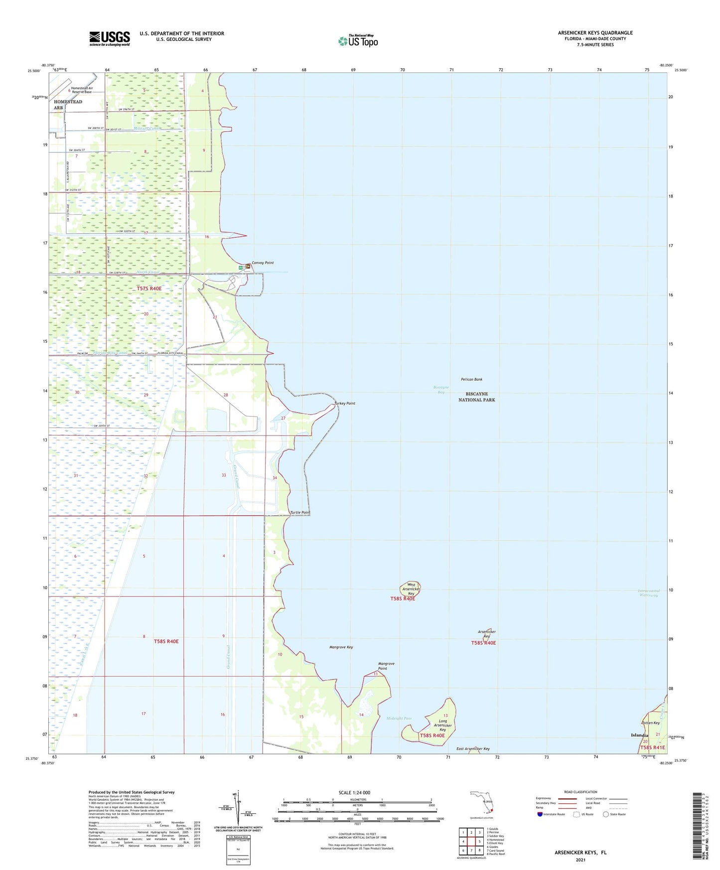
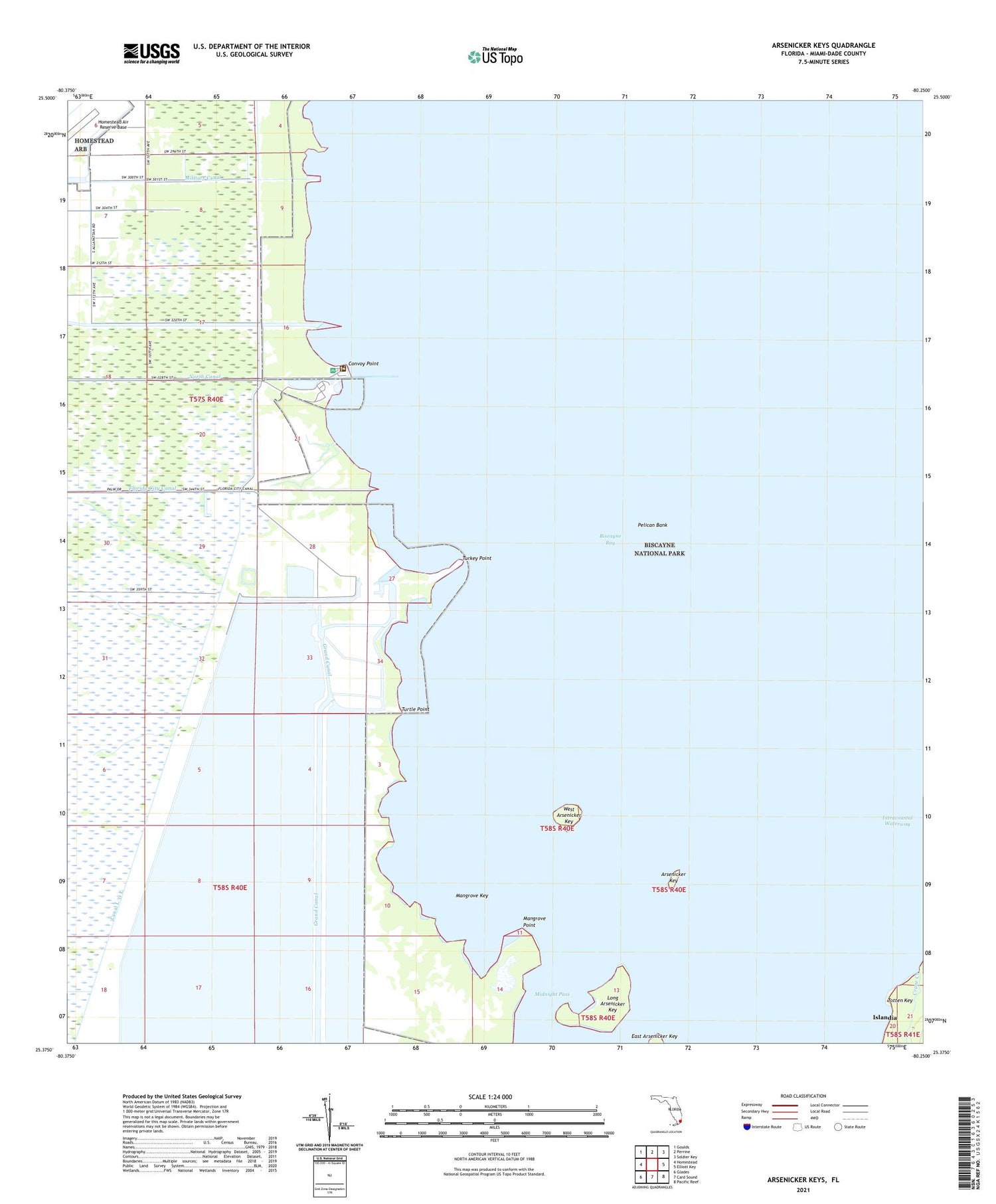
2024 topographic map quadrangle Arsenicker Keys in the state of Florida. Scale: 1:24000. Based on the newly updated USGS 7.5' US Topo map series, this map is in the following counties: Miami-Dade. The map contains contour data, water features, and other items you are used to seeing on USGS maps, but also has updated roads and other features. This is the next generation of topographic maps. Printed on high-quality waterproof paper with UV fade-resistant inks.
Quads adjacent to this one:
West: Homestead
Northwest: Goulds
North: Perrine
Northeast: Soldier Key
East: Elliott Key
Southeast: Pacific Reef
South: Card Sound
Southwest: Glades
This map covers the same area as the classic USGS quad with code o25080d3.
Contains the following named places: Arsenicker Key, Canal L 31 E, Convoy Point, Convoy Point Visitors Center, Cutter Bank, East Arsenicker Key, Flaggler Terrace Park, Florida Power and Light Turkey Point Power Plant, FPL Turkey Point Heliport, Grand Canal, Homestead Bayfront Marina, Homestead Bayfront Park, Islandia, Little River, Long Arsenicker Key, Mangrove Key, Mangrove Point, Mangrove Preserve, Midnight Pass, Military Canal, Pelican Bank, Sponge Rocks, Turkey Point, Turkey Point Nuclear Power Plant, Turtle Point, West Arsenicker Key