MyTopo
Ashton Florida US Topo Map
Couldn't load pickup availability
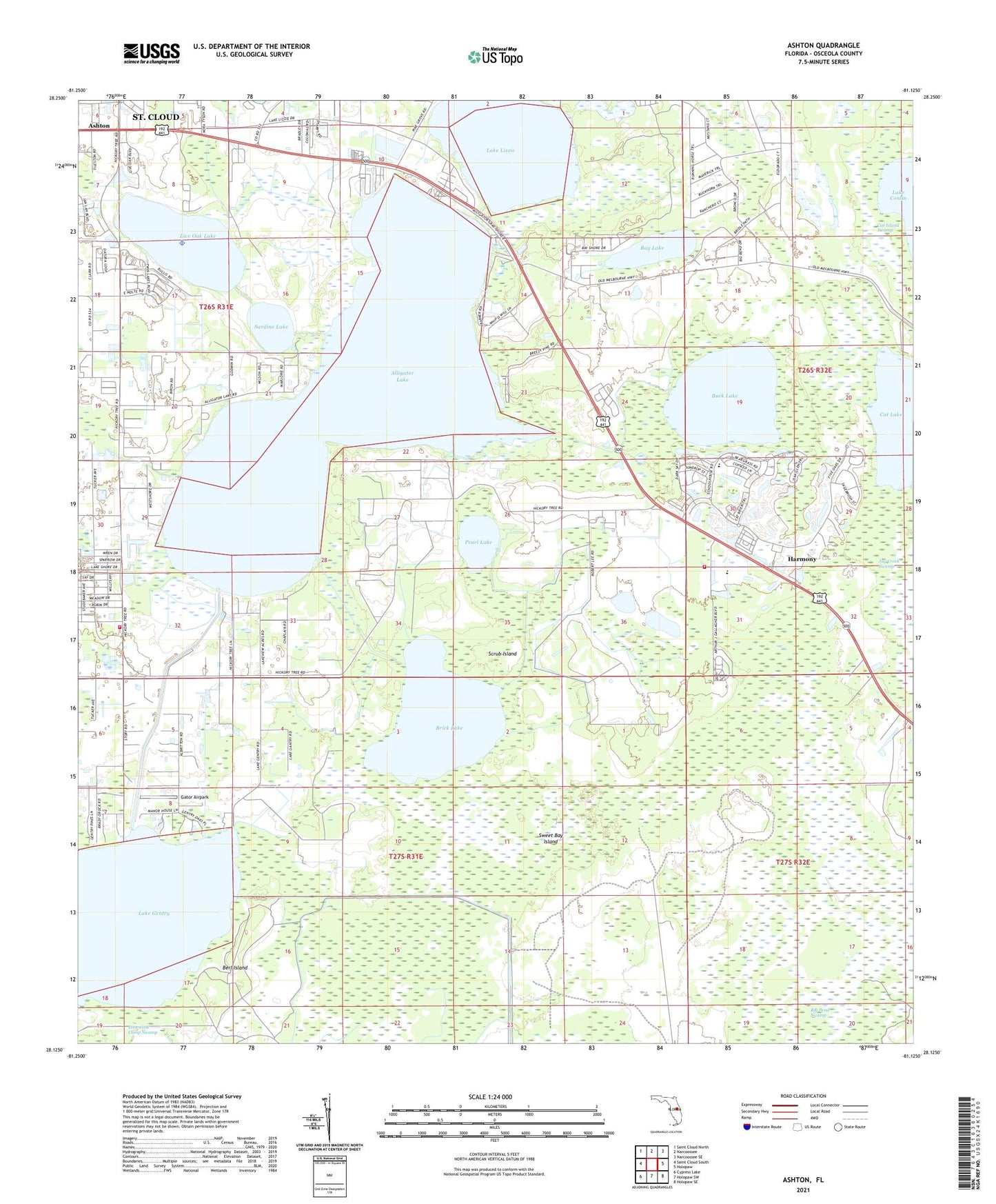
2024 topographic map quadrangle Ashton in the state of Florida. Scale: 1:24000. Based on the newly updated USGS 7.5' US Topo map series, this map is in the following counties: Osceola. The map contains contour data, water features, and other items you are used to seeing on USGS maps, but also has updated roads and other features. This is the next generation of topographic maps. Printed on high-quality waterproof paper with UV fade-resistant inks.
Quads adjacent to this one:
West: Saint Cloud South
Northwest: Saint Cloud North
North: Narcoossee
Northeast: Narcoossee SE
East: Holopaw
Southeast: Holopaw SE
South: Holopaw SW
Southwest: Cypress Lake
This map covers the same area as the classic USGS quad with code o28081b2.
Contains the following named places: Alligator Lake, Ashton, Bay Lake, Berl Island, Big Bend Swamp, Brick Lake, Buck Lake, Canoe Creek, Cat Lake, Colonial Mobile Home Park, Gator Airpark, Harmony, Harmony High School, Lake Gentry, Lake Lizzie, Lakeview Trailer Terrace, Live Oak Lake, Osceola County Fire Rescue and Emergency Medical Services Department Station 53, Pearl Lake, Sardine Lake, Scrub Island, Sharps Mobile Home Park, Sweet Bay Island