MyTopo
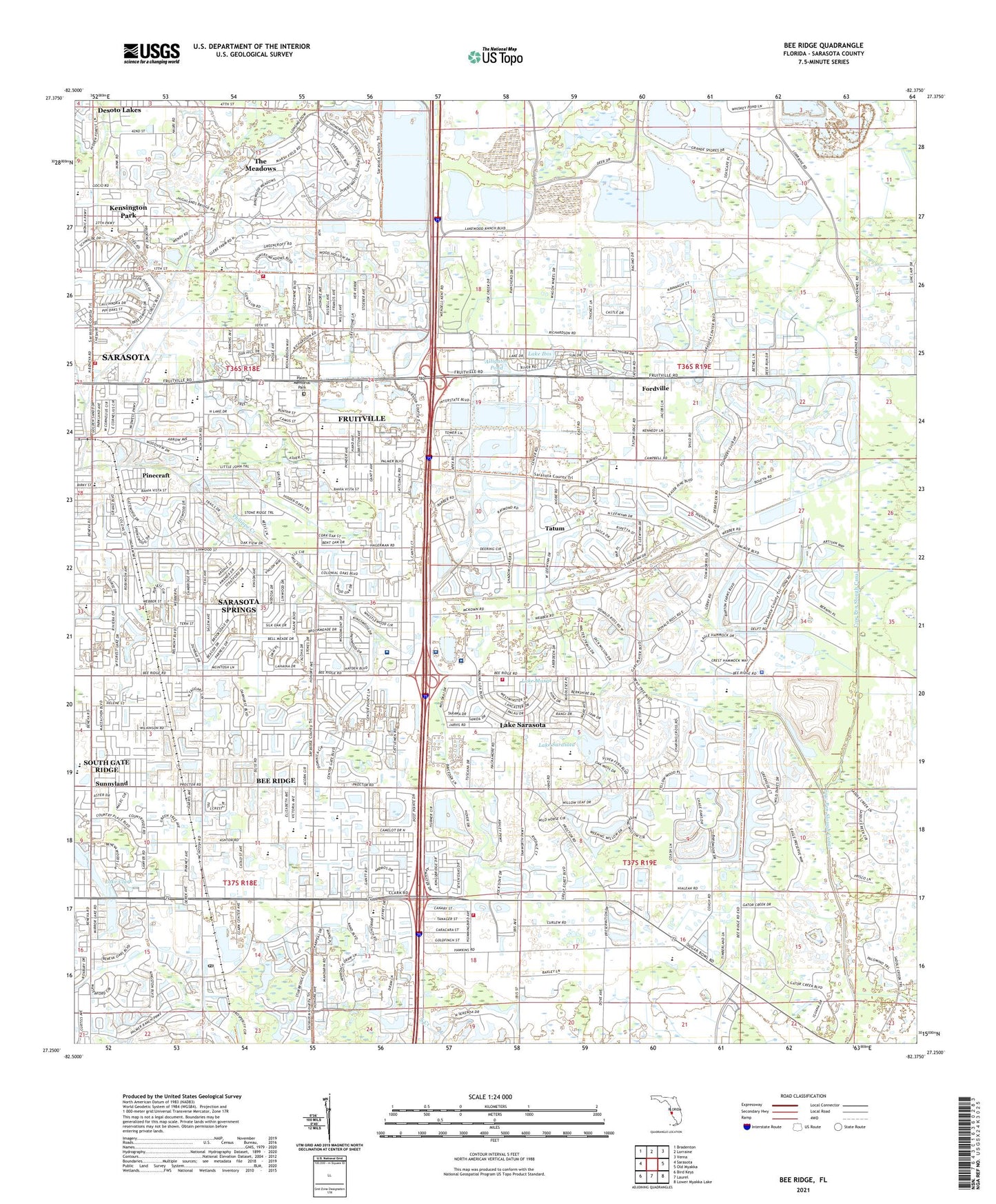
Bee Ridge Florida US Topo Map
Couldn't load pickup availability
2024 topographic map quadrangle Bee Ridge in the state of Florida. Scale: 1:24000. Based on the newly updated USGS 7.5' US Topo map series, this map is in the following counties: Sarasota. The map contains contour data, water features, and other items you are used to seeing on USGS maps, but also has updated roads and other features. This is the next generation of topographic maps. Printed on high-quality waterproof paper with UV fade-resistant inks.
Quads adjacent to this one:
West: Sarasota
Northwest: Bradenton
North: Lorraine
Northeast: Verna
East: Old Myakka
Southeast: Lower Myakka Lake
South: Laurel
Southwest: Bird Keys
This map covers the same area as the classic USGS quad with code o27082c4.
Contains the following named places: Alligator Pond, Ashton Elementary School, Bayfront Medical Center Bayflite Station 2 Ambulance, Bee Ridge, Bee Ridge Baptist Church, Bee Ridge Census Designated Place, Bee Ridge Fire Tower, Belspur, Beneva Christian Church, Brentwood Elementary School, Brethren in Christ Church, Camp Hamilton, Colonial Oaks Baptist Church, Complex Care Hospital at Ridgelake, Desoto Lakes, Doctors Hospital of Sarasota, Fordville, Fruitville, Fruitville Census Designated Place, Fruitville Elementary School, Fruitville Junction, Gator Creek Airport, Gocio Elementary School, Healthsouth Rehabilitation Hospital of Sarasota, Hyde Park, Intensive Air Ambulance, Kansas City Royals Ball Park, Kensington Park, Kensington Park Census Designated Place, Lake Clark, Lake Ibis, Lake Marae, Lake Sarasota, Lake Sarasota Census Designated Place, McIntosh Middle School, Palms Memorial Park, Pinecraft, Pinecraft Census Designated Place, Saint Thomas More Catholic Church, Sarasota County Fire Department Station 16, Sarasota County Fire Department Station 5, Sarasota County Fire Department Station 7, Sarasota County Fire Department Station 8, Sarasota County Sheriff's Office - Victims Services Center, Sarasota County Student Center, Sarasota County Technical Institute, Sarasota Department of Fire-Rescue East Side Heliport, Sarasota Middle School, Sarasota Police Department - Animal Services, Sarasota School, Sarasota Springs, Sarasota Springs Census Designated Place, South Gate Ridge, South Gate Ridge Census Designated Place, Southside Christian Church, Sunnyland, Sunrise, Tatum, Tatum Ridge, Tatum Ridge Baptist Church, The Meadows, The Meadows Census Designated Place, WKXY-AM (Sarasota), WKZM-FM (Sarasota), Wood School, WQSA-AM (Sarasota), WSGX-AM (Sarasota), ZIP Codes: 34232, 34233, 34235, 34241