MyTopo
Verna Florida US Topo Map
Couldn't load pickup availability
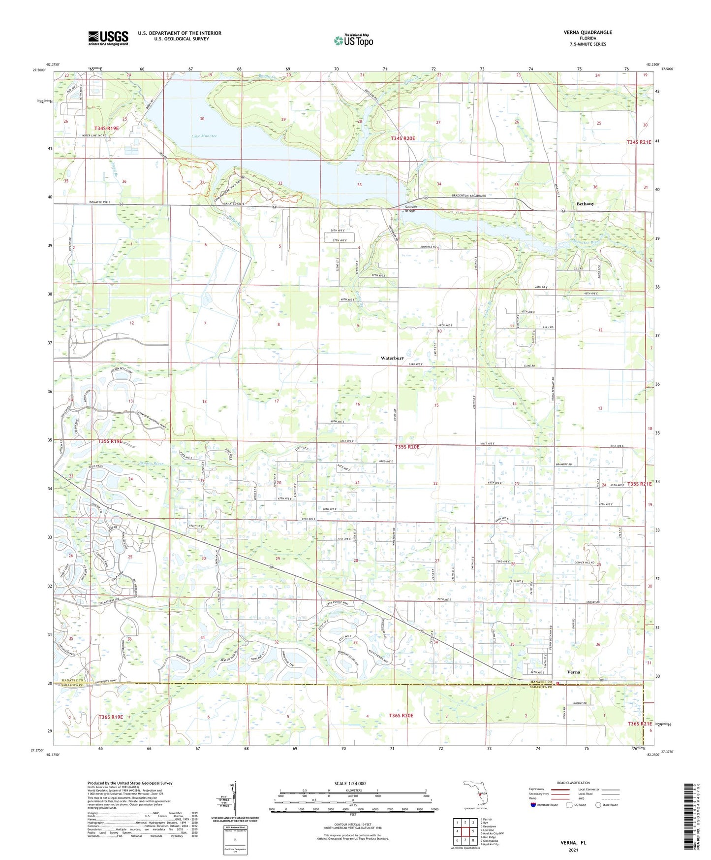
2024 topographic map quadrangle Verna in the state of Florida. Scale: 1:24000. Based on the newly updated USGS 7.5' US Topo map series, this map is in the following counties: Manatee, Sarasota. The map contains contour data, water features, and other items you are used to seeing on USGS maps, but also has updated roads and other features. This is the next generation of topographic maps. Printed on high-quality waterproof paper with UV fade-resistant inks.
Quads adjacent to this one:
West: Lorraine
Northwest: Parrish
North: Rye
Northeast: Keentown
East: Myakka City NW
Southeast: Myakka City
South: Old Myakka
Southwest: Bee Ridge
This map covers the same area as the classic USGS quad with code o27082d3.
Contains the following named places: Bethany, Boggy Creek, Corbit Branch, Craig Branch, De Soto Memorial Speedway, Fisher Branch, Gilley Creek, Lake Manatee, Lake Manatee State Park, Little Deep Branch, Myakka City Fire Department Station 2, Poley Branch, Sand Branch, Sullivan Bridge, Verna, Waterbury