MyTopo
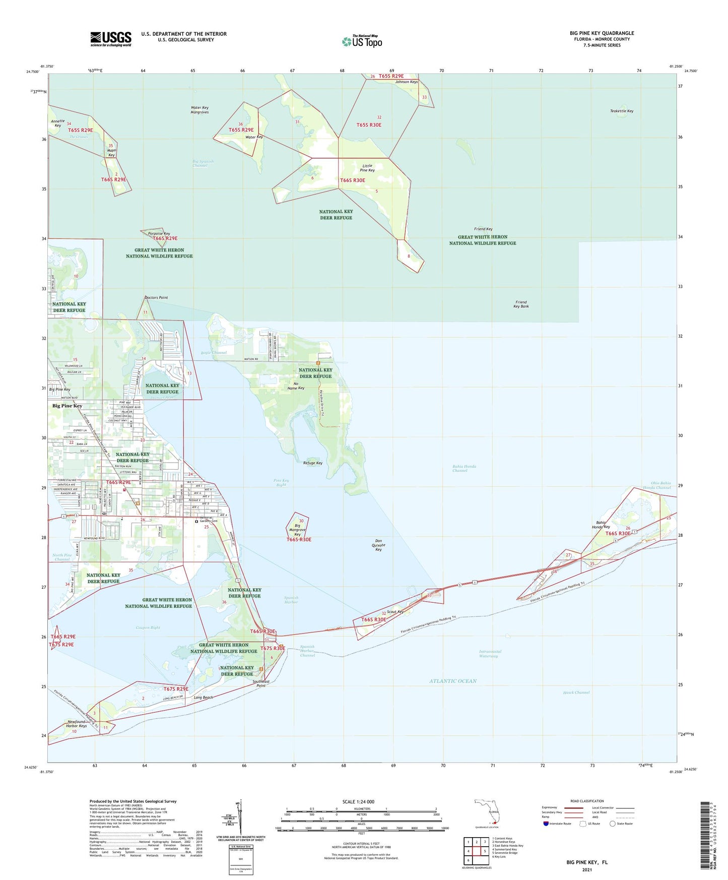
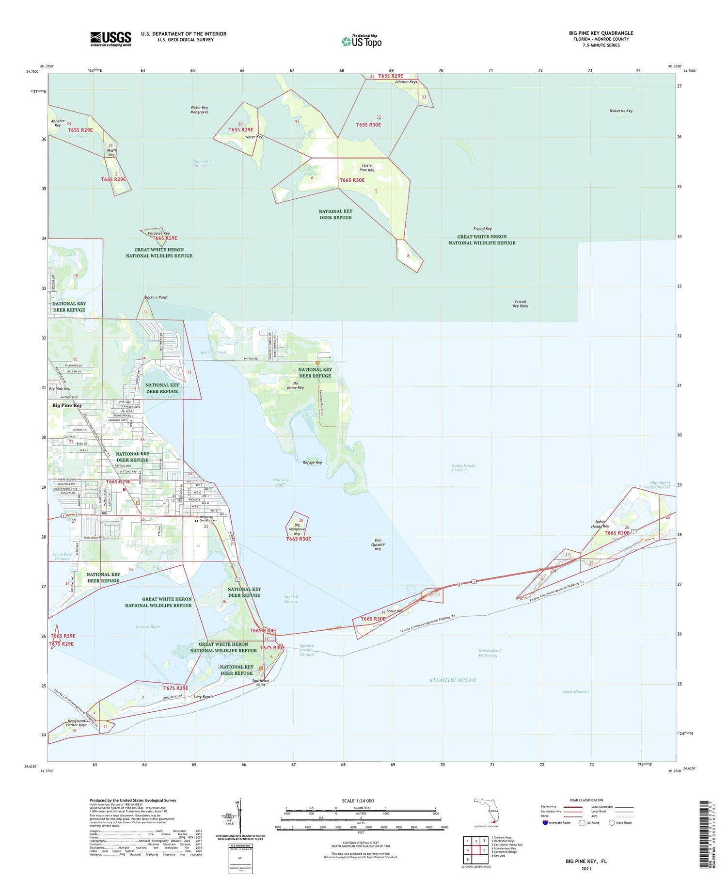
Big Pine Key Florida US Topo Map
Couldn't load pickup availability
2024 topographic map quadrangle Big Pine Key in the state of Florida. Scale: 1:24000. Based on the newly updated USGS 7.5' US Topo map series, this map is in the following counties: Monroe. The map contains contour data, water features, and other items you are used to seeing on USGS maps, but also has updated roads and other features. This is the next generation of topographic maps. Printed on high-quality waterproof paper with UV fade-resistant inks.
Quads adjacent to this one:
West: Summerland Key
Northwest: Content Keys
North: Horseshoe Keys
Northeast: East Bahia Honda Key
East: Sevenmile Bridge
Southwest: Key Lois
This map covers the same area as the classic USGS quad with code o24081f3.
Contains the following named places: Bahia Honda Channel, Bahia Honda Key, Bahia Honda State Park, Big Mangrove Key, Big Pine, Big Pine Baptist Church, Big Pine Chapel, Big Pine Church, Big Pine Key, Big Pine Key Census Designated Place, Big Pine Key Post Office, Big Pine Key Shopping Center, Big Pine Key Volunteer Fire Department - Station 13, Bogie Channel, Church of Christ, Cook Island, Coupon Bight, Coupon Bight Aquatic Preserve, Deans Trailer Park, Doctors Arm, Doctors Point, Don Quixote Key, Florida Keys Wilderness (Key Deer Refuge), Friend Key, Friend Key Bank, Howards Haven Mobile Home Park, Keys Emergency Medical Services, Little Pine Key, Long Beach, Mayo Key, Memorial Gardens Cemetery, Methodist Church-Big Pine United, Monroe County Public Library System Big Pine Key Branch, No Name Key, North Pine Channel, Ohio Bahia Honda Channel, Pine Key Bight, Porpoise Key, Refuge Key, Saint Peter Church, Saint Peters Church, Sawyer Camp, Scout Key, Southeast Point, Spanish Harbor, Spanish Harbor Channel, Teakettle Key, Water Key, Water Key Mangroves, West Summerland Key, Wesumkee Camp, ZIP Code: 33043