MyTopo
Summerland Key Florida US Topo Map
Couldn't load pickup availability
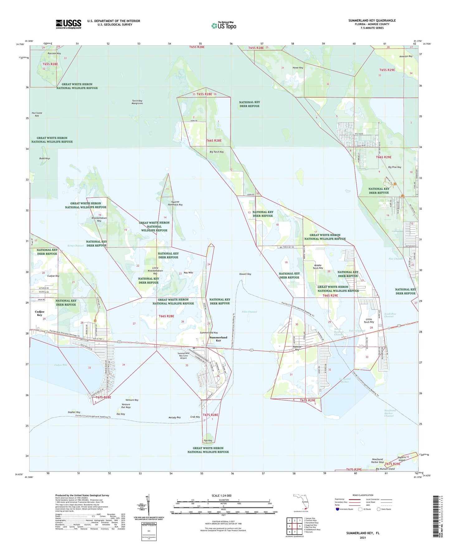
2024 topographic map quadrangle Summerland Key in the state of Florida. Scale: 1:24000. Based on the newly updated USGS 7.5' US Topo map series, this map is in the following counties: Monroe. The map contains contour data, water features, and other items you are used to seeing on USGS maps, but also has updated roads and other features. This is the next generation of topographic maps. Printed on high-quality waterproof paper with UV fade-resistant inks.
Quads adjacent to this one:
West: Sugarloaf Key
Northwest: Sawyer Key
North: Content Keys
Northeast: Horseshoe Keys
East: Big Pine Key
South: Key Lois
Southwest: Saddlebunch Keys
This map covers the same area as the classic USGS quad with code o24081f4.
Contains the following named places: Annette Key, Big Torch Key, Crab Key, Cudjoe Bay, Cudjoe Key, Cudjoe Key Census Designated Place, Florida Keys Wilderness (Great White Heron Refuge), Gopher Key, Hopkins Island, Howe Key, Howell Key, Hurricane Key, Kemp Channel, Key Who, Knockemdown Key, Little Knockemdown Key, Little Torch Key, Lucky's Landing Mobile Home Park, Melody Key, Middle Torch Key, Newfound Harbor, Newfound Harbor Channel, Newfound Harbor Keys, Niles Channel, Out Key, Pine Channel, Pye Key, Raccoon Key, Ramrod Key, South Pine Channel, Summerland Key, Summerland Key Cove Airport, Summerland Key Post Office, The Grasses, Toptree Hammock Key, Torch Channel, Torch Key Mangroves, Torch Ramrod Channel, Venture Key, Venture Out Keys, WWUS-FM (Big Pine Key)