MyTopo
Blackwater Sound Florida US Topo Map
Couldn't load pickup availability
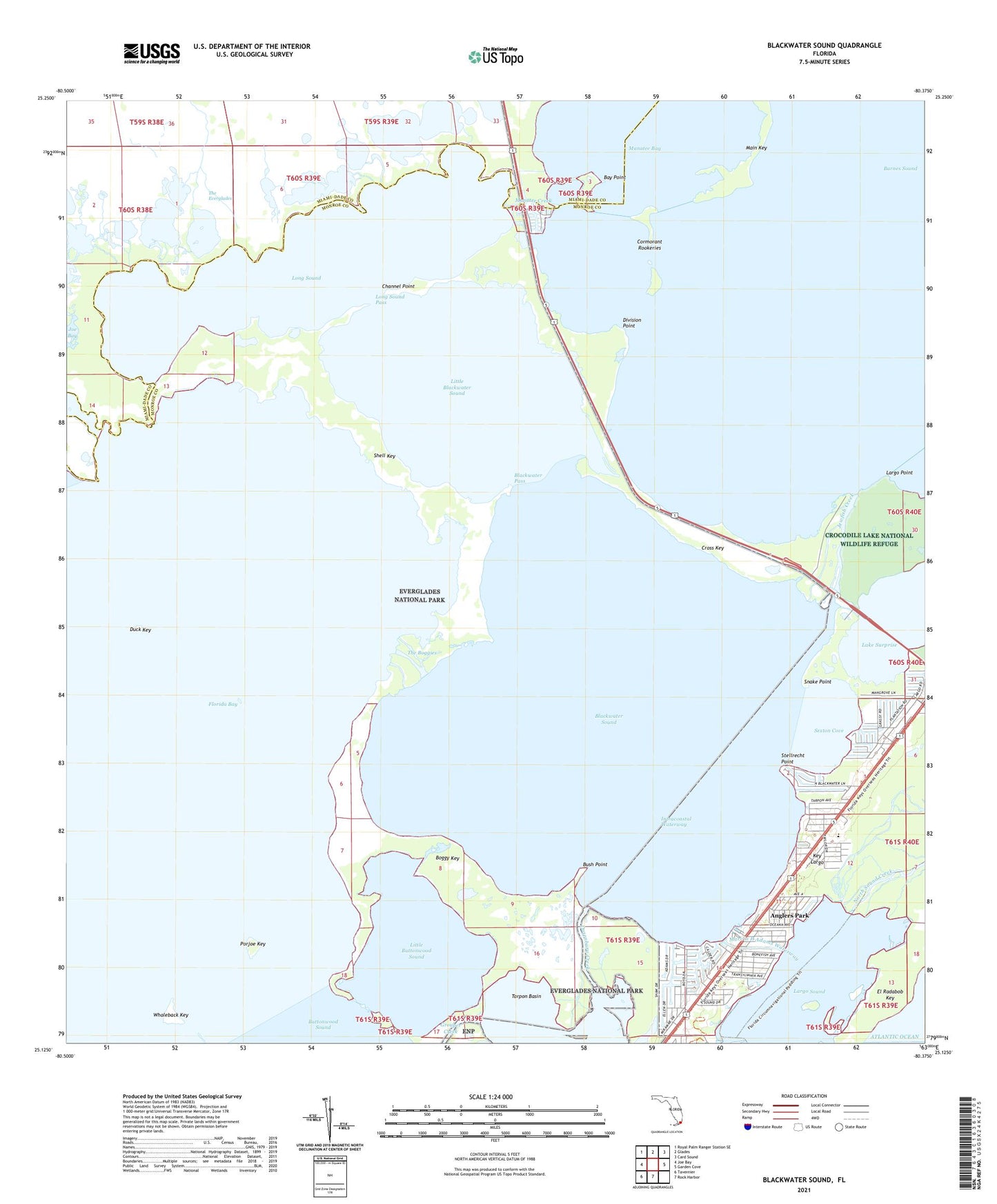
2024 topographic map quadrangle Blackwater Sound in the state of Florida. Scale: 1:24000. Based on the newly updated USGS 7.5' US Topo map series, this map is in the following counties: Miami-Dade, Monroe. The map contains contour data, water features, and other items you are used to seeing on USGS maps, but also has updated roads and other features. This is the next generation of topographic maps. Printed on high-quality waterproof paper with UV fade-resistant inks.
Quads adjacent to this one:
West: Joe Bay
Northwest: Royal Palm Ranger Station SE
North: Glades
Northeast: Card Sound
East: Garden Cove
South: Rock Harbor
Southwest: Tavernier
This map covers the same area as the classic USGS quad with code o25080b4.
Contains the following named places: Anglers Park, Barnes Sound, Bay Point, Blackwater Pass, Blackwater Sound, Boggy Key, Bush Point, Channel Point, Cormorant Rookeries, Cross Key, Division Point, Duck Key, Dusenbury Creek, Family Paradise Island Marina, Jewfish, Jewfish Creek, Key Largo Convention Center, Key Largo Marina, Key Largo School, Key Largo Volunteer Fire Department, Kings Kamp Campground Marina, Lake Surprise, Largo Point, Largo Sound, Little Blackwater Sound, Little Buttonwood Sound, Long Sound, Long Sound Pass, Main Key, Manatee Cove Mobile Home Park, Manatee Creek, Marvin D Adams Waterway, Pelican Cay Harbor Marina, Porjoe Key, Port Largo Plaza, Sexton Cove, Shell Creek, Shell Key, Snake Point, Stellrecht Point, The Boggies, The Tradewinds Shopping Center, Thursday Cove, Whaleback Key, ZIP Code: 33037