MyTopo
Boyd Florida US Topo Map
Couldn't load pickup availability
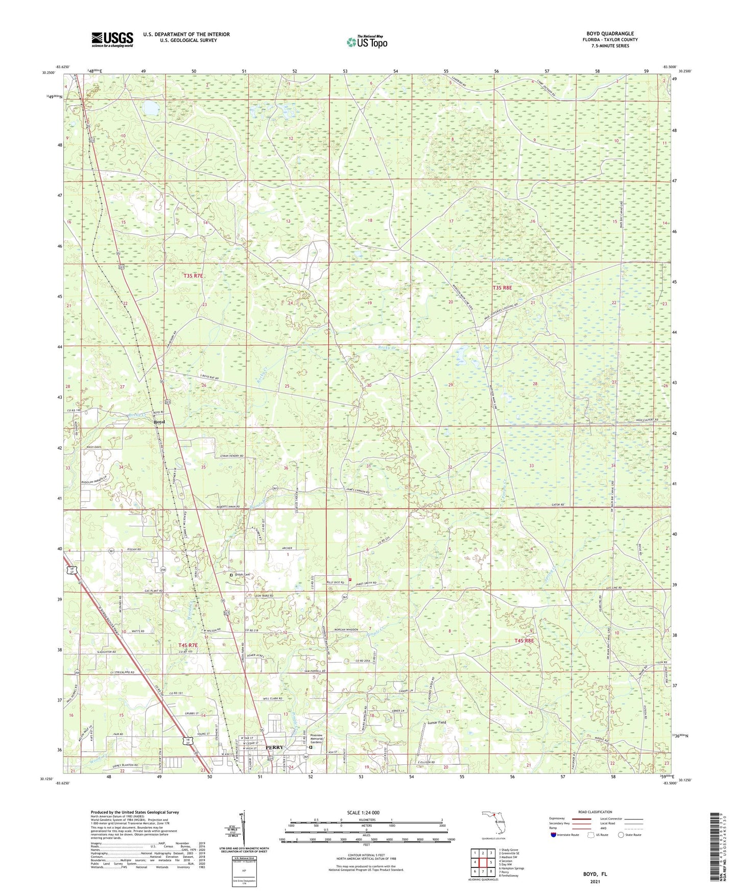
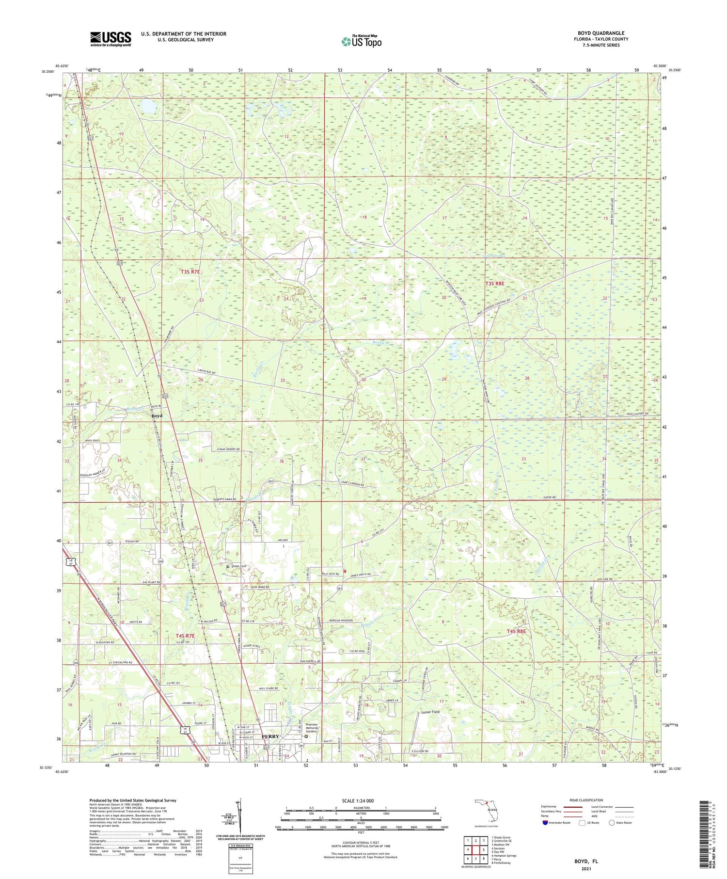
2024 topographic map quadrangle Boyd in the state of Florida. Scale: 1:24000. Based on the newly updated USGS 7.5' US Topo map series, this map is in the following counties: Taylor. The map contains contour data, water features, and other items you are used to seeing on USGS maps, but also has updated roads and other features. This is the next generation of topographic maps. Printed on high-quality waterproof paper with UV fade-resistant inks.
Quads adjacent to this one:
West: Secotan
Northwest: Shady Grove
North: Greenville SE
Northeast: Madison SW
East: Day NW
Southeast: Fenholloway
South: Perry
Southwest: Hampton Springs
This map covers the same area as the classic USGS quad with code o30083b5.
Contains the following named places: Ash Street Church of Christ, Boyd, Church of God, Doctors Hospital Heliport, Fair Road Mobile Home Court, Friendship Baptist Church, Friendship Church, Gladys Moorse Elementary School, Holmes Trailer Park, Lake Bird, Landing Field, Lumar Field, Mount Carmel Church, Pineview Memorial Gardens, Pisgah Church, Shiloh Cemetery, Shiloh Church, Solid Rock Family Christian Center, Taylor County Fire and Rescue Station 3, Taylor County High School, WNFK-FM (Perry), Woods Creek, WPRY Radio Station, WPRY-AM (Perry), ZIP Code: 32347