MyTopo
Brighton Florida US Topo Map
Couldn't load pickup availability
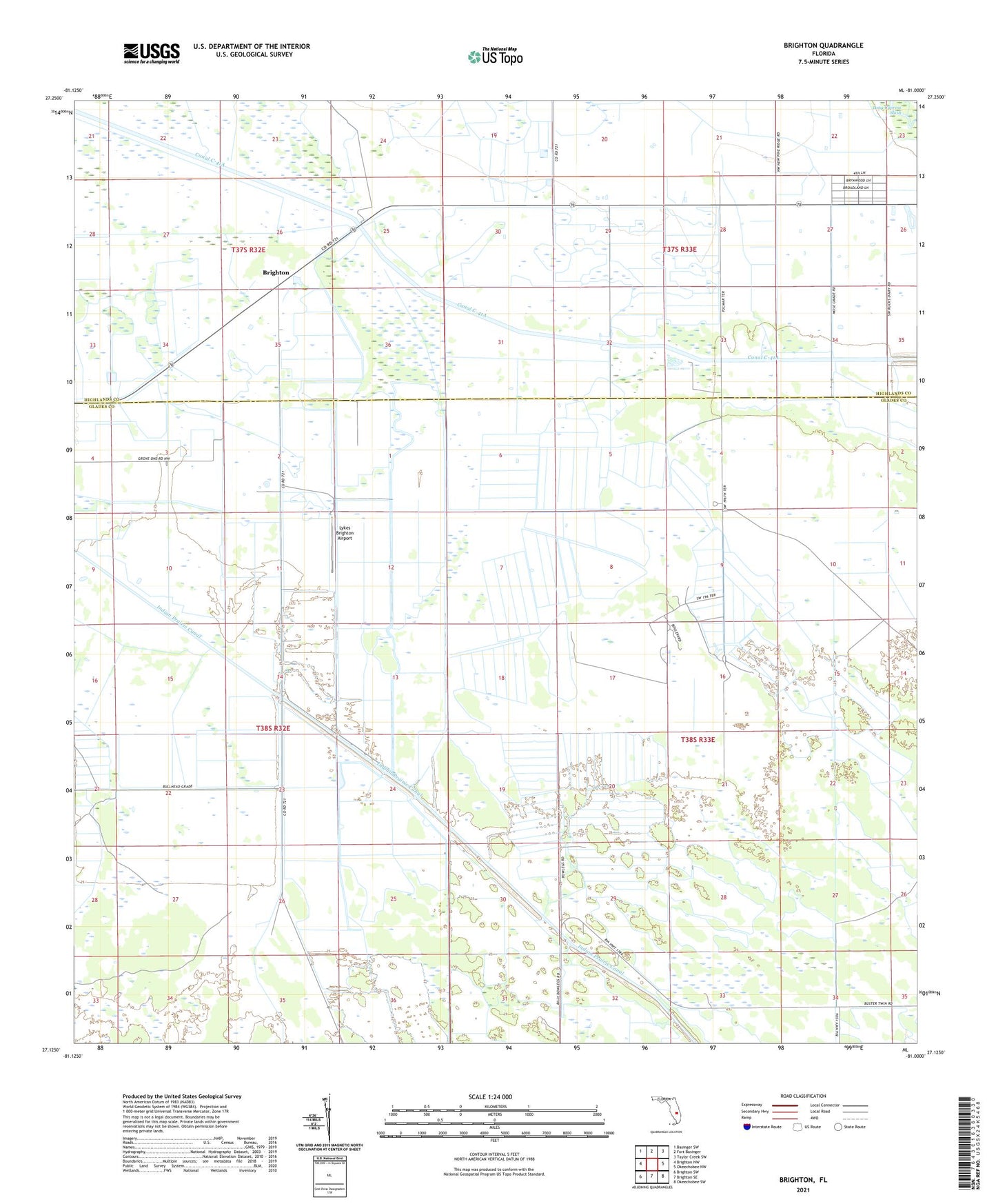
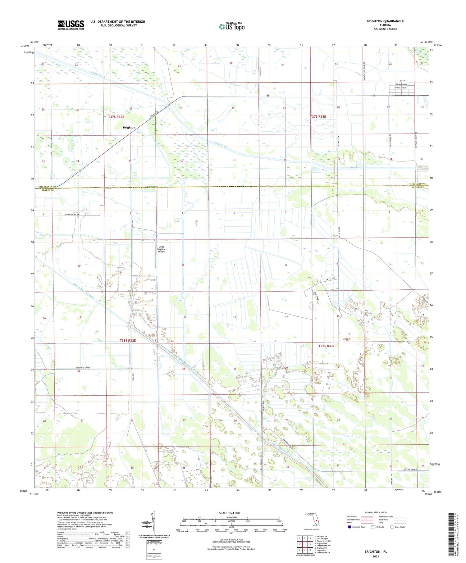
2024 topographic map quadrangle Brighton in the state of Florida. Scale: 1:24000. Based on the newly updated USGS 7.5' US Topo map series, this map is in the following counties: Glades, Highlands. The map contains contour data, water features, and other items you are used to seeing on USGS maps, but also has updated roads and other features. This is the next generation of topographic maps. Printed on high-quality waterproof paper with UV fade-resistant inks.
Quads adjacent to this one:
West: Brighton NW
Northwest: Basinger SW
North: Fort Basinger
Northeast: Taylor Creek SW
East: Okeechobee NW
Southeast: Okeechobee SW
South: Brighton SE
Southwest: Brighton SW
This map covers the same area as the classic USGS quad with code o27081b1.
Contains the following named places: Brighton, Brighton Lookout Tower, Indian Prairie Canal, Lykes Brighton Airport