MyTopo
Taylor Creek SW Florida US Topo Map
Couldn't load pickup availability
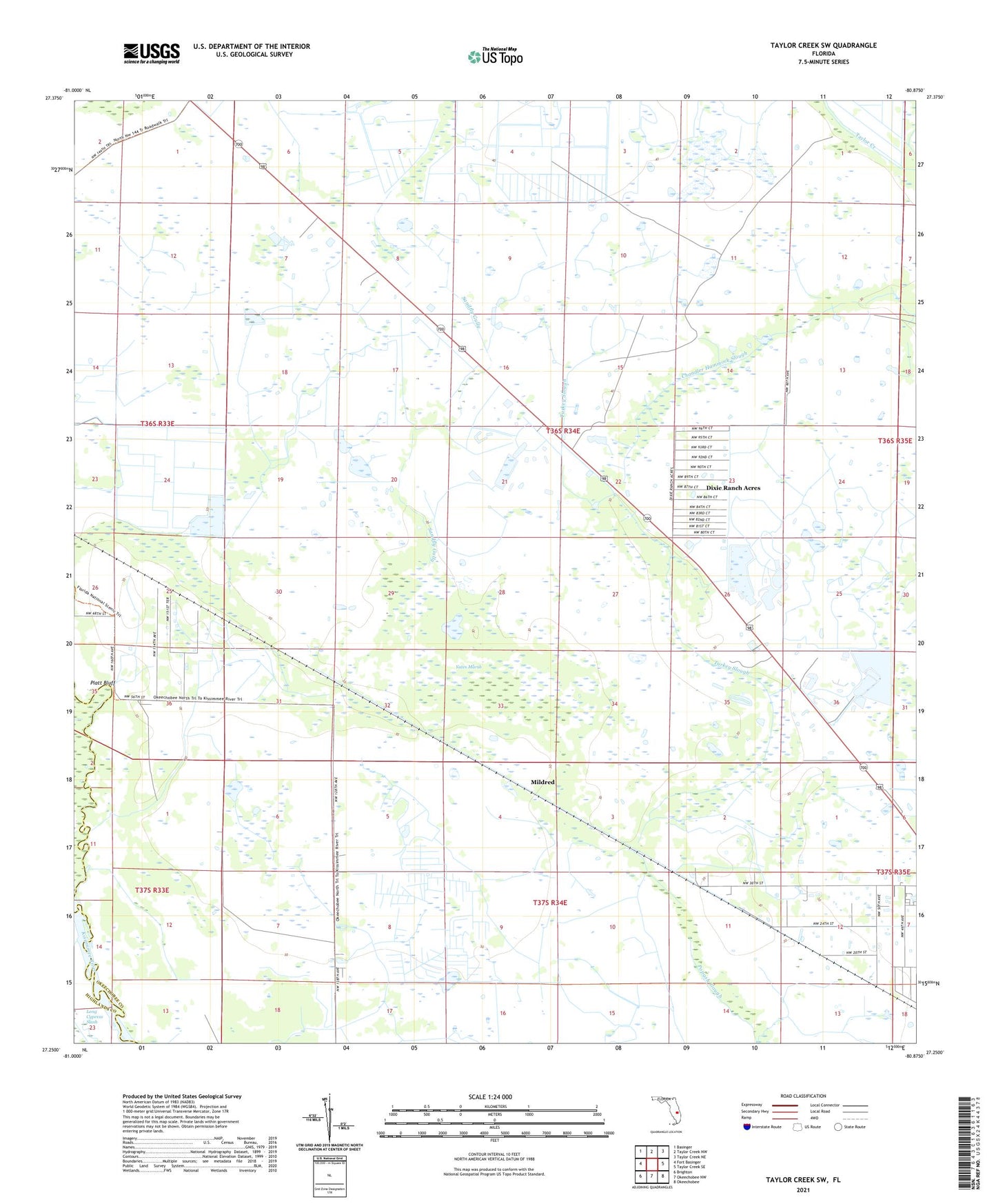
2024 topographic map quadrangle Taylor Creek SW in the state of Florida. Scale: 1:24000. Based on the newly updated USGS 7.5' US Topo map series, this map is in the following counties: Okeechobee, Highlands. The map contains contour data, water features, and other items you are used to seeing on USGS maps, but also has updated roads and other features. This is the next generation of topographic maps. Printed on high-quality waterproof paper with UV fade-resistant inks.
Quads adjacent to this one:
West: Fort Basinger
Northwest: Basinger
North: Taylor Creek NW
Northeast: Taylor Creek NE
East: Taylor Creek SE
Southeast: Okeechobee
South: Okeechobee NW
Southwest: Brighton
This map covers the same area as the classic USGS quad with code o27080c8.
Contains the following named places: 46th Avenue Villas Mobile Home Park, Chandler Hammock Slough, Dixie Ranch, Dixie Ranch Acres, Gloria Park Mobile Home Park, Mildred, Platt Bluff, Sandfly Gully, Turkey Slough, Yates Marsh