MyTopo
Citra Florida US Topo Map
Couldn't load pickup availability
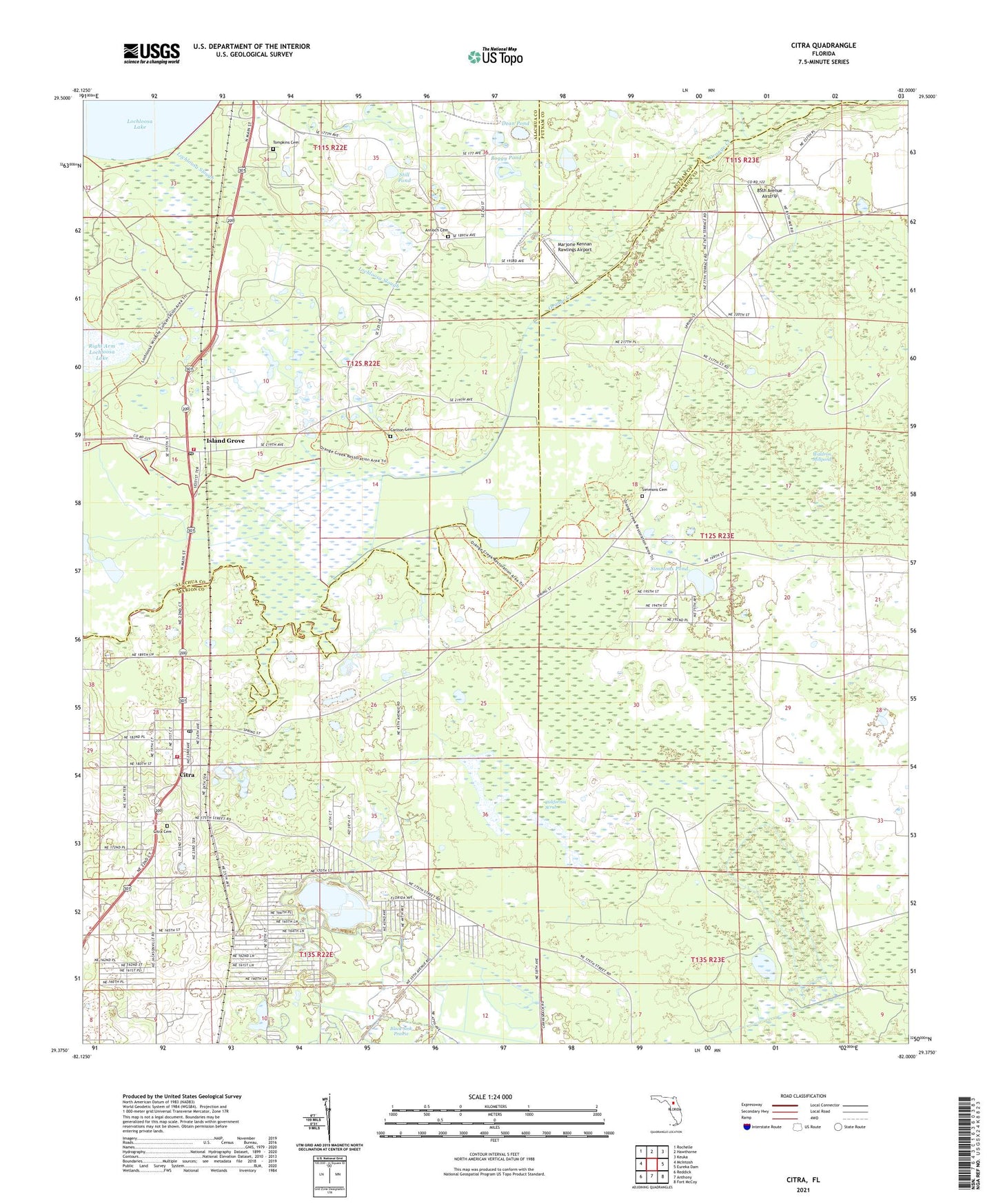
2024 topographic map quadrangle Citra in the state of Florida. Scale: 1:24000. Based on the newly updated USGS 7.5' US Topo map series, this map is in the following counties: Marion, Alachua, Putnam. The map contains contour data, water features, and other items you are used to seeing on USGS maps, but also has updated roads and other features. This is the next generation of topographic maps. Printed on high-quality waterproof paper with UV fade-resistant inks.
Quads adjacent to this one:
West: McIntosh
Northwest: Rochelle
North: Hawthorne
Northeast: Keuka
East: Eureka Dam
Southeast: Fort McCoy
South: Anthony
Southwest: Reddick
This map covers the same area as the classic USGS quad with code o29082d1.
Contains the following named places: 85th Avenue Airstrip, Antioch Cemetery, Black Sink Prairie, Boggy Pond, California Scrub, Carlton Cemetery, Church of God, Church of God By Faith, Citra, Citra Cemetery, Citra Post Office, Citra Seventh Day Adventist Church, Citra United Methodist Church, Cross Creek Volunteer Fire Department Substation, Dean Pond, Deliverance Revival Center, Faith Baptist Church, First Baptist Church of Citra, First United Methodist Church of Citra, Island Grove, Island Grove Baptist Church, Island Grove Post Office, Island Grove Volunteer Fire Department, Lochloosa Slough, Marion County Fire Rescue Station 2 Citra, Marjorie Kennan Rawlings Airport, New Hope United Methodist Church, Saint John AME Church, Simmons Baptist Church, Simmons Cemetery, Simmons Pond, Still Pond, Tompkins Cemetery, Victory Baptist Church, Waldron Millpond, Willow Plant Missionary Baptist Church, ZIP Code: 32113