MyTopo
Rochelle Florida US Topo Map
Couldn't load pickup availability
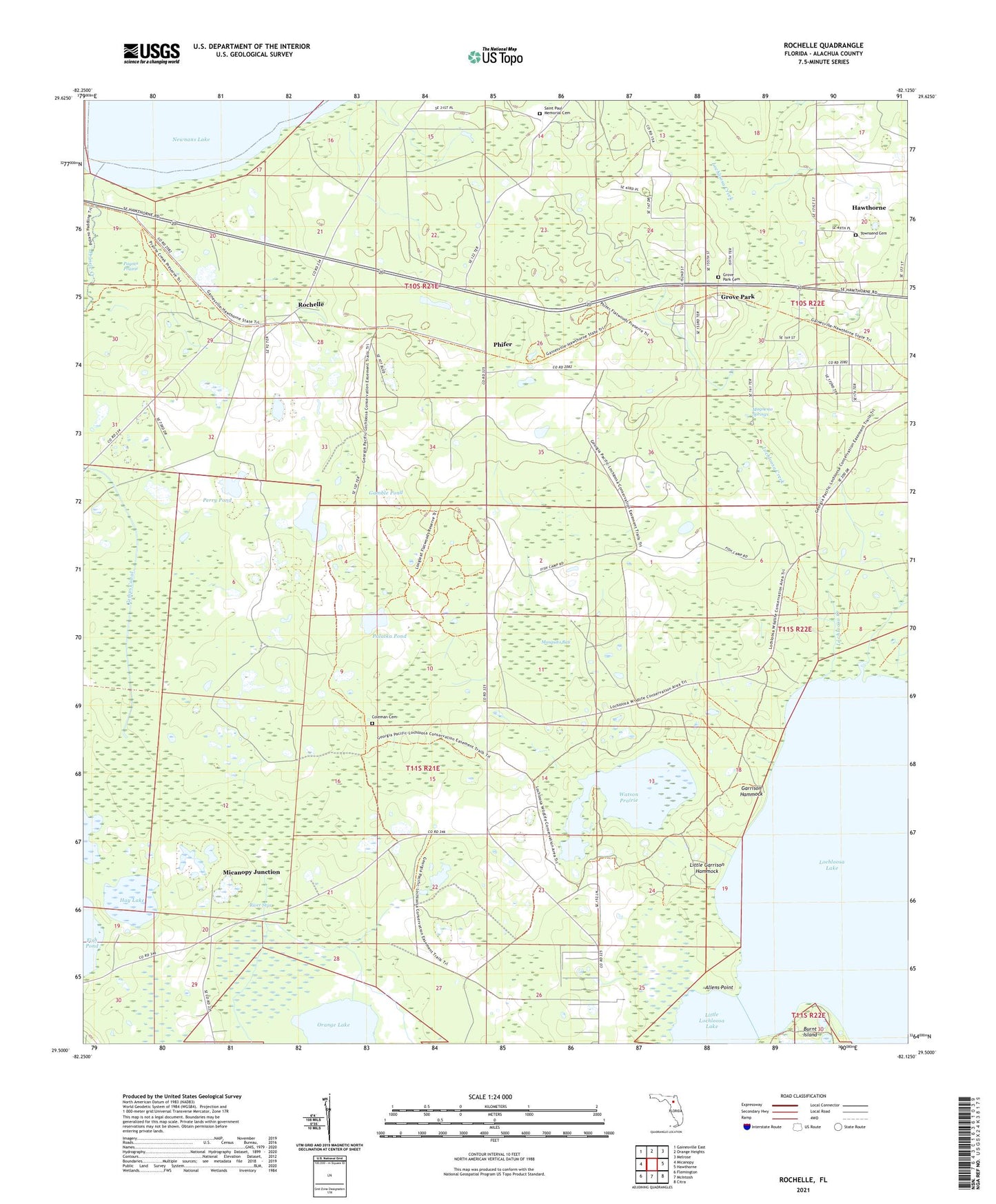
2024 topographic map quadrangle Rochelle in the state of Florida. Scale: 1:24000. Based on the newly updated USGS 7.5' US Topo map series, this map is in the following counties: Alachua. The map contains contour data, water features, and other items you are used to seeing on USGS maps, but also has updated roads and other features. This is the next generation of topographic maps. Printed on high-quality waterproof paper with UV fade-resistant inks.
Quads adjacent to this one:
West: Micanopy
Northwest: Gainesville East
North: Orange Heights
Northeast: Melrose
East: Hawthorne
Southeast: Citra
South: McIntosh
Southwest: Flemington
This map covers the same area as the classic USGS quad with code o29082e2.
Contains the following named places: Allens Point, Camps Canal, Caraway Landing, Coleman Cemetery, Fish Prairie, Gamble Pond, Garrison Hammock, Grove Park, Grove Park Cemetery, Grove Park Community Christian Church, Hall Chapel United Methodist Church, Hawthorne Division, Hay Lake, Keystone Heights Electric Substation, Little Garrison Hammock, Little Lochloosa Lake, Lochloosa Creek, Lochloosa Lake, Lochloosa Wildlife Management Area, Magnesia Springs, Micanopy Junction, Mosquito Bay, Olivet Baptist Church, Palatka Pond, Perry Pond, Phifer, River Styx, Rochelle, Saint Paul Memorial Cemetery, Saint Peter Baptist Church, Saint Peters Baptist Church, Third Bethel Baptist Church, Tillmans Pond, Townsend Cemetery, Watson Prairie