MyTopo
Clewiston North Florida US Topo Map
Couldn't load pickup availability
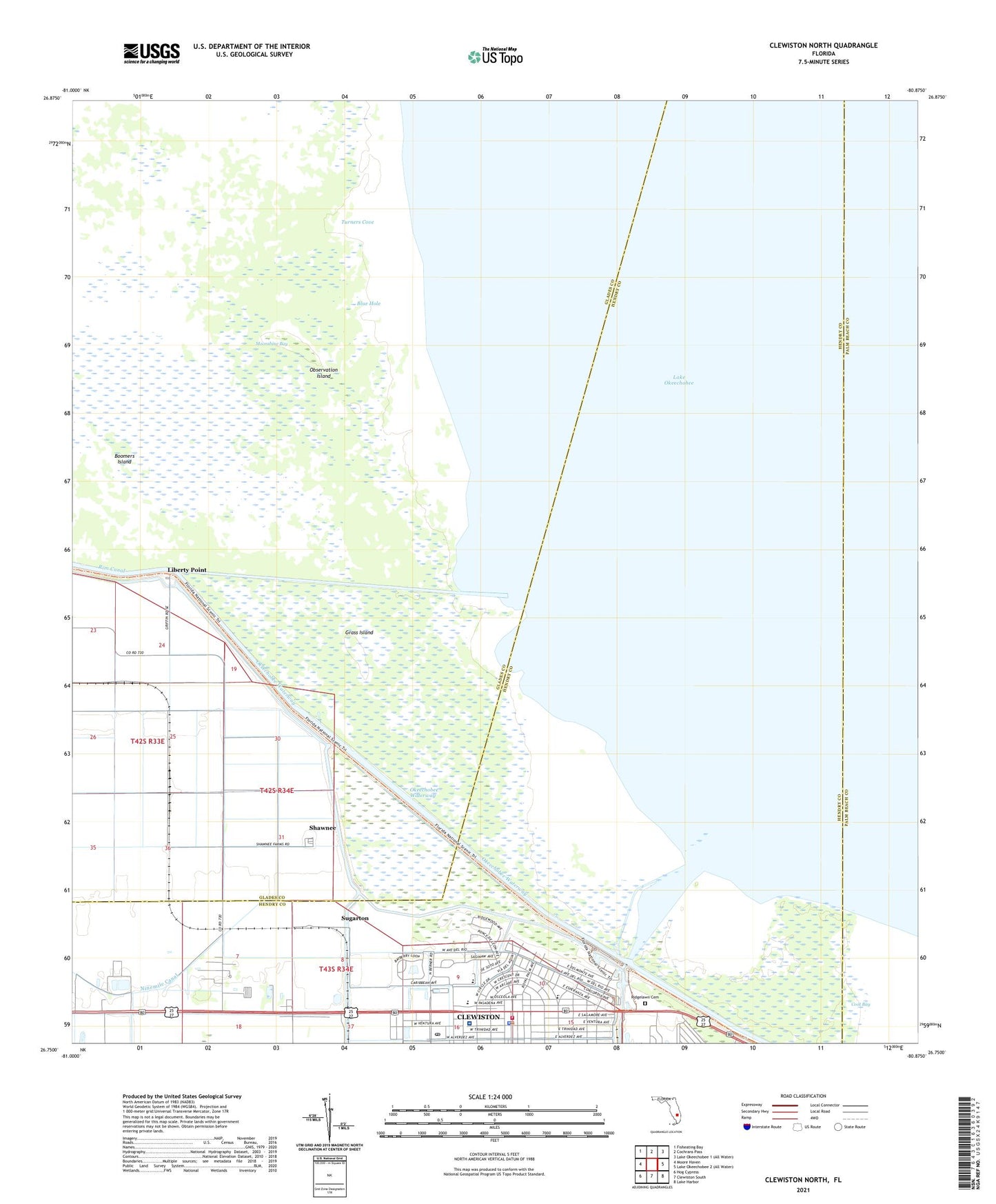
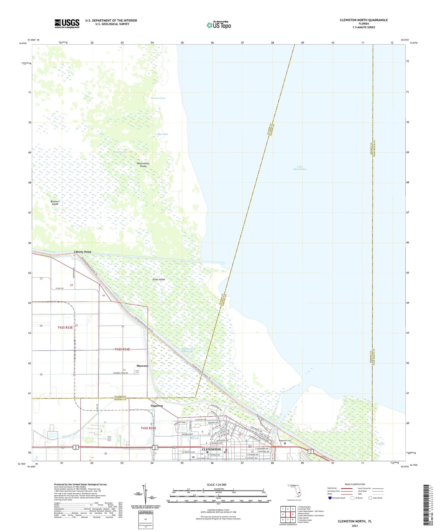
2024 topographic map quadrangle Clewiston North in the state of Florida. Scale: 1:24000. Based on the newly updated USGS 7.5' US Topo map series, this map is in the following counties: Glades, Hendry, Palm Beach. The map contains contour data, water features, and other items you are used to seeing on USGS maps, but also has updated roads and other features. This is the next generation of topographic maps. Printed on high-quality waterproof paper with UV fade-resistant inks.
Quads adjacent to this one:
West: Moore Haven
Northwest: Fisheating Bay
North: Cochrans Pass
Southeast: Lake Harbor
South: Clewiston South
Southwest: Hog Cypress
This map covers the same area as the classic USGS quad with code o26080g8.
Contains the following named places: Anglers Marina, Belchers Mobile Home Park, Blue Hole, Boomers Island, City of Clewiston, Clewiston, Clewiston Community School, Clewiston Intermediate School, Clewiston Middle School, Clewiston Museum, Clewiston Police Department, Clewiston Post Office, Clewiston Public Library, Clewiston Trailer Park, Clewiston Volunteer Fire Department, Community Presbyterian Church, Coot Bay, Faith Lutheran Church, Grass Island, Hendry County EMS - Clewiston Station 119, Hendry Hospital, Hendry Regional Medical Center, High Haven Church, Liberty Point, Liberty Point Number Two Siding, Observation Island, Ridgelawn Cemetery, Roland Martin Marina, Royal Palm Trailer Park, Saint Margarets Catholic Church, Saint Martins Episcopal Church, Shawnee, Sugar Square, Sugarland Plaza, Sugarton, Turners Cove, Ventura Mobile Home Park