
MyTopo
Cobb Rocks Florida US Topo Map
Couldn't load pickup availability
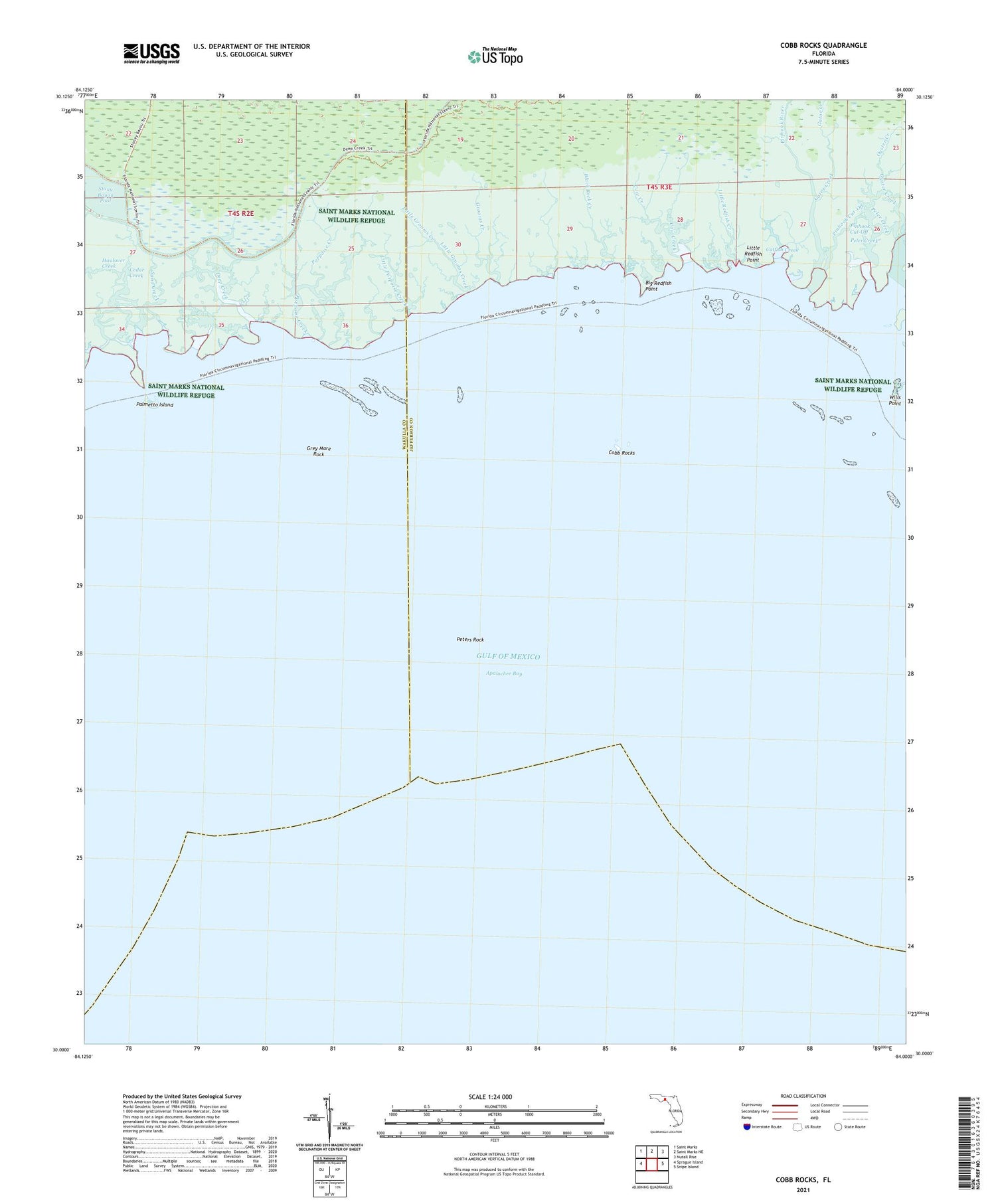
2025 topographic map quadrangle Cobb Rocks in the state of Florida. Scale: 1:24000. Based on the newly updated USGS 7.5' US Topo map series, this map is in the following counties: Jefferson, Wakulla. The map contains contour data, water features, and other items you are used to seeing on USGS maps, but also has updated roads and other features. This is the next generation of topographic maps. Printed on high-quality waterproof paper with UV fade-resistant inks.
Quads adjacent to this one:
West: Sprague Island
Northwest: Saint Marks
North: Saint Marks NE
Northeast: Nutall Rise
East: Snipe Island
This map covers the same area as the classic USGS quad with code o30084a1.
Contains the following named places: Big Redfish Point, Black Rock Creek, Catfish Creek, Cedar Creek, Cobb Rocks, Cow Creek, Deep Creek, Gator Creek, Grey Mare Rock, Grooms Creek, Little Grooms Creek, Little Porpoise Creek, Little Redfish Creek, Little Redfish Point, Oyster Creek, Palmetto Island, Peler Creek, Peters Rock, Pinhook Cut-Off, Pinhook River, Porpoise Creek, Saint Marks Wilderness, Sand Creek, Wills Point


